Enable Location

We need your location to show you interesting places around you

Discover nearby places

Find interesting locations and hidden gems around you

Precise directions

Get accurate directions and distances to places

Your location is never shared with other users. It's only used when you tap the location button.

Franklin Hall

Log in to your account

Start exploring — it's free

Trusted by 62,492 travelers worldwide

Continue with Google
Continue with Apple
or

We will send you a code to connect

By continuing, you accept our Terms and Conditions and our Privacy Policy

Check your inbox

We've sent a pincode in your inbox. Please enter the code below.

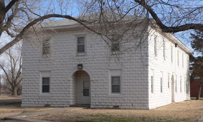
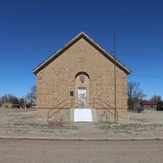
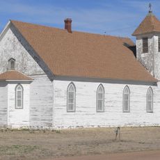
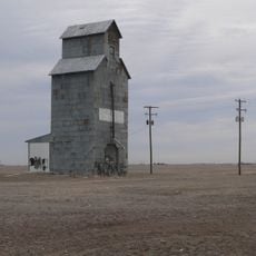
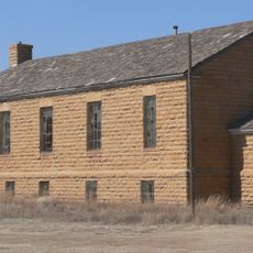
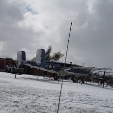
Franklin Hall, Goodwell, Oklahoma, NRHP-listed

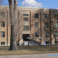
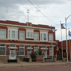
Franklin Hall is a residential building in Goodwell, Oklahoma, built around 1909-1910 by local builder Frank Shinville. It has a simple rectangular structure with a sloped asphalt roof and concrete walls, designed without following any particular architectural style.

The building dates from the earliest years of the Panhandle Agricultural Institute, which later became Oklahoma Panhandle State University. After World War II, it was converted into apartments for married students and faculty, and it remains one of the only surviving structures from the school's founding era.

Franklin Hall started as a dormitory for female students, reflecting how housing was organized by gender in early student life. The building shows how student living arrangements and daily routines changed as the school itself evolved.

The building has been partially closed in recent years due to safety concerns and needed repairs to meet current building codes. Visitors should check access conditions beforehand, as portions may not be open to the public.

It is the only surviving building from the school's founding period and was added to the National Register of Historic Places in the early 2000s. This makes it a rare connection to the earliest days of higher education development in the Oklahoma Panhandle.

The community of curious travelers

AroundUs brings together thousands of curated places, local tips, and hidden gems, enriched daily by 60,000 contributors worldwide.

Start exploring
Location
GPS coordinates
36.59417,-101.63583
Latest update
February 9, 2026 07:43
Around this place
Lake Meredith
United States of America

Lake Meredith

98.2 km
Woo Cheong Pawn Shop
China

Woo Cheong Pawn Shop

115.3 km
Rita Blanca National Grassland
United States of America

Rita Blanca National Grassland

88.1 km
Black Mesa State Park
United States of America

Black Mesa State Park

114.5 km
Picture Canyon
United States of America

Picture Canyon

109.4 km
Texhomex
United States of America

Texhomex

122.6 km
8 Mile Corner
United States of America

8 Mile Corner

57.3 km
Cimarron County Courthouse
United States of America

Cimarron County Courthouse

79.7 km
Point of Rocks
United States of America

Point of Rocks

62.8 km
Springfield Schoolhouse
United States of America

Springfield Schoolhouse

125.8 km
Stonington First Methodist-Episcopal Church
United States of America

Stonington First Methodist-Episcopal Church

92.1 km
Texas County Courthouse
United States of America

Texas County Courthouse

17 km
Dorothy's House and Land of Oz
United States of America

Dorothy's House and Land of Oz

81.1 km
Morton County WPA Bridge
United States of America

Morton County WPA Bridge

83.9 km
Hooker Woodframe Grain Elevator
United States of America

Hooker Woodframe Grain Elevator

48.6 km
Dallam County Courthouse
United States of America

Dallam County Courthouse

99.1 km
Lipscomb County Courthouse
United States of America

Lipscomb County Courthouse

128.7 km
Menno Community Hall
United States of America

Menno Community Hall

133.8 km
Grant County Courthouse District
United States of America

Grant County Courthouse District

112.5 km
Gray County Courthouse
United States of America

Gray County Courthouse

132.4 km
XIT Museum
United States of America

XIT Museum

99.3 km
Pampa City Hall
United States of America

Pampa City Hall

132.5 km
Freedom Museum USA
United States of America

Freedom Museum USA

131.9 km
Ellis Theatre
United States of America

Ellis Theatre

77.7 km
Morley Theatre
United States of America

Morley Theatre

104.9 km
Mission Theater
United States of America

Mission Theater

99.2 km
Lyric Cinema
United States of America

Lyric Cinema

59 km
White Deer Land Company Building
United States of America

White Deer Land Company Building

132.6 km
Show the full map
« Franklin Hall - Goodwell, Oklahoma, NRHP-listed » is provided by Around Us (aroundus.com). Images and texts are derived from Wikimedia project under a Creative Commons license. You are allowed to copy, distribute, and modify copies of this page, under the conditions set by the license, as long as this note is clearly visible.

Discover hidden gems everywhere you go!

From secret cafés to breathtaking viewpoints, skip the crowded tourist spots and find places that match your style. Our app makes it easy with voice search, smart filtering, route optimization, and insider tips from travelers worldwide. Download now for the complete mobile experience.

Around Us App Screenshot

A unique approach to discovering new places

Le Figaro

All the places worth exploring

France Info

A tailor-made excursion in just a few clicks

20 Minutes

Around Us
Travel Guide & Maps
Download

Send to your phone

QR Code
1

Open the camera app on your mobile.

2

Point at the QR code with your camera. A notification will appear.

3

Tap the notification to open the link.