Enable Location

We need your location to show you interesting places around you

Discover nearby places

Find interesting locations and hidden gems around you

Precise directions

Get accurate directions and distances to places

Your location is never shared with other users. It's only used when you tap the location button.

Black Mesa State Park

Log in to your account

Start exploring — it's free

Trusted by 62,528 travelers worldwide

Continue with Google
Continue with Apple
or

We will send you a code to connect

By continuing, you accept our Terms and Conditions and our Privacy Policy

Check your inbox

We've sent a pincode in your inbox. Please enter the code below.

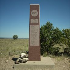
Black Mesa State Park, State park in Oklahoma panhandle, US

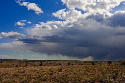
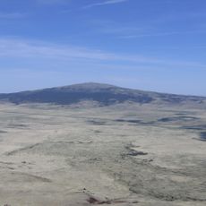
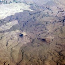
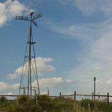
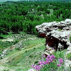
Black Mesa State Park is a nature reserve in the Oklahoma panhandle where Oklahoma, Colorado, and New Mexico meet. The landscape features grasslands below a distinctive plateau made of black volcanic rock that rises prominently above the surrounding terrain.

The black rock of the plateau formed roughly 30 million years ago when volcanic activity deposited a thick layer across the formation. This geological event gave the location its name and created the distinctive appearance that defines the park today.

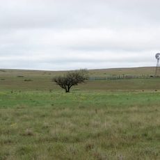
The park sits where two different ecosystems meet, supporting plants and animals found nowhere else in the region. Visitors can see how nature thrives in this transition zone during their hikes.

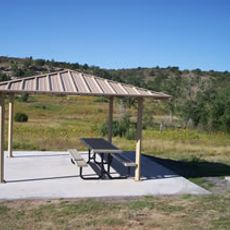
The park provides camping and RV sites with basic facilities like water and electric connections, plus picnic areas and restrooms. Visitors should prepare for temperature changes between day and night, especially during spring and fall, while exploring the trails throughout the grounds.

The location offers some of the darkest night skies in the United States, making it excellent for observing stars and meteor showers. These conditions result from its remote position far from artificial lights of nearby cities.

The community of curious travelers

AroundUs brings together thousands of curated places, local tips, and hidden gems, enriched daily by 60,000 contributors worldwide.

Start exploring
Location
GPS coordinates
36.84590,-102.88000
Latest update
December 9, 2025 18:44
Around this place
Black Mesa
United States of America

Black Mesa

49.1 km
Rita Blanca National Grassland
United States of America

Rita Blanca National Grassland

52.2 km
Sierra Grande
United States of America

Sierra Grande

90.2 km
Rabbit Ears
United States of America

Rabbit Ears

41.7 km
Clayton Lake State Park
United States of America

Clayton Lake State Park

48.3 km
Picture Canyon
United States of America

Picture Canyon

21.7 km
Texhomex
United States of America

Texhomex

40 km
8 Mile Corner
United States of America

8 Mile Corner

76.3 km
Cimarron County Courthouse
United States of America

Cimarron County Courthouse

35.2 km
United States of America

Folsom Falls

89.2 km
Eklund Hotel
United States of America

Eklund Hotel

51.6 km
Point of Rocks
United States of America

Point of Rocks

88.5 km
Luna Theater
United States of America

Luna Theater

51.7 km
Clayton Public Library
United States of America

Clayton Public Library

51.6 km
Amistad Gymnasium
United States of America

Amistad Gymnasium

106.1 km
Folsom Hotel
United States of America

Folsom Hotel

92.6 km
Gate, Fence and Hollow Tree Shelter Designed by Dionicio Rodriguez
United States of America

Gate, Fence and Hollow Tree Shelter Designed by Dionicio Rodriguez

51.5 km
Springfield Schoolhouse
United States of America

Springfield Schoolhouse

66.6 km
Stonington First Methodist-Episcopal Church
United States of America

Stonington First Methodist-Episcopal Church

79.2 km
Union County Courthouse
United States of America

Union County Courthouse

52 km
Clayton Public Schools Historic District
United States of America

Clayton Public Schools Historic District

51.4 km
Morton County WPA Bridge
United States of America

Morton County WPA Bridge

101.8 km
Dallam County Courthouse
United States of America

Dallam County Courthouse

93 km
Eklund Hotel Historic Site
United States of America

Eklund Hotel Historic Site

51.6 km
Goodson Memorial School
United States of America

Goodson Memorial School

20.5 km
Ludlow Monument
United States of America

Ludlow Monument

101.1 km
XIT Museum
United States of America

XIT Museum

93 km
Mission Theater
United States of America

Mission Theater

92.9 km
Show the full map
« Black Mesa State Park - State park in Oklahoma panhandle, US » is provided by Around Us (aroundus.com). Images and texts are derived from Wikimedia project under a Creative Commons license. You are allowed to copy, distribute, and modify copies of this page, under the conditions set by the license, as long as this note is clearly visible.

Discover hidden gems everywhere you go!

From secret cafés to breathtaking viewpoints, skip the crowded tourist spots and find places that match your style. Our app makes it easy with voice search, smart filtering, route optimization, and insider tips from travelers worldwide. Download now for the complete mobile experience.

Around Us App Screenshot

A unique approach to discovering new places

Le Figaro

All the places worth exploring

France Info

A tailor-made excursion in just a few clicks

20 Minutes

Around Us
Travel Guide & Maps
Download

Send to your phone

QR Code
1

Open the camera app on your mobile.

2

Point at the QR code with your camera. A notification will appear.

3

Tap the notification to open the link.