Cimarron County

Log in to your account

AroundUs is a community-driven map of interesting places, built by curious explorers like you. It grows with every review, story, and photo you share.
Connect to save your favorite spots, contribute locations, and create personalized routes.
Continue with Google
Continue with Apple
Continue with X
Continue with Facebook
Continue with email
By continuing, you accept our Terms and Conditions and our Privacy Policy
Create an account
Add to collection
Map
Suggest a change
Share

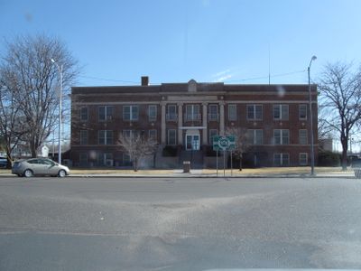
Cimarron County, County in western Oklahoma, United States

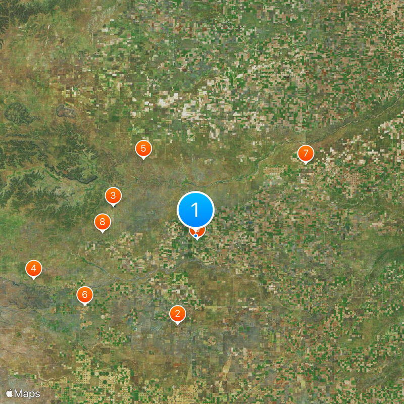
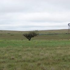
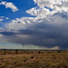
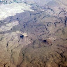
Cimarron County is an administrative area spanning 1,841 square miles across Oklahoma's Panhandle. The landscape features Black Mesa, a distinctive high point, along with extensive agricultural lands that define much of the terrain.

The area was known as No Man's Land before 1890, a region without clear legal authority where ranchers and settlers lived outside established laws. This period ended in 1907 when the territory became part of the state of Oklahoma.

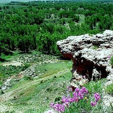
The Kenton Caves hold Native American artifacts, tools, and rock art that show thousands of years of people living in this region. These caves tell the story of how long communities have called this place home.

The area is accessible via several highways, including US routes 56, 64, 412, and 287, connecting to neighboring states and regional services. Visitors should be prepared with a vehicle, as the region is sparsely settled with considerable distances between locations.

This is the only county in the United States that touches four different states - Colorado, Kansas, New Mexico, and Texas. This geographic position makes the region cartographically and politically one of a kind.

Location: Oklahoma

Inception: 1907

Capital city: Boise City

Shares border with: Dallam County, Baca County, Morton County, Texas County, Sherman County, Union County

GPS coordinates: 36.74000,-102.52000

Latest update: December 19, 2025 22:23

Photos
Around this place
Rita Blanca National Grassland
United States of America

Rita Blanca National Grassland

34.8 km
Black Mesa State Park
United States of America

Black Mesa State Park

34.2 km
Rabbit Ears
United States of America

Rabbit Ears

65 km
Picture Canyon
United States of America

Picture Canyon

36.2 km
Texhomex
United States of America

Texhomex

50.6 km
8 Mile Corner
United States of America

8 Mile Corner

51 km
United States of America

Camp Nichols

36.3 km
Cimarron County Courthouse
United States of America

Cimarron County Courthouse

1.3 km
Eklund Hotel
United States of America

Eklund Hotel

67.5 km
Point of Rocks
United States of America

Point of Rocks

65.7 km
Clayton Public Library
United States of America

Clayton Public Library

67.4 km
United States of America

CCC Ranch Headquarters

55.5 km
Gate, Fence and Hollow Tree Shelter Designed by Dionicio Rodriguez
United States of America

Gate, Fence and Hollow Tree Shelter Designed by Dionicio Rodriguez

67.2 km
Stonington First Methodist-Episcopal Church
United States of America

Stonington First Methodist-Episcopal Church

68.4 km
Clayton Public Schools Historic District
United States of America

Clayton Public Schools Historic District

67 km
Eklund Hotel Historic Site
United States of America

Eklund Hotel Historic Site

67.5 km
Goodson Memorial School
United States of America

Goodson Memorial School

54.6 km
United States of America

Tracey Woodframe Grain Elevator

68.3 km
United States of America

Cimarron Heritage Center Museum

552 m
United States of America

Clarks Monument

53.7 km
United States of America

Devils Elbow

30.1 km
United States of America

Autograph Cliff

15.5 km
United States of America

Point Rock Golf Club

63.2 km
United States of America

Clayton Golf Club

65.9 km
United States of America

Petrified Log Exhibit

34.5 km
United States of America

Herzstein Memorial Museum Historic Site

67.5 km
United States of America

Public Shooting Range

63.3 km
United States of America

Point of Rocks

65.7 km
Show the full map
Reviews

Visited this place? Tap the stars to rate it and share your experience / photos with the community! Try now! You can cancel it anytime.

Administrative divisions
« Cimarron County - County in western Oklahoma, United States » is provided by Around Us (aroundus.com). Images and texts are derived from Wikimedia project under a Creative Commons license. You are allowed to copy, distribute, and modify copies of this page, under the conditions set by the license, as long as this note is clearly visible.

Discover hidden gems everywhere you go!

From secret cafés to breathtaking viewpoints, skip the crowded tourist spots and find places that match your style. Our app makes it easy with voice search, smart filtering, route optimization, and insider tips from travelers worldwide. Download now for the complete mobile experience.

Around Us App Screenshot

A unique approach to discovering new places

Le Figaro

All the places worth exploring

France Info

A tailor-made excursion in just a few clicks

20 Minutes