Enable Location

We need your location to show you interesting places around you

Discover nearby places

Find interesting locations and hidden gems around you

Precise directions

Get accurate directions and distances to places

Your location is never shared with other users. It's only used when you tap the location button.

Clayton Lake State Park

Log in to your account

Start exploring — it's free

Trusted by 63,445 travelers worldwide

Continue with Google
Continue with Apple
or

We will send you a code to connect

By continuing, you accept our Terms and Conditions and our Privacy Policy

Check your inbox

We've sent a pincode in your inbox. Please enter the code below.

Discussion Reviews 1 Photos 1 Collections
4.1k Popularity

Clayton Lake State Park, State park and dark sky observation site in Union County, New Mexico.

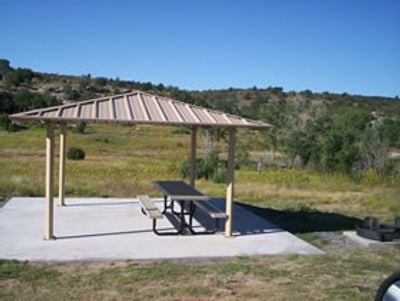
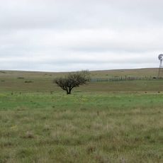
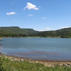
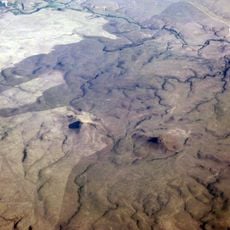
Clayton Lake State Park is a recreation area centered on a large freshwater reservoir surrounded by grasslands in northeastern New Mexico at an elevation of 5,186 feet (1,580 meters). The park features camping areas, picnic grounds, and water access for swimming and fishing throughout the year.

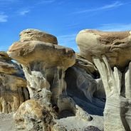
The park was established in 1965 and gained wider attention when workers uncovered dinosaur tracks during dam construction in the 1980s. These discoveries revealed that the area was once crossed by large reptiles from the Cretaceous period.

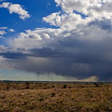
The observatory here lets visitors study constellations and celestial bodies in one of the darkest locations in New Mexico. Programs are designed so people can observe the night sky without light pollution interfering with their view.

The park offers 26 developed campsites with electrical hookups, modern restrooms, and showers for overnight stays and day visits. The facilities and gentle terrain make the area accessible for most visitors.

The exposed bedrock near the spillway shows over 500 fossilized dinosaur footprints from the Cretaceous period. These tracks remain visible to visitors walking along the site and tell the story of ancient life in this area.

The community of curious travelers

AroundUs brings together thousands of curated places, local tips, and hidden gems, enriched daily by 60,000 contributors worldwide.

Start exploring
Location
Inception
1965
GPS coordinates
36.57830,-103.30600
Latest update
December 6, 2025 17:42
Wonders of New Mexico, between raw nature and legends of the Far West

From underground caves to pure gypsum fields, New Mexico offers landscapes shaped by millions of years of geology and the cultures that have left their marks there.

Around this place
Black Mesa
United States of America

Black Mesa

56.1 km
Folsom Site
United States of America

Folsom Site

76.2 km
Rita Blanca National Grassland
United States of America

Rita Blanca National Grassland

65.2 km
Sierra Grande
United States of America

Sierra Grande

52.9 km
Sugarite Canyon State Park
United States of America

Sugarite Canyon State Park

105.2 km
Black Mesa State Park
United States of America

Black Mesa State Park

48.3 km
Rabbit Ears
United States of America

Rabbit Ears

7.5 km
Picture Canyon
United States of America

Picture Canyon

69.1 km
Texhomex
United States of America

Texhomex

28.5 km
Raton Downtown Historic District
United States of America

Raton Downtown Historic District

107.2 km
Trinchera Cave Archeological District
United States of America

Trinchera Cave Archeological District

90.9 km
Cimarron County Courthouse
United States of America

Cimarron County Courthouse

72.8 km
United States of America

Folsom Falls

60.9 km
Eklund Hotel
United States of America

Eklund Hotel

17.8 km
Luna Theater
United States of America

Luna Theater

17.8 km
Clayton Public Library
United States of America

Clayton Public Library

17.9 km
Amistad Gymnasium
United States of America

Amistad Gymnasium

74.6 km
St. John's Methodist Episcopal Church
United States of America

St. John's Methodist Episcopal Church

88.5 km
Folsom Hotel
United States of America

Folsom Hotel

62.2 km
Gate, Fence and Hollow Tree Shelter Designed by Dionicio Rodriguez
United States of America

Gate, Fence and Hollow Tree Shelter Designed by Dionicio Rodriguez

18.2 km
Union County Courthouse
United States of America

Union County Courthouse

17.9 km
Clayton Public Schools Historic District
United States of America

Clayton Public Schools Historic District

18.3 km
Dallam County Courthouse
United States of America

Dallam County Courthouse

90.8 km
Eklund Hotel Historic Site
United States of America

Eklund Hotel Historic Site

17.8 km
Goodson Memorial School
United States of America

Goodson Memorial School

42.5 km
Longfellow School
United States of America

Longfellow School

106.8 km
Ludlow Monument
United States of America

Ludlow Monument

77.7 km
XIT Museum
United States of America

XIT Museum

90.8 km
Show the full map
Reviews
Share your experience

No review yet

Discussions
Start a discussion...

No discussion yet

« Clayton Lake State Park - State park and dark sky observation site in Union County, New Mexico » is provided by Around Us (aroundus.com). Images and texts are derived from Wikimedia project under a Creative Commons license. You are allowed to copy, distribute, and modify copies of this page, under the conditions set by the license, as long as this note is clearly visible.

Discover hidden gems everywhere you go!

From secret cafés to breathtaking viewpoints, skip the crowded tourist spots and find places that match your style. Our app makes it easy with voice search, smart filtering, route optimization, and insider tips from travelers worldwide. Download now for the complete mobile experience.

Around Us App Screenshot

A unique approach to discovering new places

Le Figaro

All the places worth exploring

France Info

A tailor-made excursion in just a few clicks

20 Minutes

Around Us
Travel Guide & Maps
Download

Send to your phone

QR Code
1

Open the camera app on your mobile.

2

Point at the QR code with your camera. A notification will appear.

3

Tap the notification to open the link.