Sugarite Canyon State Park

Log in to your account

AroundUs is a community-driven map of interesting places, built by curious explorers like you. It grows with every review, story, and photo you share.
Connect to save your favorite spots, contribute locations, and create personalized routes.
By continuing, you accept our Terms and Conditions and our Privacy Policy

Sugarite Canyon State Park

Add to collection
Map
Suggest a change
Share

Sugarite Canyon State Park, State park in Colfax County, New Mexico.

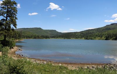
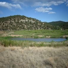
Sugarite Canyon State Park is a 3,600-acre protected area situated where the Rocky Mountains meet the Great Plains. The landscape combines pine forests, two lakes, meadows, and dramatic mesa formations within a largely undeveloped setting.

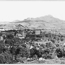
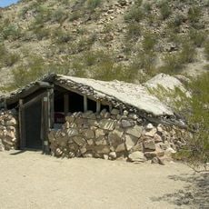
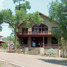
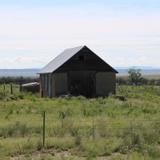
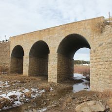
Coal mining shaped the region starting in 1894, leading to the founding of the mining town of Sugarite in 1912. The settlement briefly flourished as a coal community before economic shifts caused its gradual decline.

The name derives from either the Comanche and Ute word for a local bird or the Spanish term Chicorica, meaning chicory plant.

The area offers over 20 kilometers of hiking trails for various fitness levels plus fishing and camping opportunities. Visitors should bring sturdy footwear and prepare for changing elevations and variable weather conditions.

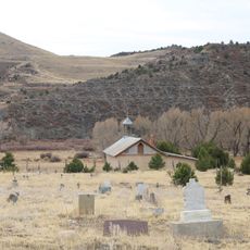
Hikers can reach the park's highest point on the Ponderosa Ridge Trail and discover ruins from the former mining town along the way. These hidden remains tell the story of a vanished community set within the park's natural landscape.

Location: Colfax County

Inception: 1985

Website: https://emnrd.nm.gov/spd/find-a-park/sugarite-canyon-state-park

GPS coordinates: 36.95920,-104.38600

Latest update: December 9, 2025 18:43

Photos
Around this place
Raton Pass
United States of America

Raton Pass

9.7 km
Folsom Site
United States of America

Folsom Site

29.3 km
Trinidad Lake State Park
United States of America

Trinidad Lake State Park

26.4 km
Raton Mesa
United States of America

Raton Mesa

8.3 km
Raton Downtown Historic District
United States of America

Raton Downtown Historic District

8.2 km
Ludlow Tent Colony Site
United States of America

Ludlow Tent Colony Site

45.8 km
Trinchera Cave Archeological District
United States of America

Trinchera Cave Archeological District

40.2 km
Penitente Canyon
United States of America

Penitente Canyon

28 km
Frank G. Bloom House
United States of America

Frank G. Bloom House

25.9 km
Trinidad History Museum
United States of America

Trinidad History Museum

25.6 km
St. John's Methodist Episcopal Church
United States of America

St. John's Methodist Episcopal Church

16.9 km
Colfax County Courthouse
United States of America

Colfax County Courthouse

7.8 km
First Baptist Church
United States of America

First Baptist Church

26.4 km
Cokedale Historic District
United States of America

Cokedale Historic District

29.1 km
Our Lady of Guadalupe Church and Medina Cemetery
United States of America

Our Lady of Guadalupe Church and Medina Cemetery

41.3 km
Earl School
United States of America

Earl School

42.4 km
Corazon de Trinidad
United States of America

Corazon de Trinidad

25.6 km
Frank Latuda House
United States of America

Frank Latuda House

26.6 km
Baca House and Outbuilding
United States of America

Baca House and Outbuilding

25.6 km
El Raton Theatre
United States of America

El Raton Theatre

7.9 km
Aultman House
United States of America

Aultman House

26.7 km
Jaffa Opera House
United States of America

Jaffa Opera House

25.6 km
Columbian School
United States of America

Columbian School

7.1 km
Longfellow School
United States of America

Longfellow School

8.1 km
Original Townsite Historic District
United States of America

Original Townsite Historic District

8.4 km
Bridge over Burro Cañon
United States of America

Bridge over Burro Cañon

36.4 km
Ludlow Monument
United States of America

Ludlow Monument

34.6 km
Raton Museum
United States of America

Raton Museum

8 km
Show the full map
Reviews

Visited this place? Tap the stars to rate it and share your experience / photos with the community! Try now! You can cancel it anytime.

« Sugarite Canyon State Park - State park in Colfax County, New Mexico » is provided by Around Us (aroundus.com). Images and texts are derived from Wikimedia project under a Creative Commons license. You are allowed to copy, distribute, and modify copies of this page, under the conditions set by the license, as long as this note is clearly visible.

Discover hidden gems everywhere you go!

From secret cafés to breathtaking viewpoints, skip the crowded tourist spots and find places that match your style. Our app makes it easy with voice search, smart filtering, route optimization, and insider tips from travelers worldwide. Download now for the complete mobile experience.

Around Us App Screenshot

A unique approach to discovering new places

Le Figaro

All the places worth exploring

France Info

A tailor-made excursion in just a few clicks

20 Minutes