Enable Location

We need your location to show you interesting places around you

Discover nearby places

Find interesting locations and hidden gems around you

Precise directions

Get accurate directions and distances to places

Your location is never shared with other users. It's only used when you tap the location button.

Hemphill County

Log in to your account

Start exploring — it's free

Trusted by 62,488 travelers worldwide

Continue with Google
Continue with Apple
or

We will send you a code to connect

By continuing, you accept our Terms and Conditions and our Privacy Policy

Check your inbox

We've sent a pincode in your inbox. Please enter the code below.

Hemphill County, County in Texas Panhandle, US.

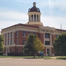
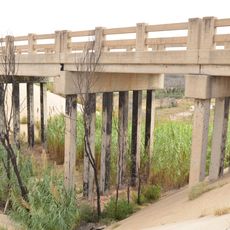
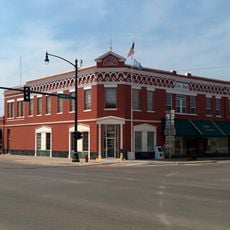
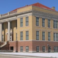
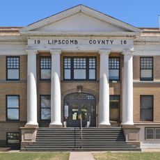
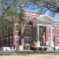
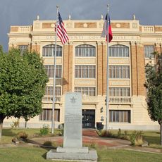
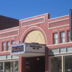
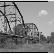
Hemphill County is a county in Texas's Panhandle region that spans rolling plains with the Canadian River flowing through its northern area. The seat is located in Canadian, a small city serving as the administrative center.

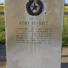
Founded in 1887 and named after John Hemphill, the county was established after indigenous peoples including Apache, Comanche, and Kiowa left the region in 1875. This marked a transition in how the land would be settled and developed.

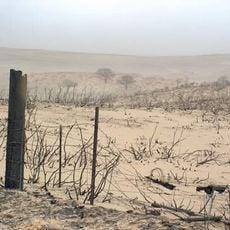
Agriculture and ranching shape how people use the land here, with wheat fields and pastures marking the landscape across generations. These activities remain visible in how the countryside is organized and maintained today.

Two main highways, U.S. 60 and U.S. 83, cross through the county and connect it to nearby communities and larger centers. These routes make it easy to navigate and reach other parts of the region.

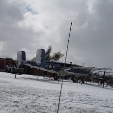
The Buffalo Wallow Fight of 1874 was a military clash between U.S. Army forces and Native American tribes that took place within the county's boundaries. This battle represents a pivotal moment in the region's frontier conflicts.

The community of curious travelers

AroundUs brings together thousands of curated places, local tips, and hidden gems, enriched daily by 60,000 contributors worldwide.

Start exploring
Location
Inception
1887
Capital city
Canadian
Shares border with
Lipscomb County, Wheeler County, Roger Mills County, Roberts County, Gray County, Ellis County
GPS coordinates
35.83000,-100.28000
Latest update
December 8, 2025 13:42
Around this place
Woo Cheong Pawn Shop
China

Woo Cheong Pawn Shop

70 km
McClellan Creek National Grassland
United States of America

McClellan Creek National Grassland

87.2 km
Fort Elliott
United States of America

Fort Elliott

38.2 km
Devils Rope Barbed Wire Museum
United States of America

Devils Rope Barbed Wire Museum

72.6 km
West Winds Motel
United States of America

West Winds Motel

77.7 km
Beckham County Courthouse
United States of America

Beckham County Courthouse

83.6 km
Route 66 Bridge over the Chicago, Rock Island and Gulf Railroad
United States of America

Route 66 Bridge over the Chicago, Rock Island and Gulf Railroad

69 km
Sayre Downtown Historic District
United States of America

Sayre Downtown Historic District

83.4 km
J. W. Danner House
United States of America

J. W. Danner House

83.1 km
Roberts County Courthouse
United States of America

Roberts County Courthouse

35.5 km
Lipscomb County Courthouse
United States of America

Lipscomb County Courthouse

45 km
Ellis County Courthouse
United States of America

Ellis County Courthouse

57 km
Gray County Courthouse
United States of America

Gray County Courthouse

69.9 km
Pampa H2O Aquatic Center
United States of America

Pampa H2O Aquatic Center

70.1 km
Devil's Rope Museum
United States of America

Devil's Rope Museum

72.6 km
The Artesian Beach
United States of America

The Artesian Beach

73 km
Pioneer West Museum
United States of America

Pioneer West Museum

68.4 km
Pampa City Hall
United States of America

Pampa City Hall

69.9 km
Freedom Museum USA
United States of America

Freedom Museum USA

70.5 km
Palace Theatre
United States of America

Palace Theatre

13.3 km
Ellis Theatre
United States of America

Ellis Theatre

78.8 km
National Route 66 Museum
United States of America

National Route 66 Museum

89.4 km
White Deer Land Company Building
United States of America

White Deer Land Company Building

69.8 km
McLean Commercial Historic District
United States of America

McLean Commercial Historic District

72.6 km
Shattuck Windmill Museum
United States of America

Shattuck Windmill Museum

60.4 km
Phillips 66 Station (McLean, Texas)
United States of America

Phillips 66 Station (McLean, Texas)

72.6 km
Roberts County Museum
United States of America

Roberts County Museum

35.7 km
Canadian River Wagon Bridge
United States of America

Canadian River Wagon Bridge

14.2 km
Show the full map
Administrative divisions
« Hemphill County - County in Texas Panhandle, US » is provided by Around Us (aroundus.com). Images and texts are derived from Wikimedia project under a Creative Commons license. You are allowed to copy, distribute, and modify copies of this page, under the conditions set by the license, as long as this note is clearly visible.

Discover hidden gems everywhere you go!

From secret cafés to breathtaking viewpoints, skip the crowded tourist spots and find places that match your style. Our app makes it easy with voice search, smart filtering, route optimization, and insider tips from travelers worldwide. Download now for the complete mobile experience.

Around Us App Screenshot

A unique approach to discovering new places

Le Figaro

All the places worth exploring

France Info

A tailor-made excursion in just a few clicks

20 Minutes

Around Us
Travel Guide & Maps
Download

Send to your phone

QR Code
1

Open the camera app on your mobile.

2

Point at the QR code with your camera. A notification will appear.

3

Tap the notification to open the link.