Enable Location

We need your location to show you interesting places around you

Discover nearby places

Find interesting locations and hidden gems around you

Precise directions

Get accurate directions and distances to places

Your location is never shared with other users. It's only used when you tap the location button.

Spiro Mounds

Log in to your account

Start exploring — it's free

Trusted by 62,015 travelers worldwide

Continue with Google
Continue with Apple
or

We will send you a code to connect

By continuing, you accept our Terms and Conditions and our Privacy Policy

Check your inbox

We've sent a pincode in your inbox. Please enter the code below.

Spiro Mounds, Archaeological site in Redland, Oklahoma.

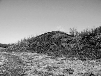
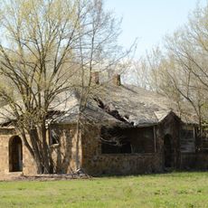
Spiro Mounds is an archaeological site in LeFlore County, Oklahoma, covering roughly 150 acres (60 hectares) along the Arkansas River. The grounds include twelve earthen mounds of different sizes and functions, among them structures for burials and residential areas.

The settlement began around the year 850 and grew over six centuries into a major center of Mississippian culture. Around 1450, the inhabitants left the site, likely due to environmental shifts or changes in trade routes.

The people who lived here belonged to a community that maintained contact with other settlements across hundreds of miles, exchanging shells, copper and stone. These connections brought ideas and craft techniques into the Arkansas River valley, reflected in the preserved objects found at the site.

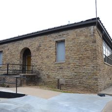
Visitors can walk the trails between the mounds and view the exhibits at the archaeological center. Guided tours led by specialists provide insight into the excavations and the history of the site.

One of the larger mounds contained a sealed chamber where organic materials such as textiles and woven baskets survived. These rare finds provide insight into the daily life and craftsmanship of a community long gone.

The community of curious travelers

AroundUs brings together thousands of curated places, local tips, and hidden gems, enriched daily by 60,000 contributors worldwide.

Start exploring
Location
GPS coordinates
35.31194,-94.56861
Latest update
December 19, 2025 23:56
Around this place
Fort Smith National Historic Site
United States of America

Fort Smith National Historic Site

15.1 km
Fort Smith Trolley Museum
United States of America

Fort Smith Trolley Museum

15 km
Fort Smith National Cemetery
United States of America

Fort Smith National Cemetery

15 km
Jenson Tunnel
United States of America

Jenson Tunnel

15.5 km
St. Louis–San Francisco 4003
United States of America

St. Louis–San Francisco 4003

15 km
Fort Smith Masonic Temple
United States of America

Fort Smith Masonic Temple

15.9 km
Fort Smith Museum of History
United States of America

Fort Smith Museum of History

15.3 km
Birney Safety Streetcar No. 224
United States of America

Birney Safety Streetcar No. 224

15 km
Commercial Hotel
United States of America

Commercial Hotel

15.4 km
W.H.H. Clayton House
United States of America

W.H.H. Clayton House

16.1 km
W. D. Mayo Lock and Dam
United States of America

W. D. Mayo Lock and Dam

996 m
Judge Isaac C. Parker Federal Building
United States of America

Judge Isaac C. Parker Federal Building

15.3 km
Sebastian County Courthouse/Ft. Smith City Hall
United States of America

Sebastian County Courthouse/Ft. Smith City Hall

15.3 km
Maumelle Ordnance Works Locomotive 1
United States of America

Maumelle Ordnance Works Locomotive 1

15 km
New Theatre
United States of America

New Theatre

15.6 km
Ft. Smith Confederate Monument
United States of America

Ft. Smith Confederate Monument

15.3 km
Belle Grove Historic District
United States of America

Belle Grove Historic District

16 km
United States Air Force Locomotive No. 1246
United States of America

United States Air Force Locomotive No. 1246

15 km
James Sparks House
United States of America

James Sparks House

16.2 km
West Garrison Avenue Historic District
United States of America

West Garrison Avenue Historic District

15.4 km
Bonneville House
United States of America

Bonneville House

16 km
Oscar Chambers House
United States of America

Oscar Chambers House

16.1 km
Williams School
United States of America

Williams School

16.3 km
Tucker School
United States of America

Tucker School

15.2 km
Robert Wanslow House
United States of America

Robert Wanslow House

16.3 km
Arkoma School
United States of America

Arkoma School

13.2 km
Harold Adams Office Building
United States of America

Harold Adams Office Building

16 km
Tillman Shaw House
United States of America

Tillman Shaw House

16 km
Show the full map
« Spiro Mounds - Archaeological site in Redland, Oklahoma » is provided by Around Us (aroundus.com). Images and texts are derived from Wikimedia project under a Creative Commons license. You are allowed to copy, distribute, and modify copies of this page, under the conditions set by the license, as long as this note is clearly visible.

Discover hidden gems everywhere you go!

From secret cafés to breathtaking viewpoints, skip the crowded tourist spots and find places that match your style. Our app makes it easy with voice search, smart filtering, route optimization, and insider tips from travelers worldwide. Download now for the complete mobile experience.

Around Us App Screenshot

A unique approach to discovering new places

Le Figaro

All the places worth exploring

France Info

A tailor-made excursion in just a few clicks

20 Minutes

Around Us
Travel Guide & Maps
Download

Send to your phone

QR Code
1

Open the camera app on your mobile.

2

Point at the QR code with your camera. A notification will appear.

3

Tap the notification to open the link.