Chest opened
+${chestReward.xp} XP
Explorer
NOUVEAU ×${chestReward.collectible.quantity}
tapez pour fermer
Chest locked

Open chests in the app

Around Us is built for your phone — chests unlock when you walk, explore and capture nearby places.

Enable Location

We need your location to show you interesting places around you

Discover nearby places

Find interesting locations and hidden gems around you

Precise directions

Get accurate directions and distances to places

Your location is never shared with other users. It's only used when you tap the location button.

Log in to your account

Start exploring — it's free

Trusted by 72,978 travelers worldwide

Continue with Google
Continue with Apple
or

We will send you a code to connect

By continuing, you accept our Terms and Conditions and our Privacy Policy

Check your inbox

We've sent a pincode in your inbox. Please enter the code below.

Heavener Runestone State Park
Discussion Reviews Photo
5.4k Popularity

Heavener Runestone State Park, Archaeological park in LeFlore County, Oklahoma, United States

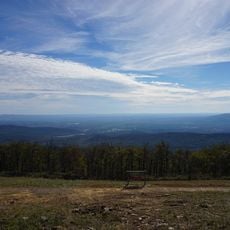
Heavener Runestone State Park is an outdoor area in eastern Oklahoma featuring woodlands and foothills where a large sandstone boulder with eight runic markings serves as the main draw. The site offers hiking trails, picnic grounds, and basic lodging options for overnight visitors.

The stone inscription was discovered in 1923 on the mountainside and remained largely unknown until growing interest in Norse connections brought attention to the carved boulder. Oklahoma established the park in 1970 to protect and preserve the site for public access.

The annual celebration at the park features Celtic music performances, staged combat demonstrations, and traditional games that draw visitors interested in Norse traditions. These events take place over multiple weekends and create a gathering space for people curious about Nordic heritage.

The site is free to visit and accessible during daylight hours with trails suitable for walking. Wear sturdy shoes and be prepared for uneven ground covered with tree roots and loose stones when exploring the grounds and marked paths.

The runic carvings on the boulder translate to 'Glome's Valley,' suggesting it may have marked land ownership by early travelers from northern Europe. No other Norse artifacts have ever been found in the surrounding region, making this stone an isolated mystery among local historians.

The community of curious travelers

AroundUs brings together thousands of curated places, local tips, and hidden gems, enriched daily by 60,000 contributors worldwide.

Start exploring
Location
Inception
1970
GPS coordinates
34.90000,-94.57810
Latest update
December 18, 2025 11:40
Around this place
Queen Wilhelmina State Park
United States of America

Queen Wilhelmina State Park

30.7 km
Lake Wister
United States of America

Lake Wister

14.7 km
Jenson Tunnel
United States of America

Jenson Tunnel

37.4 km
Peter Conser House
United States of America

Peter Conser House

12.2 km
Lake Wister State Park
United States of America

Lake Wister State Park

17.7 km
James E. Reynolds House
United States of America

James E. Reynolds House

26.4 km
Hartford Water Tower
United States of America

Hartford Water Tower

23 km
Mountain Fork Bridge
United States of America

Mountain Fork Bridge

44.5 km
C.E. Foster House
United States of America

C.E. Foster House

30.3 km
Jones Memorial Methodist Church
United States of America

Jones Memorial Methodist Church

22.9 km
Greenwood Presbyterian Church
United States of America

Greenwood Presbyterian Church

45.8 km
Trahern's Station
United States of America

Trahern's Station

31.9 km
Old Sebastian County Jail
United States of America

Old Sebastian County Jail

45.6 km
Scott County Courthouse
United States of America

Scott County Courthouse

44.5 km
Terry House
United States of America

Terry House

17.7 km
Hackett Creek Bridge
United States of America

Hackett Creek Bridge

35.9 km
LeFlore County Courthouse
United States of America

LeFlore County Courthouse

17.7 km
United States of America

Summerfield School

39.6 km
Williams School
United States of America

Williams School

29.8 km
C.E. Forrester House
United States of America

C.E. Forrester House

45.1 km
Skullyville County Jail
United States of America

Skullyville County Jail

33 km
Coop Creek Bridge
United States of America

Coop Creek Bridge

35.8 km
Old Scott County Jail
United States of America

Old Scott County Jail

44.4 km
Sebastian County Road 4G Bridge
United States of America

Sebastian County Road 4G Bridge

17.7 km
Bates School
United States of America

Bates School

18 km
Hartford Commercial Historic District
United States of America

Hartford Commercial Historic District

22.7 km
Old Huntington Jail
United States of America

Old Huntington Jail

35.4 km
Scott Theatre
United States of America

Scott Theatre

44.5 km
Show the full map
Reviews
Share your experience

No review yet

Discussions
Start a discussion...

No discussion yet

« Heavener Runestone State Park - Archaeological park in LeFlore County, Oklahoma, United States » is provided by Around Us (aroundus.com). Images and texts are derived from Wikimedia project under a Creative Commons license. You are allowed to copy, distribute, and modify copies of this page, under the conditions set by the license, as long as this note is clearly visible.

Discover hidden gems everywhere you go!

From secret cafés to breathtaking viewpoints, skip the crowded tourist spots and find places that match your style. Our app makes it easy with voice search, smart filtering, route optimization, and insider tips from travelers worldwide. Download now for the complete mobile experience.

Around Us App Screenshot

A unique approach to discovering new places

Le Figaro

All the places worth exploring

France Info

A tailor-made excursion in just a few clicks

20 Minutes

Around Us
Travel Guide & Maps
Download

Send to your phone

QR Code
1

Open the camera app on your mobile.

2

Point at the QR code with your camera. A notification will appear.

3

Tap the notification to open the link.