Quivira National Wildlife Refuge, National Wildlife Refuge and Ramsar site in central Kansas, United States
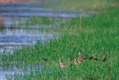
Quivira National Wildlife Refuge is a federally protected area in central Kansas made up of salt marshes, sand prairies, and wetlands. The mix of saline and freshwater conditions creates a range of habitats that draws over 300 bird species throughout the year.
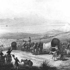
In 1541, Spanish explorer Francisco Vásquez de Coronado crossed this region searching for a legendary city of gold called Quivira. He found no city, but his journey left behind the name that the refuge still carries today.
The name Quivira comes from the Wichita people who lived across these plains for centuries. Visitors who walk the trails today carry that name forward without always knowing the community it points to.
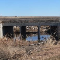
Two main roads run through the refuge and give a broad view of the different zones, making it easy to cover a lot of ground by car. Walking trails and a raised boardwalk over the marshes offer a closer look, so bringing water and sturdy shoes is a good idea, especially in warmer months.
The refuge holds 34 wetlands with salt levels normally found only along ocean coasts, a rare condition for a landlocked area. That salinity draws species that would not typically appear this far inland, making the birdwatching here different from most prairie sites.
The community of curious travelers
AroundUs brings together thousands of curated places, local tips, and hidden gems, enriched daily by 60,000 contributors worldwide.