Enable Location

We need your location to show you interesting places around you

Discover nearby places

Find interesting locations and hidden gems around you

Precise directions

Get accurate directions and distances to places

Your location is never shared with other users. It's only used when you tap the location button.

Rice County

Log in to your account

Start exploring — it's free

Trusted by 65,437 travelers worldwide

Continue with Google
Continue with Apple
or

We will send you a code to connect

By continuing, you accept our Terms and Conditions and our Privacy Policy

Check your inbox

We've sent a pincode in your inbox. Please enter the code below.

Discussion Reviews 1 Photos
9.9k Popularity

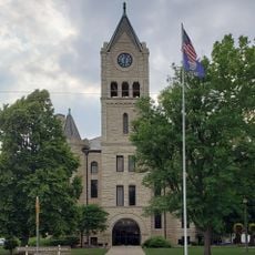
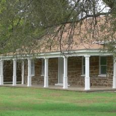
Rice County, County in Kansas, United States

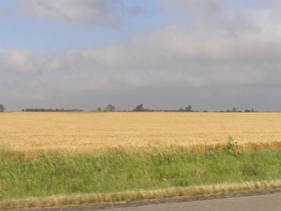
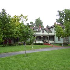
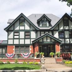
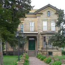
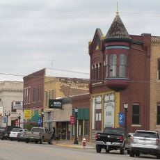
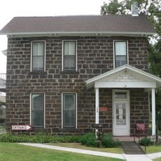
Rice County is a county in central Kansas, with the town of Lyons serving as its county seat. The land is mostly flat, covered by farmland and grassland, with small towns scattered across the area.

The county was established in 1867 and named after Brigadier-General Samuel Allen Rice, a Union officer in the Civil War. He died in 1864 from wounds received at the Battle of Jenkins Ferry.

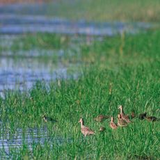
Quivira National Wildlife Refuge sits within the county and draws birders who come to see rare migratory species passing through the Great Plains. The refuge lies along a major bird migration corridor, making it a well-known stop for nature photographers.

Quivira National Wildlife Refuge has marked trails and viewing areas that are open throughout the year. Early fall and spring are generally the best times to spot migratory birds passing through.

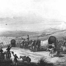
Original wagon ruts from the Santa Fe Trail are still visible in the ground at several spots across the county. These deep grooves were pressed into the earth by heavily loaded trade wagons in the 19th century and have survived to this day.

The community of curious travelers

AroundUs brings together thousands of curated places, local tips, and hidden gems, enriched daily by 60,000 contributors worldwide.

Start exploring
Location
Inception
February 26, 1867
Capital city
Lyons
Shares border with
Ellsworth County, Reno County, McPherson County, Barton County, Stafford County
GPS coordinates
38.35000,-98.20000
Latest update
March 3, 2026 10:12
Around this place
Kansas Cosmosphere and Space Center
United States of America

Kansas Cosmosphere and Space Center

40 km
Mushroom Rock State Park
United States of America

Mushroom Rock State Park

44.4 km
Kanopolis State Park
United States of America

Kanopolis State Park

38.4 km
Quivira National Wildlife Refuge
United States of America

Quivira National Wildlife Refuge

32.7 km
Fort Harker
United States of America

Fort Harker

40.2 km
Hutchinson Zoo
United States of America

Hutchinson Zoo

43.5 km
Kansas Motorcycle Museum
United States of America

Kansas Motorcycle Museum

39.2 km
Fox Theater
United States of America

Fox Theater

40.5 km
St. Theresa's Catholic Church
United States of America

St. Theresa's Catholic Church

40.2 km
Hans Hanson House
United States of America

Hans Hanson House

39.5 km
Rice County Courthouse
United States of America

Rice County Courthouse

442 m
Santa Fe Trail
United States of America

Santa Fe Trail

19.4 km
John R. Wright House
United States of America

John R. Wright House

46.3 km
McPherson County Courthouse
United States of America

McPherson County Courthouse

46.4 km
Kuns–Collier House
United States of America

Kuns–Collier House

46.4 km
Arthur Larkin House
United States of America

Arthur Larkin House

41.6 km
Ellsworth Downtown Historic District
United States of America

Ellsworth Downtown Historic District

42.4 km
Perry Hodgden House
United States of America

Perry Hodgden House

42.2 km
Salt City Splash
United States of America

Salt City Splash

43.1 km
Insurance Building
United States of America

Insurance Building

42.3 km
Reno County Courthouse
United States of America

Reno County Courthouse

40.2 km
Reno County Museum
United States of America

Reno County Museum

40.9 km
Ft Harker Museum
United States of America

Ft Harker Museum

40.3 km
Hutchinson Art Center
United States of America

Hutchinson Art Center

40 km
Fort Harker Officers' Quarters
United States of America

Fort Harker Officers' Quarters

40.3 km
Downtown Core North Historic District
United States of America

Downtown Core North Historic District

40.3 km
Fort Harker Guardhouse
United States of America

Fort Harker Guardhouse

40.3 km
Fairgrounds Water Park
United States of America

Fairgrounds Water Park

39.4 km
Show the full map
Reviews
Share your experience

No review yet

Discussions
Start a discussion...

No discussion yet

Administrative divisions
« Rice County - County in Kansas, United States » is provided by Around Us (aroundus.com). Images and texts are derived from Wikimedia project under a Creative Commons license. You are allowed to copy, distribute, and modify copies of this page, under the conditions set by the license, as long as this note is clearly visible.

Discover hidden gems everywhere you go!

From secret cafés to breathtaking viewpoints, skip the crowded tourist spots and find places that match your style. Our app makes it easy with voice search, smart filtering, route optimization, and insider tips from travelers worldwide. Download now for the complete mobile experience.

Around Us App Screenshot

A unique approach to discovering new places

Le Figaro

All the places worth exploring

France Info

A tailor-made excursion in just a few clicks

20 Minutes

Around Us
Travel Guide & Maps
Download

Send to your phone

QR Code
1

Open the camera app on your mobile.

2

Point at the QR code with your camera. A notification will appear.

3

Tap the notification to open the link.