Chest opened
+${chestReward.xp} XP
Explorer
NOUVEAU ×${chestReward.collectible.quantity}
tapez pour fermer
Chest locked

Open chests in the app

Around Us is built for your phone — chests unlock when you walk, explore and capture nearby places.

Enable Location

We need your location to show you interesting places around you

Discover nearby places

Find interesting locations and hidden gems around you

Precise directions

Get accurate directions and distances to places

Your location is never shared with other users. It's only used when you tap the location button.

Wakita

Log in to your account

Start exploring — it's free

Trusted by 72,883 travelers worldwide

Continue with Google
Continue with Apple
or

We will send you a code to connect

By continuing, you accept our Terms and Conditions and our Privacy Policy

Check your inbox

We've sent a pincode in your inbox. Please enter the code below.

Discussion Reviews 1 Photos
39k Popularity

Wakita, Agricultural town in Grant County, Oklahoma, United States.

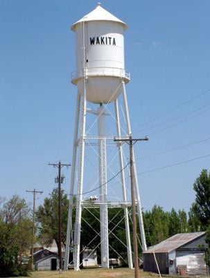
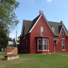
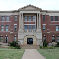
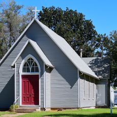
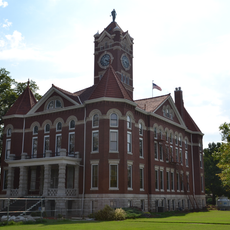
Wakita is a small agricultural town in Grant County, Oklahoma, situated near the Kansas border at an elevation of about 1,175 feet. The settlement sits on a modest area of land surrounded by flat farmland and prairie, with basic community services including a bank and town hall.

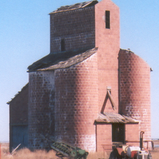
The settlement began in 1893 during the Cherokee Outlet Opening, when settlers moved into newly opened prairie lands. The arrival of the Hutchison and Southern Railroad in 1897 contributed significantly to the town's growth and connected it to wider markets.

The name comes from a Cherokee word referring to water gathering in small hollows shaped by buffalo movement across the land. Residents maintain a connection to this heritage and to the wide open prairie that surrounds the community.

This is a small town, so plan ahead for any services you may need during your visit. Larger shopping and dining options are available in Enid, which lies to the southeast.

The town gained widespread attention when it served as a filming location for the 1996 movie Twister, a popular disaster film about storm chasers. This connection to cinema led to the establishment of a museum dedicated to the film and its production.

The community of curious travelers

AroundUs brings together thousands of curated places, local tips, and hidden gems, enriched daily by 60,000 contributors worldwide.

Start exploring
Location
Elevation above the sea
359 m
GPS coordinates
36.88167,-97.92389
Latest update
December 17, 2025 09:20
Around this place
Great Salt Plains Lake
United States of America

Great Salt Plains Lake

28.2 km
Salt Plains National Wildlife Refuge
United States of America

Salt Plains National Wildlife Refuge

30.5 km
United States of America

Great Salt Plains State Park

25.2 km
Salter House
United States of America

Salter House

44.9 km
Ingersoll Tile Elevator
United States of America

Ingersoll Tile Elevator

42.5 km
Cherokee Friends Church
United States of America

Cherokee Friends Church

40.8 km
Caldwell Carnegie Library
United States of America

Caldwell Carnegie Library

32.6 km
Grant County Courthouse
United States of America

Grant County Courthouse

18.8 km
United States of America

First Congregational Church

31.7 km
Old Runnymede Church
United States of America

Old Runnymede Church

46.5 km
United States of America

Anthony Theater

31.6 km
Harper County Courthouse
United States of America

Harper County Courthouse

31.7 km
United States of America

Anthony Public Library

31.5 km
Pond Creek Masonic Lodge No. 125
United States of America

Pond Creek Masonic Lodge No. 125

26.2 km
Caldwell United States Post Office
United States of America

Caldwell United States Post Office

32.7 km
United States of America

Harper Standpipe

46 km
United States of America

Anthony United States Post Office

31.5 km
United States of America

I.P. Campbell Building

46 km
Alfalfa County Courthouse
United States of America

Alfalfa County Courthouse

41 km
United States of America

Oknoname 04706 Reservoir

30.1 km
United States of America

Lake Blackwell

46.2 km
United States of America

Upper Red Rock Creek Site 24 Reservoir

45.2 km
United States of America

Baptist Village Golf Course

47.8 km
United States of America

Rocket

35.8 km
United States of America

Rocket

35.8 km
United States of America

Rocket pasture

35.8 km
United States of America

Big Marsh Boardwalk

25.2 km
United States of America

Scenic viewpoint

36.4 km
Show the full map
Reviews
Share your experience

No review yet

Discussions
Start a discussion...

No discussion yet

« Wakita - Agricultural town in Grant County, Oklahoma, United States » is provided by Around Us (aroundus.com). Images and texts are derived from Wikimedia project under a Creative Commons license. You are allowed to copy, distribute, and modify copies of this page, under the conditions set by the license, as long as this note is clearly visible.

Discover hidden gems everywhere you go!

From secret cafés to breathtaking viewpoints, skip the crowded tourist spots and find places that match your style. Our app makes it easy with voice search, smart filtering, route optimization, and insider tips from travelers worldwide. Download now for the complete mobile experience.

Around Us App Screenshot

A unique approach to discovering new places

Le Figaro

All the places worth exploring

France Info

A tailor-made excursion in just a few clicks

20 Minutes

Around Us
Travel Guide & Maps
Download

Send to your phone

QR Code
1

Open the camera app on your mobile.

2

Point at the QR code with your camera. A notification will appear.

3

Tap the notification to open the link.