Chest opened
+${chestReward.xp} XP
Explorer
NOUVEAU ×${chestReward.collectible.quantity}
tapez pour fermer
Chest locked

Open chests in the app

Around Us is built for your phone — chests unlock when you walk, explore and capture nearby places.

Enable Location

We need your location to show you interesting places around you

Discover nearby places

Find interesting locations and hidden gems around you

Precise directions

Get accurate directions and distances to places

Your location is never shared with other users. It's only used when you tap the location button.

Elohim City

Log in to your account

Start exploring — it's free

Trusted by 72,916 travelers worldwide

Continue with Google
Continue with Apple
or

We will send you a code to connect

By continuing, you accept our Terms and Conditions and our Privacy Policy

Check your inbox

We've sent a pincode in your inbox. Please enter the code below.

Discussion Reviews 2 Photos
50.7k Popularity

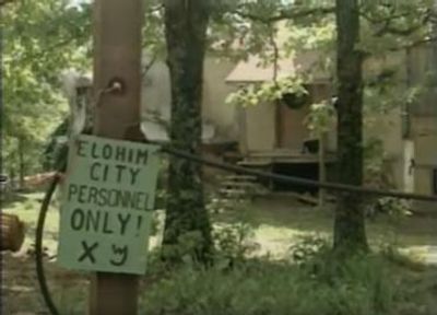
Elohim City, Religious compound in Adair County, Oklahoma, United States.

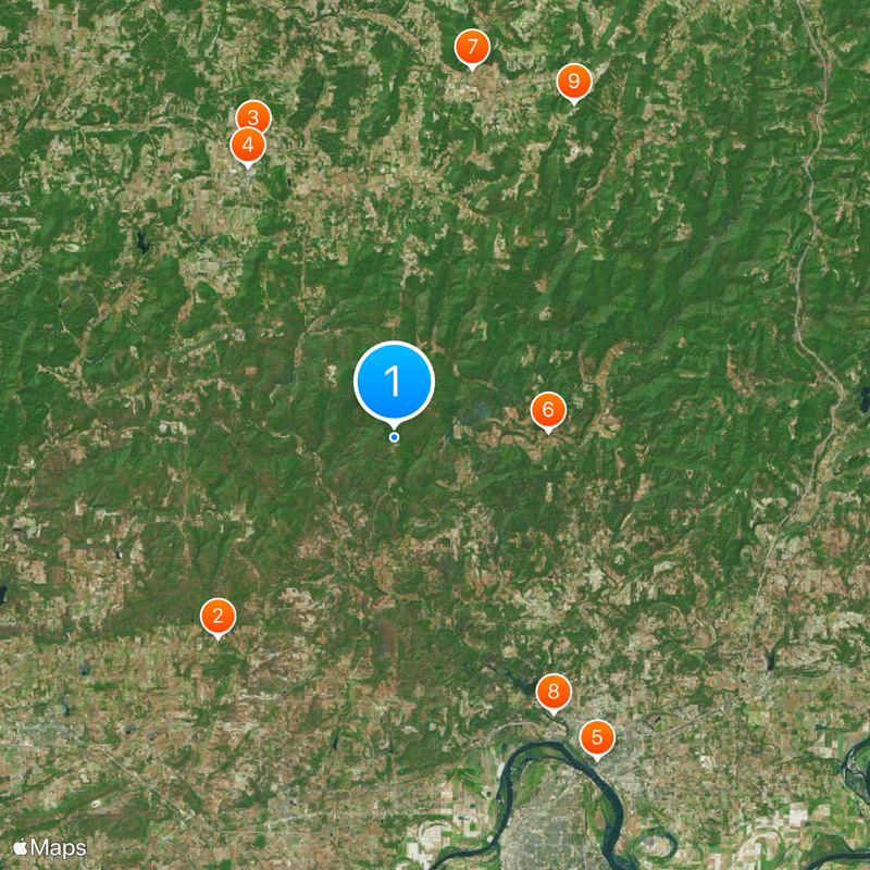
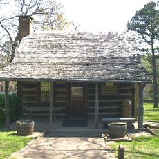
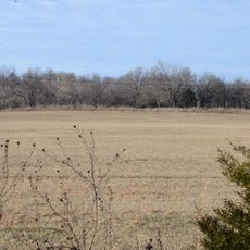
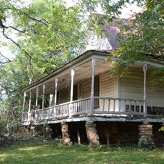
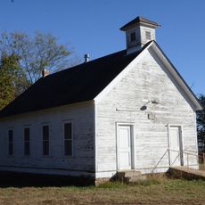
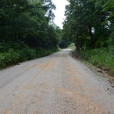
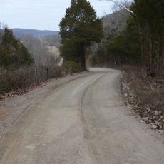
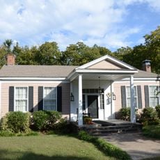
Elohim City is a settlement spanning approximately 400 acres of mountainous land along the Oklahoma-Arkansas border. The community consists of various residential structures, including mobile homes and dome-shaped buildings, distributed across the property.

Robert G. Millar, an immigrant from Ontario, Canada, founded Elohim City in 1973 with 18 family members as a spiritual community. The settlement developed over time into an independent operation with its own economic activities.

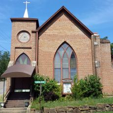
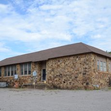
Daily religious services occur in the central church-community center, where residents gather to study Old Testament teachings and participate in communal activities.

Access to the community is limited, and visitors should be aware that this is private property. The area is relatively remote, so it makes sense to check ahead about current accessibility before planning a visit.

The settlement has received national attention due to its connection to various movements and events of major historical significance. These associations have significantly shaped public perception of the community.

The community of curious travelers

AroundUs brings together thousands of curated places, local tips, and hidden gems, enriched daily by 60,000 contributors worldwide.

Start exploring
Location
GPS coordinates
35.64170,-94.51440
Latest update
December 14, 2025 18:31
Around this place
Sequoyah's Cabin
United States of America

Sequoyah's Cabin

18.9 km
United States of America

Adair State Park

23.3 km
Adair County Courthouse
United States of America

Adair County Courthouse

21.8 km
Mount Olive United Methodist Church
United States of America

Mount Olive United Methodist Church

27 km
Lee Creek Bridge
United States of America

Lee Creek Bridge

10.9 km
Twin Bridges Historic District
United States of America

Twin Bridges Historic District

26.7 km
Lee Creek Bridge
United States of America

Lee Creek Bridge

22.6 km
Cane Hill Battlefield
United States of America

Cane Hill Battlefield

26.9 km
Cedarville School Building
United States of America

Cedarville School Building

15.5 km
Evansville-Dutch Mills Road Bridge
United States of America

Evansville-Dutch Mills Road Bridge

24.7 km
Butterfield Overland Mail Route Lucian Wood Road Segment
United States of America

Butterfield Overland Mail Route Lucian Wood Road Segment

15.6 km
Slack-Comstock-Marshall Farm
United States of America

Slack-Comstock-Marshall Farm

8.1 km
No. 12 School
United States of America

No. 12 School

24.6 km
Butterfield Overland Mail Route Segment
United States of America

Butterfield Overland Mail Route Segment

22.8 km
Butterfield Overland Mail Route Lee Creek Road Segment
United States of America

Butterfield Overland Mail Route Lee Creek Road Segment

15.4 km
Clarke-Harrell-Burson House
United States of America

Clarke-Harrell-Burson House

26 km
Henry "Harry" Charles Pernot House
United States of America

Henry "Harry" Charles Pernot House

26.9 km
Sequoyah's Cabin
United States of America

Sequoyah's Cabin

18.9 km
Drennen Scott House
United States of America

Drennen Scott House

26.9 km
United States of America

Candy Mink Park

14 km
United States of America

Greasy Lake

16.3 km
United States of America

Star Bluff

10.6 km
United States of America

Stilwell City Lake

22.6 km
United States of America

Sallisaw Creek Site 19 Reservoir

19.6 km
United States of America

Cedars Country Club

26 km
United States of America

KCS Stilwell Depot

21.7 km
United States of America

Statue, Work of art

25 km
United States of America

Monument featuring aircraft, aircraft model

25.3 km
Show the full map
Reviews
Share your experience

No review yet

Discussions
Start a discussion...

No discussion yet

« Elohim City - Religious compound in Adair County, Oklahoma, United States » is provided by Around Us (aroundus.com). Images and texts are derived from Wikimedia project under a Creative Commons license. You are allowed to copy, distribute, and modify copies of this page, under the conditions set by the license, as long as this note is clearly visible.

Discover hidden gems everywhere you go!

From secret cafés to breathtaking viewpoints, skip the crowded tourist spots and find places that match your style. Our app makes it easy with voice search, smart filtering, route optimization, and insider tips from travelers worldwide. Download now for the complete mobile experience.

Around Us App Screenshot

A unique approach to discovering new places

Le Figaro

All the places worth exploring

France Info

A tailor-made excursion in just a few clicks

20 Minutes

Around Us
Travel Guide & Maps
Download

Send to your phone

QR Code
1

Open the camera app on your mobile.

2

Point at the QR code with your camera. A notification will appear.

3

Tap the notification to open the link.