Enable Location

We need your location to show you interesting places around you

Discover nearby places

Find interesting locations and hidden gems around you

Precise directions

Get accurate directions and distances to places

Your location is never shared with other users. It's only used when you tap the location button.

Borgarknappur

Log in to your account

Start exploring — it's free

Trusted by 62,374 travelers worldwide

Continue with Google
Continue with Apple
or

We will send you a code to connect

By continuing, you accept our Terms and Conditions and our Privacy Policy

Check your inbox

We've sent a pincode in your inbox. Please enter the code below.

Borgarknappur

Borgarknappur, Mountain summit in Suðuroy, Faroe Islands.

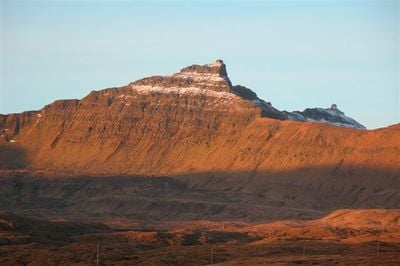
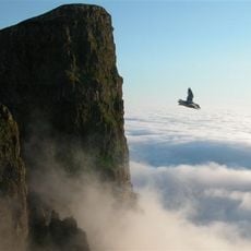
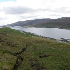
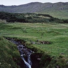
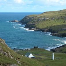
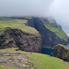
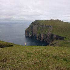
Borgarknappur is a mountain summit on Suðuroy in the Faroe Islands that rises 574 meters (1,883 feet) above sea level with steep slopes and exposed rock throughout. The terrain features dramatic cliffs and bare stone formations that define the upper sections of the peak.

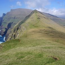
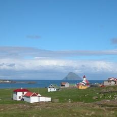
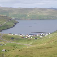
Ancient paths crossing the mountain at Mannaskarð pass served as vital communication routes between five different villages before modern roads were built. These historical routes show how important the mountain was as a central hub for human movement in the region.

The mountain's name comes from Faroese language traditions that describe natural defensive features and landscape characteristics. Local people have always used such naming to identify and understand their surroundings.

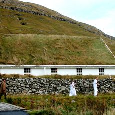
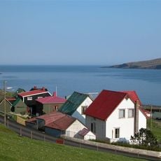
Hiking trails to the summit begin from several villages including Øravík, Fámjin, Porkeri, Hov, and Vágur and are marked by stone cairns. The paths are reasonably clear, but weather in this region changes quickly, so hikers should prepare for variable and sometimes harsh conditions.

The mountain serves as a meeting point where multiple historical paths converge, creating a natural intersection pattern in the landscape. This location made it a significant place where different old routes could connect and cross.

The community of curious travelers

AroundUs brings together thousands of curated places, local tips, and hidden gems, enriched daily by 60,000 contributors worldwide.

Start exploring
Elevation above the sea
574 m
GPS coordinates
61.50349,-6.84529
Latest update
December 14, 2025 20:29
« Borgarknappur - Mountain summit in Suðuroy, Faroe Islands » is provided by Around Us (aroundus.com). Images and texts are derived from Wikimedia project under a Creative Commons license. You are allowed to copy, distribute, and modify copies of this page, under the conditions set by the license, as long as this note is clearly visible.

Discover hidden gems everywhere you go!

From secret cafés to breathtaking viewpoints, skip the crowded tourist spots and find places that match your style. Our app makes it easy with voice search, smart filtering, route optimization, and insider tips from travelers worldwide. Download now for the complete mobile experience.

Around Us App Screenshot

A unique approach to discovering new places

Le Figaro

All the places worth exploring

France Info

A tailor-made excursion in just a few clicks

20 Minutes

Around Us
Travel Guide & Maps
Download

Send to your phone

QR Code
1

Open the camera app on your mobile.

2

Point at the QR code with your camera. A notification will appear.

3

Tap the notification to open the link.