Enable Location

We need your location to show you interesting places around you

Discover nearby places

Find interesting locations and hidden gems around you

Precise directions

Get accurate directions and distances to places

Your location is never shared with other users. It's only used when you tap the location button.

Beinisvørð

Log in to your account

Start exploring — it's free

Trusted by 62,371 travelers worldwide

Continue with Google
Continue with Apple
or

We will send you a code to connect

By continuing, you accept our Terms and Conditions and our Privacy Policy

Check your inbox

We've sent a pincode in your inbox. Please enter the code below.

Beinisvørð

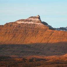
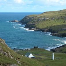
Beinisvørð, Sea cliff and summit in Suðuroy, Faroe Islands.

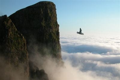
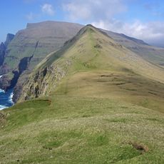
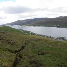
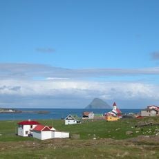
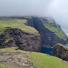
Beinisvørð is a sea cliff and mountain peak on the island of Suðuroy in the Faroe Islands that rises steeply about 469 meters above the Atlantic. It forms a distinctive triangular shape in the landscape between the villages of Lopra and Sumba.

The cliff formed through natural erosion and geological forces over thousands of years and was used as a military observation post by British forces during World War II. A major landslide in 1975 permanently altered the structure of the rock face.

The cliffs were historically used for collecting seabird eggs, a dangerous practice that shaped how people lived and worked in this remote place. This tradition shows how closely residents depended on the natural resources around them.

The best approach is via the mountain road Hesturin that runs between Lopra and Sumba, where marked parking areas mark the start of walking trails. The paths can be steep and slippery, so solid footwear and caution in windy conditions are needed.

Numerous seabirds still nest in the crevices and ledges of the cliff, offering visitors a chance to observe the rich birdlife of this region. The colonies are especially active and loud during breeding season.

The community of curious travelers

AroundUs brings together thousands of curated places, local tips, and hidden gems, enriched daily by 60,000 contributors worldwide.

Start exploring
Elevation above the sea
469 m
GPS coordinates
61.42020,-6.76076
Latest update
December 12, 2025 12:03
« Beinisvørð - Sea cliff and summit in Suðuroy, Faroe Islands » is provided by Around Us (aroundus.com). Images and texts are derived from Wikimedia project under a Creative Commons license. You are allowed to copy, distribute, and modify copies of this page, under the conditions set by the license, as long as this note is clearly visible.

Discover hidden gems everywhere you go!

From secret cafés to breathtaking viewpoints, skip the crowded tourist spots and find places that match your style. Our app makes it easy with voice search, smart filtering, route optimization, and insider tips from travelers worldwide. Download now for the complete mobile experience.

Around Us App Screenshot

A unique approach to discovering new places

Le Figaro

All the places worth exploring

France Info

A tailor-made excursion in just a few clicks

20 Minutes

Around Us
Travel Guide & Maps
Download

Send to your phone

QR Code
1

Open the camera app on your mobile.

2

Point at the QR code with your camera. A notification will appear.

3

Tap the notification to open the link.