Gráfelli, Mountain summit in Eysturoy, Faroe Islands.
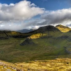
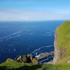
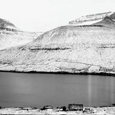
Gráfelli is a mountain on Eysturoy in the Faroe Islands, rising to 856 metres and the second-highest peak in the archipelago. It stands at the northern end of the island, near the villages of Funningur and Gjógv. To its south-west lies Slættaratindur, 24 metres higher, separated from Gráfelli by a 640-metre saddle called Bláaberg. West of the summit is the small peak Krákan, and to the north the 762-metre Sandfelli.
The mountain has served as a natural landmark for shepherds and fishermen across generations of Faroese settlement and navigation. Its prominent position made it an important guide point for inhabitants managing life in these remote islands.
Sheep graze freely across the green slopes, shaping the landscape as they have for centuries in the daily life of Faroese communities. This form of pastoral farming remains visible and integral to how locals interact with the mountain.
The hike starts from the village of Funningur, following the southeastern ridge as the main route, with summer months offering better conditions for access. Visitors should prepare for exposed terrain, steep sections, and changing weather typical of mountain hiking in these islands.
Between Gráfelli and Slættaratindur lies a 640-metre saddle called Bláaberg. West of the summit stands a small, sharply defined peak named Krákan, and to the north the ridge continues to Sandfelli at 762 metres. Gráfelli is one of only ten Faroese mountains that rise more than 800 metres above the sea.
The community of curious travelers
AroundUs brings together thousands of curated places, local tips, and hidden gems, enriched daily by 93,997 contributors worldwide.