Enable Location

We need your location to show you interesting places around you

Discover nearby places

Find interesting locations and hidden gems around you

Precise directions

Get accurate directions and distances to places

Your location is never shared with other users. It's only used when you tap the location button.

Nevis Peak

Log in to your account

Start exploring — it's free

Trusted by 63,159 travelers worldwide

Continue with Google
Continue with Apple
or

We will send you a code to connect

By continuing, you accept our Terms and Conditions and our Privacy Policy

Check your inbox

We've sent a pincode in your inbox. Please enter the code below.

Nevis Peak
Discussion Reviews 1 Photos
8.9k Popularity

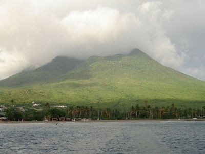
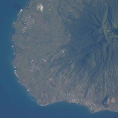
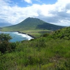
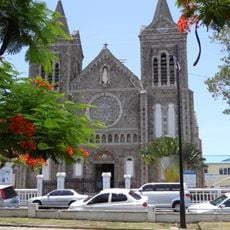
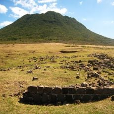
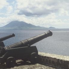
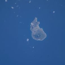
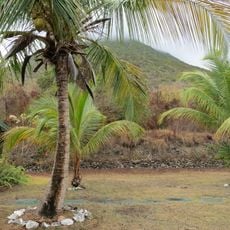
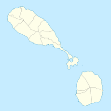
Nevis Peak, Dormant volcano in Saint Kitts and Nevis, Caribbean.

Nevis Peak is a stratovolcano rising to 985 meters (3,232 feet) and surrounded by four additional flank lava domes encircling its main summit cone. The mountain displays the typical layered structure of this volcano type, with steep slopes built up over many eruptions.

The volcano formed through repeated volcanic activity spanning millions of years, creating the island's highest point. Recent seismic records show a magnitude 4.8 earthquake in 2008 that occurred northeast of the peak at considerable depth.

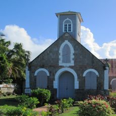
The peak serves as a geographical meeting point for all five parishes of Nevis, functioning as a central reference for how the island's administrative regions are organized.

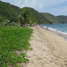
The trails to the summit demand good fitness and experience, as the terrain is steep and weather can change rapidly. Starting early in the day and checking conditions beforehand helps ensure a safer visit.

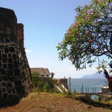
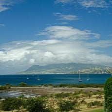
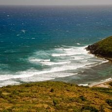
Active fumaroles and hot springs line the volcano's coastal slopes, revealing that volcanic processes continue beneath the surface despite the mountain's dormant status. These thermal features make it one of the few Caribbean volcanoes still showing signs of internal heat.

The community of curious travelers

AroundUs brings together thousands of curated places, local tips, and hidden gems, enriched daily by 60,000 contributors worldwide.

Start exploring
Elevation above the sea
985 m
GPS coordinates
17.15009,-62.58320
Latest update
December 8, 2025 19:56
Around this place
Warner Park Sporting Complex
Saint Kitts and Nevis

Warner Park Sporting Complex

22.2 km
Brimstone Hill Fortress National Park
Saint Kitts and Nevis

Brimstone Hill Fortress National Park

34.7 km
Mount Liamuiga
Saint Kitts and Nevis

Mount Liamuiga

33.4 km
The Quill
Netherlands

The Quill

54 km
St. Kitts Scenic Railway
Saint Kitts and Nevis

St. Kitts Scenic Railway

22.7 km
Fort Charles
Saint Kitts and Nevis

Fort Charles

5.7 km
Museum of Nevis History
Saint Kitts and Nevis

Museum of Nevis History

5 km
Co-Cathedral of Immaculate Conception, Basseterre
Saint Kitts and Nevis

Co-Cathedral of Immaculate Conception, Basseterre

21.9 km
St. George's Anglican Church
Saint Kitts and Nevis

St. George's Anglican Church

21.8 km
Pinney's Beach
Saint Kitts and Nevis

Pinney's Beach

4.9 km
Fort Oranje
Netherlands

Fort Oranje

56.6 km
National Museum
Saint Kitts and Nevis

National Museum

21.9 km
Independence Square
Saint Kitts and Nevis

Independence Square

22 km
Quill/Boven National Park
Netherlands

Quill/Boven National Park

54.2 km
Berkeley Memorial
Saint Kitts and Nevis

Berkeley Memorial

22 km
Government House, Saint Christopher and Nevis
Saint Kitts and Nevis

Government House, Saint Christopher and Nevis

22.9 km
Fort de Windt
Netherlands

Fort de Windt

53.6 km
National Museum of Montserrat
United Kingdom

National Museum of Montserrat

56.2 km
Sint Eustatius National Marine Park
Netherlands

Sint Eustatius National Marine Park

55.8 km
Botanical garden of Sint Eustatius
Netherlands

Botanical garden of Sint Eustatius

53.2 km
Église Saint-Thomas de Middle Island
Saint Kitts and Nevis

Église Saint-Thomas de Middle Island

31.5 km
Dutch Reformed Church, Sint Eustatius
Netherlands

Dutch Reformed Church, Sint Eustatius

56.5 km
Église Saint-Jean-du-Figuier de Church Ground
Saint Kitts and Nevis

Église Saint-Jean-du-Figuier de Church Ground

2.9 km
Église Saint-Paul de Charlestown
Saint Kitts and Nevis

Église Saint-Paul de Charlestown

4.9 km
White House Bay
Saint Kitts and Nevis

White House Bay

13.2 km
Dieppe Bay
Saint Kitts and Nevis

Dieppe Bay

38.6 km
South Friars Bay
Saint Kitts and Nevis

South Friars Bay

16.8 km
North Friar's Bay (luuk sa Saint Kitts ug Nevis, lat 17,28, long -62,67)
Saint Kitts and Nevis

North Friar's Bay (luuk sa Saint Kitts ug Nevis, lat 17,28, long -62,67)

17.1 km
Show the full map
Reviews
Share your experience

No review yet

Discussions
Start a discussion...

No discussion yet

« Nevis Peak - Dormant volcano in Saint Kitts and Nevis, Caribbean » is provided by Around Us (aroundus.com). Images and texts are derived from Wikimedia project under a Creative Commons license. You are allowed to copy, distribute, and modify copies of this page, under the conditions set by the license, as long as this note is clearly visible.

Discover hidden gems everywhere you go!

From secret cafés to breathtaking viewpoints, skip the crowded tourist spots and find places that match your style. Our app makes it easy with voice search, smart filtering, route optimization, and insider tips from travelers worldwide. Download now for the complete mobile experience.

Around Us App Screenshot

A unique approach to discovering new places

Le Figaro

All the places worth exploring

France Info

A tailor-made excursion in just a few clicks

20 Minutes

Around Us
Travel Guide & Maps
Download

Send to your phone

QR Code
1

Open the camera app on your mobile.

2

Point at the QR code with your camera. A notification will appear.

3

Tap the notification to open the link.