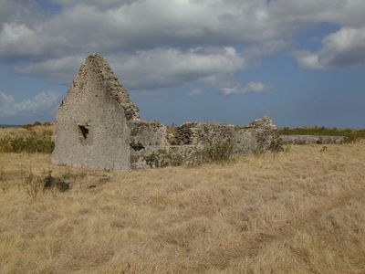
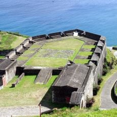
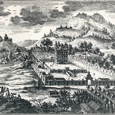
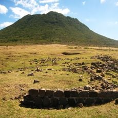
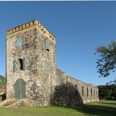
Fort Charles, Colonial fort in Sandy Point, Saint Kitts and Nevis.
Fort Charles is a fortified structure in Sandy Point built around the 1670s to protect English trading interests. The ruins display the typical layout with bastions, gun emplacements, and various functional spaces that once supported garrison operations.
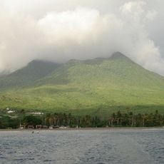
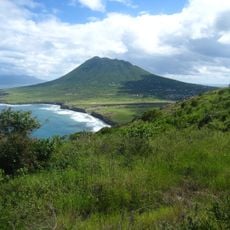
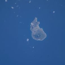
The fortification emerged during 17th-century Anglo-Dutch conflicts when Sandy Point held major strategic importance as the island's main harbor. The structure later became a symbol of English control over Caribbean trade routes.
The fort's name honors King Charles II and reflects the island's colonial past. Today visitors can observe how the structure was organized and which areas supported daily life for soldiers and officers stationed there.
The site sits in the historic Sandy Point area and can be explored on foot with ruins mostly exposed to the elements. Sturdy footwear is recommended since the ground is uneven and partly rocky.
In the 1950s the facility was converted into a medical center and later housed a polling station. This reuse shows how the site shifted from military stronghold to a place serving civilian needs.
GPS coordinates: 17.13284,-62.63328
Latest update: December 12, 2025 17:45
Warner Park Sporting Complex
20.7 km
Brimstone Hill Fortress National Park
32.1 km
Mount Liamuiga
31.5 km
Nevis Peak
5.7 km
The Quill
51.6 km
St. Kitts Scenic Railway
21.7 km
Museum of Nevis History
1 km
Château de la Montagne
24.7 km
Co-Cathedral of Immaculate Conception, Basseterre
20.5 km
St. George's Anglican Church
20.3 km
Pinney's Beach
2.3 km
National Museum
20.4 km
Independence Square
20.5 km
Quill/Boven National Park
51.8 km
Berkeley Memorial
20.5 km
Government House, Saint Christopher and Nevis
21.3 km
Fort de Windt
51.1 km
Sint Eustatius National Marine Park
53.3 km
Botanical garden of Sint Eustatius
50.9 km
Église Saint-Thomas de Middle Island
29 km
Dutch Reformed Church, Sint Eustatius
53.9 km
Église Saint-Jean-du-Figuier de Church Ground
3.4 km
Église Saint-Paul de Charlestown
1.1 km
White House Bay
13.2 km
Dieppe Bay
37.1 km
South Friars Bay
16.2 km
North Friar's Bay (luuk sa Saint Kitts ug Nevis, lat 17,28, long -62,67)
16.7 km
Historic zone of Basseterre
21 kmVisited this place? Tap the stars to rate it and share your experience / photos with the community! Try now! You can cancel it anytime.
Discover hidden gems everywhere you go!
From secret cafés to breathtaking viewpoints, skip the crowded tourist spots and find places that match your style. Our app makes it easy with voice search, smart filtering, route optimization, and insider tips from travelers worldwide. Download now for the complete mobile experience.
A unique approach to discovering new places❞
— Le Figaro
All the places worth exploring❞
— France Info
A tailor-made excursion in just a few clicks❞
— 20 Minutes