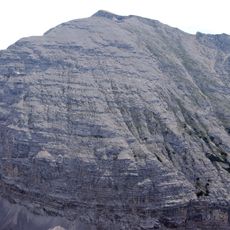
Rumer Spitze, Limestone summit in Tyrol, Austria
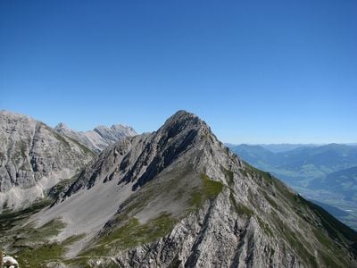
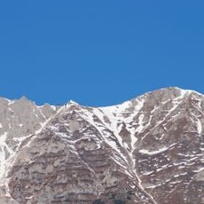
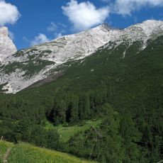
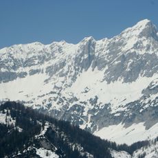
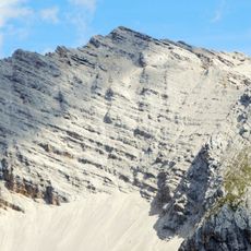
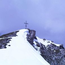
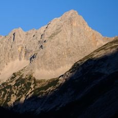
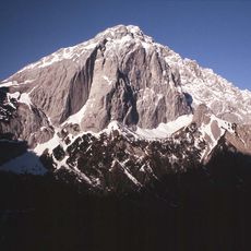
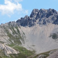
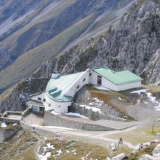
Rumer Spitze is a limestone summit in the Northern Limestone Alps rising sharply above the Mühlau valley near Innsbruck. The rock face displays the pale gray character typical of these mountains and features ridges that offer several demanding climbing routes.
The area became a protected region in the mid-20th century to preserve the limestone landscape of the region. Protection status has kept it under government management focused on conservation over the decades.
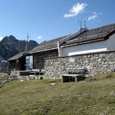
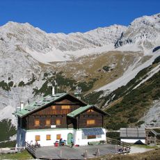
Local mountaineering groups regularly organize guided climbs to Rumer Spitze, teaching traditional Alpine climbing techniques to new generations of climbers.
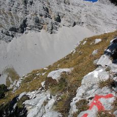
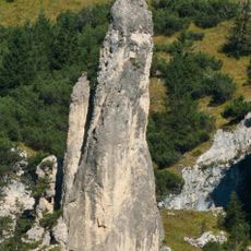
Visitors should expect technical difficulty and steep sections, especially on the common routes from the south and west. Good weather and daylight hours are essential, as narrow rock passages require careful navigation and descent becomes difficult in darkness.
From the summit, climbers can see an extensive panorama across numerous other mountain peaks in the region on clear days. The view results from the mountain's prominent position, which makes it a strategic vantage point within the limestone ranges.
Location: Tyrol
Elevation above the sea: 2,454 m
Made from material: limestone
GPS coordinates: 47.32058,11.42611
Latest update: December 13, 2025 17:00
Hafelekarspitze
3.1 km
Burgruine Thaur
3.7 km
Kaisersäule
2.9 km
Grosser Lafatscher
3.4 km
Stempeljochspitze
1.8 km
Karmel St. Josef und St. Teresa
3.6 km
Hintere Bachofenspitze
2.9 km
Gleirschspitze
2.2 km
Rosskopf
2.4 km
Little Lafatscher
3.8 km
Messstation Hafelekar
3.3 km
Pfeiser Spitze
1.5 km
Sonntagkarspitze
2.9 km
Kaskarspitze
3.1 km
Ansitz Madleinhof
3.8 km
Gleirschtaler Brandjoch
1.3 km
Rumer Nadel
1.6 km
Heiliggrabkapelle
3.8 km
Knappenhäusl
3.6 km
Nordkettenbahn Station Hafelekar
3.3 km
Ehem. Hofbrunnenleitungshäuschen westlich der Schweinsbrücke
3.6 km
Hauptwasserschloss und Hauptwasserfassung Mühlau
2.5 km
Königsberg mining buildings
3.7 km
Bildstock mit Pietà
3.8 km
Prehistoric hilltop settlement and early medieval fortifications Kiechlberg
2.5 km
Ausstieg des Alten Klammstollens
2.3 km
Portalanlage Thaur/Torbogen
3.8 km
Trinkwasserversorgung, Trinkwasserbehälter und Krafthausanlage Mühlau 1
3.7 kmVisited this place? Tap the stars to rate it and share your experience / photos with the community! Try now! You can cancel it anytime.
Discover hidden gems everywhere you go!
From secret cafés to breathtaking viewpoints, skip the crowded tourist spots and find places that match your style. Our app makes it easy with voice search, smart filtering, route optimization, and insider tips from travelers worldwide. Download now for the complete mobile experience.
A unique approach to discovering new places❞
— Le Figaro
All the places worth exploring❞
— France Info
A tailor-made excursion in just a few clicks❞
— 20 Minutes