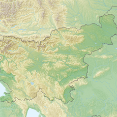
Trupejevo Poldne, Mountain summit in Western Karawanks, Slovenia.
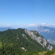
Techantinger Mittagskogel is a mountain summit in the Western Karawanks on the Slovenian-Austrian border, standing about 1931 meters high. From this peak, you can look out over the Upper Sava Valley with views toward Spik in the Julian Alps and the Carinthian landscape beyond.
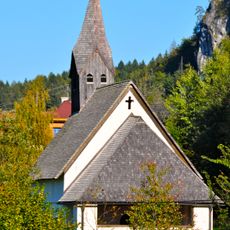
The mountain name comes from the Trupej farmstead on the Austrian side, while the German name derives from Tetchanting village. This border mountain region has long drawn walkers and herders from both countries.
The summit sits on the border between Slovenia and Austria and draws hikers from both sides, with local trails starting from Gozd Martuljek and the Austrian village of Tetchanting. Both sides of the mountain show different characteristics in their landscape and use.
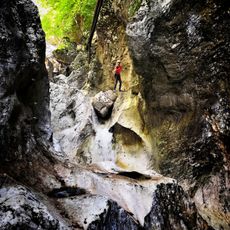
The climb requires solid hiking gear and physical preparation, with routes from both sides of the border offering different difficulty levels. Winter conditions mean you need extra equipment for ski touring when snow is deep.
The peak can be reached on foot as well as by ski in winter, making it a versatile mountain destination. The route over the Austrian side follows historic herder and trade paths that run along the border.
GPS coordinates: 46.51534,13.86064
Latest update: December 14, 2025 20:04
Burgruine Finkenstein
4.8 km
Mallestiger Mittagskogel
1.9 km
Kanzianiberg
4.3 km
Spodnji Martuljkov slap
5.4 km
Kanzianiberg Klettersteig
4.2 km
Pfarrkirche Sankt Stefan
6.1 km
Visoki Kurji vrh
3 km
Pfarrkirche Heiliger Michael, Fürnitz
6 km
Filialkirche hl. Radegund, Techanting
4.8 km
Filialkirche hl. Lorenz, Gödersdorf, Finkenstein am Faaker See
5.4 km
Wallfahrtskirche Maria Siebenbrünn (Radendorf)
6.2 km
Filialkirche hl. Agnes, Korpitsch
5 km
Filialkirche hl. Stefan, Goritschach
4.1 km
Kath. Filialkirche hl. Job und Friedhof
5.2 km
Pfarrkirche Sankt Leonhard bei Siebenbrünn
6.2 km
Filialkirche hl. Dreifaltigkeit, Pogöriach
5.8 km
Filialkirche Kanzianiberg, Finkenstein am Faaker See
4.2 km
Filialkirche hl. Margaretha, Mallestig
5.2 km
Kriegerdenkmal
6.1 km
Höhensiedlung Kanzianiberg
4.2 km
Wirtschaftsgebäude
5.5 km
Pfarrhof
5.9 km
Schloss Neufinkenstein
5.4 km
Schule, Stiegerhof, Nagersch(n)igghof, ehem. Schloss
4.8 km
Kriegerdenkmal
6 km
Kreuzweg
4.3 km
Hügelgräberfeld Kanzianiberg
4.5 km
Sonstiger Bergbau, Schmiedehammer, Ehem. Gewerkenhaus in Müllnern
6.1 kmVisited this place? Tap the stars to rate it and share your experience / photos with the community! Try now! You can cancel it anytime.
Discover hidden gems everywhere you go!
From secret cafés to breathtaking viewpoints, skip the crowded tourist spots and find places that match your style. Our app makes it easy with voice search, smart filtering, route optimization, and insider tips from travelers worldwide. Download now for the complete mobile experience.
A unique approach to discovering new places❞
— Le Figaro
All the places worth exploring❞
— France Info
A tailor-made excursion in just a few clicks❞
— 20 Minutes