Enable Location

We need your location to show you interesting places around you

Discover nearby places

Find interesting locations and hidden gems around you

Precise directions

Get accurate directions and distances to places

Your location is never shared with other users. It's only used when you tap the location button.

Pliva Lakes

Log in to your account

Start exploring — it's free

Trusted by 61,550 travelers worldwide

Continue with Google
Continue with Apple
or

We will send you a code to connect

By continuing, you accept our Terms and Conditions and our Privacy Policy

Check your inbox

We've sent a pincode in your inbox. Please enter the code below.

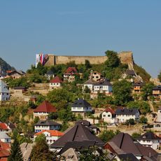
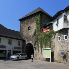
Pliva Lakes, Natural lakes in Jajce Municipality, Bosnia and Herzegovina

Description

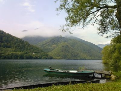
Pliva Lakes consist of two connected bodies of water nestled in limestone terrain, separated by natural barriers and spanning several kilometers. The pair sits close together, creating a continuous water system in the Jajce area.

History

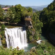
These lakes formed naturally through geological processes that created tufa barriers over time, shaping the landscape we see today. In 1963, major international kayaking championships took place here, bringing global attention to the area.

Culture

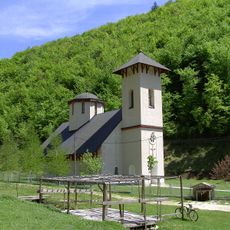
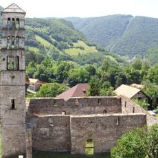
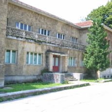
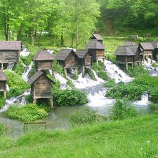
Traditional watermills line the area between the two lakes, reminding visitors how water power shaped local life for hundreds of years. You can see how these structures once served as centers of daily activity and community work.

Practical

The area is accessible year-round, though summer offers the best conditions for water activities like swimming, kayaking, and fishing. Walking trails run along the shoreline, making it easy to explore at your own pace without a guide.

Did you know?

These lakes formed through complex tectonic shifts combined with slow limestone deposits, creating a rare natural formation in the region. This unusual geological process explains why traditional watermills thrived specifically at this location.

Location
Jajce Municipality
Address
Kralja Stjepana Tomaševića, Jajce 70101
GPS coordinates
44.34705,17.22908
Latest update
December 12, 2025 17:40

AroundUs brings together thousands of curated places, local tips, and hidden gems, enriched daily by 60,000 contributors worldwide. Discover all places nearby (Jajce Municipality).

Around this place
Pliva Waterfall
Bosnia and Herzegovina

Pliva Waterfall

3.5 km
Glogovac monastery
Bosnia and Herzegovina

Glogovac monastery

13.4 km
Jajce Mithraeum
Bosnia and Herzegovina

Jajce Mithraeum

3 km
Walled city of Jajce
Bosnia and Herzegovina

Walled city of Jajce

3.4 km
Jajce Fortress
Bosnia and Herzegovina

Jajce Fortress

3.3 km
Temple of Saint Sava in Mrkonjić Grad
Bosnia and Herzegovina

Temple of Saint Sava in Mrkonjić Grad

13.2 km
St. Mary’s Church with St. Luke’s Belltower
Bosnia and Herzegovina

St. Mary’s Church with St. Luke’s Belltower

3.3 km
Catacombs in Jajce, the historical monument
Bosnia and Herzegovina

Catacombs in Jajce, the historical monument

3.2 km
Sultana Esma Mosque
Bosnia and Herzegovina

Sultana Esma Mosque

3.5 km
Esma Sultana Mosque architectural ensemble
Bosnia and Herzegovina

Esma Sultana Mosque architectural ensemble

3.4 km
Gradski stadion Luke
Bosnia and Herzegovina

Gradski stadion Luke

13.5 km
Serbia

Црква Рођења Светог Јована Крститеља у Шипову

13.3 km
Franciscan monastery of Saint Luke, Jajce
Bosnia and Herzegovina

Franciscan monastery of Saint Luke, Jajce

3.6 km
Museum of the Second session of the AVNOJ
Bosnia and Herzegovina

Museum of the Second session of the AVNOJ

3.3 km
Ramparts of the Walled city of Jajce
Bosnia and Herzegovina

Ramparts of the Walled city of Jajce

3.5 km
Église de la Nativité-de-la-Mère-de-Dieu de Mrkonjić Grad
Bosnia and Herzegovina

Église de la Nativité-de-la-Mère-de-Dieu de Mrkonjić Grad

14 km
Église de la Mère-de-Dieu de Jajce
Bosnia and Herzegovina

Église de la Mère-de-Dieu de Jajce

2.9 km
Travnik Gate
Bosnia and Herzegovina

Travnik Gate

3.4 km
Sarač’s house, the Finances Building (Lower Vocational School) and the Old primary school (Lower Music School), the architectural ensemble
Bosnia and Herzegovina

Sarač’s house, the Finances Building (Lower Vocational School) and the Old primary school (Lower Music School), the architectural ensemble

3.3 km
Category:Banja Luka Gate of Walled city of Jajce
Bosnia and Herzegovina

Category:Banja Luka Gate of Walled city of Jajce

3.5 km
Okić Mosque
Bosnia and Herzegovina

Okić Mosque

3.4 km
Ramadan beg's mosque
Bosnia and Herzegovina

Ramadan beg's mosque

3.1 km
Pliva River Watermills
Bosnia and Herzegovina

Pliva River Watermills

204 m
Omerbeg house
Bosnia and Herzegovina

Omerbeg house

3.4 km
Kršlak house
Bosnia and Herzegovina

Kršlak house

3.4 km
Kršlak house (2nd house)
Bosnia and Herzegovina

Kršlak house (2nd house)

3.4 km
Burić house in Jajce, the site and remains of the historic monument
Bosnia and Herzegovina

Burić house in Jajce, the site and remains of the historic monument

3.3 km

Show the full map
« Pliva Lakes - Natural lakes in Jajce Municipality, Bosnia and Herzegovina » is provided by Around Us (aroundus.com). Images and texts are derived from Wikimedia project under a Creative Commons license. You are allowed to copy, distribute, and modify copies of this page, under the conditions set by the license, as long as this note is clearly visible.

Discover hidden gems everywhere you go!

From secret cafés to breathtaking viewpoints, skip the crowded tourist spots and find places that match your style. Our app makes it easy with voice search, smart filtering, route optimization, and insider tips from travelers worldwide. Download now for the complete mobile experience.

Around Us App Screenshot

A unique approach to discovering new places

Le Figaro

All the places worth exploring

France Info

A tailor-made excursion in just a few clicks

20 Minutes

Around Us
Travel Guide & Maps
Download

Send to your phone

QR Code
1

Open the camera app on your mobile.

2

Point at the QR code with your camera. A notification will appear.

3

Tap the notification to open the link.