Enable Location

We need your location to show you interesting places around you

Discover nearby places

Find interesting locations and hidden gems around you

Precise directions

Get accurate directions and distances to places

Your location is never shared with other users. It's only used when you tap the location button.

Sirajganj District

Log in to your account

Start exploring — it's free

Trusted by 61,999 travelers worldwide

Continue with Google
Continue with Apple
or

We will send you a code to connect

By continuing, you accept our Terms and Conditions and our Privacy Policy

Check your inbox

We've sent a pincode in your inbox. Please enter the code below.

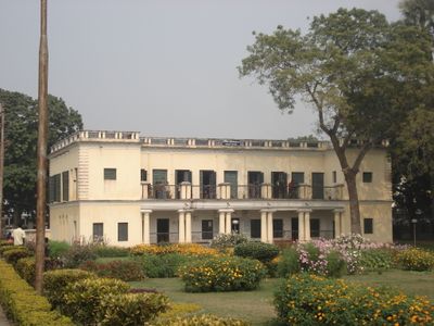
Sirajganj District, Administrative district in Rajshahi Division, Bangladesh

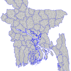
Sirajganj District is an administrative region in northern Bangladesh's Rajshahi Division, located between major rivers. The area is divided into nine administrative subdivisions, with Sirajganj city serving as the district headquarters and main commercial hub.

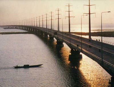
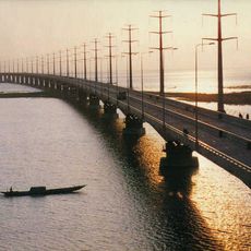
The district takes its name from Zamindar Siraj Ali Chowdhury, a former landowner of the region. A significant earthquake in 1762 altered the course of the Jamuna River and resulted in the formation of the Baral River.

Traditional Bengali entertainment forms like folk songs and boat racing remain central to local celebrations and community gatherings. These practices reflect the region's deep connection to river life and have been passed down through generations.

The best time to visit is during cooler months when the climate is more pleasant. Most locations in the region are accessible by car or public transport, with regular services connecting the administrative subdivisions.

The region is a major center for dairy farming, with thousands of local farms supplying fresh products across the area. This agricultural tradition has evolved into a modern industry that drives the local economy.

The community of curious travelers

AroundUs brings together thousands of curated places, local tips, and hidden gems, enriched daily by 60,000 contributors worldwide.

Start exploring
Capital city
Sirajganj
Elevation above the sea
7 m
Shares border with
Bogura District, Jamalpur District, Tangail District, Manikganj District, Pabna District, Natore District
GPS coordinates
24.33000,89.62000
Latest update
December 17, 2025 09:11
« Sirajganj District - Administrative district in Rajshahi Division, Bangladesh » is provided by Around Us (aroundus.com). Images and texts are derived from Wikimedia project under a Creative Commons license. You are allowed to copy, distribute, and modify copies of this page, under the conditions set by the license, as long as this note is clearly visible.

Discover hidden gems everywhere you go!

From secret cafés to breathtaking viewpoints, skip the crowded tourist spots and find places that match your style. Our app makes it easy with voice search, smart filtering, route optimization, and insider tips from travelers worldwide. Download now for the complete mobile experience.

Around Us App Screenshot

A unique approach to discovering new places

Le Figaro

All the places worth exploring

France Info

A tailor-made excursion in just a few clicks

20 Minutes

Around Us
Travel Guide & Maps
Download

Send to your phone

QR Code
1

Open the camera app on your mobile.

2

Point at the QR code with your camera. A notification will appear.

3

Tap the notification to open the link.