Mowdok Mual, Mountain summit at Thanchi Upazila, Bangladesh
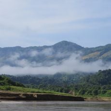
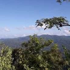
Mowdok Mual is a mountain summit located on the Bangladesh-Myanmar border in Thanchi Upazila, rising prominently above the surrounding terrain. The peak forms part of the Chittagong Hills mountain range, with steep slopes and panoramic views of the valleys below.
In 2005 the British climber Jing Fullen made the first recorded ascent and calculated the height at 1,064 m, a position matching Russian-built topographic maps. A Bangladeshi team led by Yahia Khan, including Everest climber Sajal Khaled, climbed it in 2007. Two expeditions in 2011 put the height at 3,488 and 3,461 ft; Tazing Dong (3,198 ft) remains Bangladesh's officially recognised highest peak.
Indigenous groups including Marma, Chakma, and Tripura communities live in villages around the mountain and maintain their traditional ways of life. Visitors walking through the area can see how people use the land and practice customs passed down through generations.
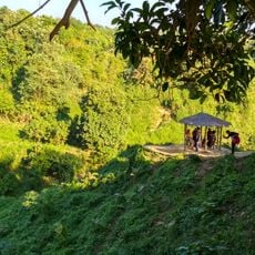
Visiting this summit requires official permits due to its border location, and a local guide is essential for navigating the steep terrain safely. The mountain conditions demand physical fitness and proper preparation before attempting the climb.
The first recorded ascent was in 2005 by the English climber Jing Fullen, who put the height at 1,064 m and a position matching a Russian-built topographic map. A Bangladeshi team led by Yahia Khan, including Everest summiteer Sajal Khaled, climbed it in 2007. Two expeditions in 2011 measured 3,488 and 3,461 ft.
The community of curious travelers
AroundUs brings together thousands of curated places, local tips, and hidden gems, enriched daily by 93,959 contributors worldwide.