Pic Champlain, Mountain peak in Bas-Saint-Laurent, Canada.
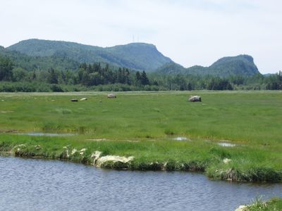
Pic Champlain is a mountain summit in Bic National Park that rises 346 meters above sea level with steep flanks on both sides. The peak's geological formation creates the prominent landscape feature visitors notice when exploring the park area.
The mountain was documented during an early exploration of the Saint Lawrence River and later named to commemorate that discovery. Its geological layers reflect different periods in the region's deep past and connect to a larger mountain system.
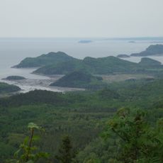
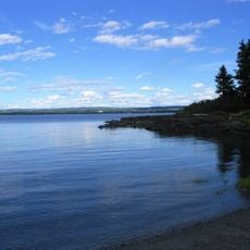
The summit serves as a natural vantage point where visitors can observe the Saint Lawrence valley landscape from above. Today, hikers use this location to connect with the regional geography and notice the rock formations that shape the area.
The hike to the summit takes roughly two hours for the round trip on a path of about three kilometers. The climb is manageable for average hikers but requires good footwear and care on the steeper sections.
The mountain contains rock layers from different geological periods that form part of the Appalachian mountain system. These ancient layers tell the story of Earth's development in this corner of North America.
The community of curious travelers
AroundUs brings together thousands of curated places, local tips, and hidden gems, enriched daily by 60,000 contributors worldwide.