Enable Location

We need your location to show you interesting places around you

Discover nearby places

Find interesting locations and hidden gems around you

Precise directions

Get accurate directions and distances to places

Your location is never shared with other users. It's only used when you tap the location button.

Grand Falls

Log in to your account

Start exploring — it's free

Trusted by 68,098 travelers worldwide

Continue with Google
Continue with Apple
or

We will send you a code to connect

By continuing, you accept our Terms and Conditions and our Privacy Policy

Check your inbox

We've sent a pincode in your inbox. Please enter the code below.

Grand Falls
Discussion Reviews 3 Photos
19.4k Popularity

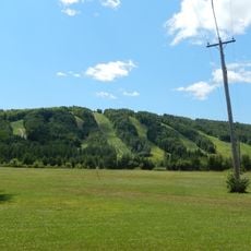
Grand Falls, town in New Brunswick, Canada

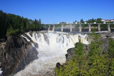
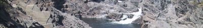
Grand Falls is a town on the Saint John River in New Brunswick, Canada, defined by a large waterfall that drops about 75 feet (23 meters) over rock ledges. The river has carved a deep gorge through the landscape, and a hydroelectric dam built in 1931 generates power from the flowing water.

The falls were first recorded in 1686 when a priest from Quebec documented the site and called it Grand Sault, meaning big waterfall in French. In 1791, a fort was built here as a stopping point for soldiers and traders, and after border disputes in the 1800s, the area became part of New Brunswick in 1842.

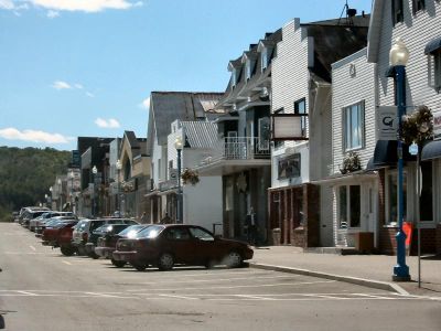
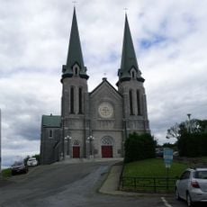
Grand Falls is a bilingual community where French and English are spoken daily in the streets and local gatherings. The waterfalls and river shape how people here see themselves, reflected in celebrations like the Potato Festival where locals and visitors gather together.

A walking trail about a mile long with stairs leads through the Falls and Gorge area, offering closer views of the water and rocks. The park has picnic areas, parking, and activities like kayaking, zip lining across the gorge, and riverside walks suitable for different ages and abilities.

In 1904, a man named Van Morrell walked across the falls on a tightrope, a daring feat remembered at O.B. Davis Park where the tightrope ring remains visible. This stunt shows how the falls have long attracted people seeking to test themselves against natural forces.

The community of curious travelers

AroundUs brings together thousands of curated places, local tips, and hidden gems, enriched daily by 60,000 contributors worldwide.

Start exploring
Location
Founders
Maliseet people
Elevation above the sea
160 m
Shares border with
Saint-André
GPS coordinates
47.03440,-67.73940
Latest update
February 16, 2026 22:40
Around this place
Double Eagle II
United States of America

Double Eagle II

50.2 km
Aroostook Valley Country Club
Canada

Aroostook Valley Country Club

26.3 km
Mars Hill
United States of America

Mars Hill

57.4 km
United States of America

Loring Commerce Centre

16.1 km
Aroostook National Wildlife Refuge
United States of America

Aroostook National Wildlife Refuge

13.7 km
New Brunswick Botanical Garden
Canada

New Brunswick Botanical Garden

67.4 km
Loring Air Force Base Double Cantilever Hangar
United States of America

Loring Air Force Base Double Cantilever Hangar

15.9 km
Loring Air Force Base Arch Hangar
United States of America

Loring Air Force Base Arch Hangar

15.6 km
National Weather Service Caribou, Maine
United States of America

National Weather Service Caribou, Maine

27.8 km
Fort Fairfield - Andover Border Crossing
United States of America

Fort Fairfield - Andover Border Crossing

30.2 km
Mark and Emily Turner Memorial Library
United States of America

Mark and Emily Turner Memorial Library

44.7 km
Florenceville Bridge
Canada

Florenceville Bridge

66.6 km
Acadian Landing Site
United States of America

Acadian Landing Site

53.7 km
Gustaf Adolph Lutheran Church
United States of America

Gustaf Adolph Lutheran Church

30.8 km
Musée Culturel du Mont-Carmel
United States of America

Musée Culturel du Mont-Carmel

39 km
Mont Farlagne
Canada

Mont Farlagne

64 km
Gray Memorial United Methodist Church and Parsonage
United States of America

Gray Memorial United Methodist Church and Parsonage

28.7 km
Acadian Village
United States of America

Acadian Village

26.9 km
Fort Fairfield Public Library
United States of America

Fort Fairfield Public Library

30.1 km
Philo Reed House
United States of America

Philo Reed House

30.3 km
Governor Brann School
United States of America

Governor Brann School

19.5 km
De la République Provincial Park
Canada

De la République Provincial Park

66.8 km
P'tit Sault Blockhouse
Canada

P'tit Sault Blockhouse

57.3 km
Cathédrale de l'Immaculée-Conception d'Edmundston
Canada

Cathédrale de l'Immaculée-Conception d'Edmundston

57.9 km
Potato World
Canada

Potato World

66.2 km
Mont Farlagne
Canada

Mont Farlagne

64 km
Isaie and Scholastique Martin House
United States of America

Isaie and Scholastique Martin House

57.6 km
Simon-Larouche Pavilion
Canada

Simon-Larouche Pavilion

57.4 km
Show the full map
Reviews
Share your experience

No review yet

Discussions
Start a discussion...

No discussion yet

« Grand Falls - town in New Brunswick, Canada » is provided by Around Us (aroundus.com). Images and texts are derived from Wikimedia project under a Creative Commons license. You are allowed to copy, distribute, and modify copies of this page, under the conditions set by the license, as long as this note is clearly visible.

Discover hidden gems everywhere you go!

From secret cafés to breathtaking viewpoints, skip the crowded tourist spots and find places that match your style. Our app makes it easy with voice search, smart filtering, route optimization, and insider tips from travelers worldwide. Download now for the complete mobile experience.

Around Us App Screenshot

A unique approach to discovering new places

Le Figaro

All the places worth exploring

France Info

A tailor-made excursion in just a few clicks

20 Minutes

Around Us
Travel Guide & Maps
Download

Send to your phone

QR Code
1

Open the camera app on your mobile.

2

Point at the QR code with your camera. A notification will appear.

3

Tap the notification to open the link.