Great Lakes Megalopolis

Log in to your account

AroundUs is a community-driven map of interesting places, built by curious explorers like you. It grows with every review, story, and photo you share.
Connect to save your favorite spots, contribute locations, and create personalized routes.
Continue with Google
Continue with Apple
Continue with X
Continue with Facebook
Continue with email
By continuing, you accept our Terms and Conditions and our Privacy Policy
Create an account
Add to collection
Map
Suggest a change
Share

Great Lakes Megalopolis, Bi-national megalopolis in Great Lakes region, United States and Canada

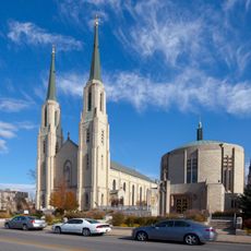
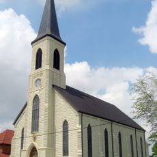
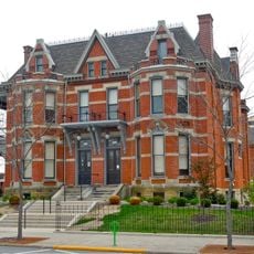
The Great Lakes Megalopolis is an extensive urban region spanning the border between the United States and Canada, encompassing major cities and their surrounding metropolitan areas. This interconnected urban system features dense transportation networks, significant industrial zones, and multiple important business and cultural hubs.

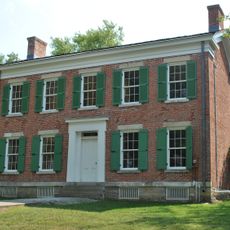
French geographer Jean Gottmann first identified this region as a major metropolitan corridor in 1961, introducing the formal concept of the megalopolis. The area experienced rapid growth during the 19th and 20th centuries due to industrialization and its strategic location along Great Lakes shipping routes.

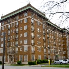
The region serves as a major center for higher education and research, with leading universities that shape the intellectual character of cities and regions. These institutions draw students and professionals from around the world and contribute significantly to local economies and cultural life.

The region is connected through multiple transportation options including railways, highways, and regional airports that allow efficient travel between cities. The most practical way to explore is to base yourself in one of the major cities and plan visits to other areas from there.

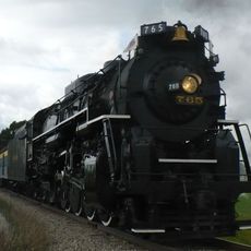
The region handles more than 200 million tons of cargo annually through its waterways, making it one of North America's most important trade corridors. This massive movement of goods relies on the world's largest surface freshwater system and demonstrates how water transport shaped the area's economic importance.

GPS coordinates: 41.00000,-85.00000

Latest update: December 18, 2025 11:41

Photos
Around this place
Nickel Plate Road 765
United States of America

Nickel Plate Road 765

11.1 km
Embassy Theatre
United States of America

Embassy Theatre

14.5 km
Cathedral of the Immaculate Conception
United States of America

Cathedral of the Immaculate Conception

14.3 km
Richardville House
United States of America

Richardville House

14.2 km
Foellinger-Freimann Botanical Conservatory
United States of America

Foellinger-Freimann Botanical Conservatory

14.4 km
United States of America

Fort Wayne Moraine

0 m
Abraham Lincoln: The Hoosier Youth
United States of America

Abraham Lincoln: The Hoosier Youth

14.3 km
Fort Wayne Park and Boulevard System Historic District
United States of America

Fort Wayne Park and Boulevard System Historic District

10.4 km
Saint Mary's Catholic Church
United States of America

Saint Mary's Catholic Church

14.1 km
E. Ross Adair Federal Building and United States Courthouse
United States of America

E. Ross Adair Federal Building and United States Courthouse

14.4 km
Fairfield Manor
United States of America

Fairfield Manor

14.1 km
St. Louis, Besancon, Historic District
United States of America

St. Louis, Besancon, Historic District

7.6 km
St. Peter's Square
United States of America

St. Peter's Square

13.1 km
Christian G. Strunz House
United States of America

Christian G. Strunz House

14.5 km
Alexander Taylor Rankin House
United States of America

Alexander Taylor Rankin House

14.4 km
Williams-Woodland Park Historic District
United States of America

Williams-Woodland Park Historic District

13.7 km
McColloch-Weatherhogg Double House
United States of America

McColloch-Weatherhogg Double House

14.4 km
Southwood Park Historic District
United States of America

Southwood Park Historic District

13.4 km
Illsley Place-West Rudisill Historic District
United States of America

Illsley Place-West Rudisill Historic District

14.1 km
Lafayette Place Historic District
United States of America

Lafayette Place Historic District

12.2 km
Lakeside Historic District
United States of America

Lakeside Historic District

14.3 km
South Wayne Historic District
United States of America

South Wayne Historic District

14 km
Foster Park Neighborhood Historic District
United States of America

Foster Park Neighborhood Historic District

14.1 km
Blackstone Building
United States of America

Blackstone Building

13.8 km
Oakdale Historic District
United States of America

Oakdale Historic District

13.7 km
Harry A. Keplinger House
United States of America

Harry A. Keplinger House

13.8 km
William C. and Clara Hagerman House
United States of America

William C. and Clara Hagerman House

14.4 km
(Christ Holding a Chalice)
United States of America

(Christ Holding a Chalice)

14.3 km
Show the full map
Reviews

Visited this place? Tap the stars to rate it and share your experience / photos with the community! Try now! You can cancel it anytime.

« Great Lakes Megalopolis - Bi-national megalopolis in Great Lakes region, United States and Canada » is provided by Around Us (aroundus.com). Images and texts are derived from Wikimedia project under a Creative Commons license. You are allowed to copy, distribute, and modify copies of this page, under the conditions set by the license, as long as this note is clearly visible.

Discover hidden gems everywhere you go!

From secret cafés to breathtaking viewpoints, skip the crowded tourist spots and find places that match your style. Our app makes it easy with voice search, smart filtering, route optimization, and insider tips from travelers worldwide. Download now for the complete mobile experience.

Around Us App Screenshot

A unique approach to discovering new places

Le Figaro

All the places worth exploring

France Info

A tailor-made excursion in just a few clicks

20 Minutes