Chest opened
+${chestReward.xp} XP
Explorer
NOUVEAU ×${chestReward.collectible.quantity}
tapez pour fermer
Chest locked

Open chests in the app

Around Us is built for your phone — chests unlock when you walk, explore and capture nearby places.

Enable Location

We need your location to show you interesting places around you

Discover nearby places

Find interesting locations and hidden gems around you

Precise directions

Get accurate directions and distances to places

Your location is never shared with other users. It's only used when you tap the location button.

French River

Log in to your account

Start exploring — it's free

Trusted by 72,889 travelers worldwide

Continue with Google
Continue with Apple
or

We will send you a code to connect

By continuing, you accept our Terms and Conditions and our Privacy Policy

Check your inbox

We've sent a pincode in your inbox. Please enter the code below.

Discussion Reviews 1 Photos
10.5k Popularity

French River, Municipality in Sudbury District, Canada

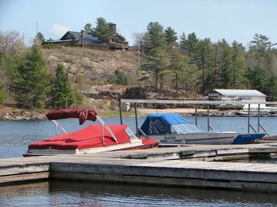
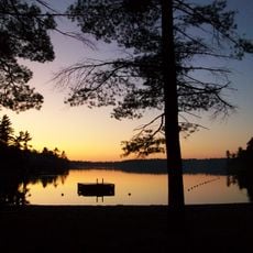
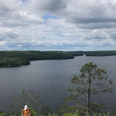
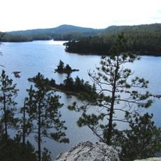
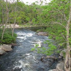
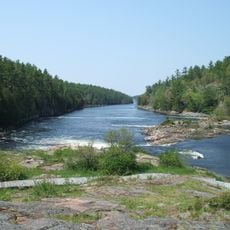
French River is a municipality in Northern Ontario centered on a waterway that flows from Lake Nipissing to Georgian Bay, spanning approximately 110 kilometers. The terrain features numerous islands, lakes, and rapids that define the landscape.

The waterway served as a major trading route in the 17th century for European fur traders moving between Montreal and Lake Superior. This use shaped the region's early economic development significantly.

The river's name reflects the presence of French fur traders who traveled through this waterway during the colonial era, making it a corridor for commerce and exploration that shaped the region's early development.

Access to this area is mainly by boat or canoe, with several entry and exit points distributed along the waterway. The best time to visit is from late spring through early fall, when the waterways are most safely navigable.

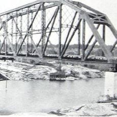
A notable bridge crosses the waterway and holds the distinction of being Canada's largest cable-supported crossing designed for snowmobiles. This structure connects winter trails and shows how transportation adapts to the region's geographic conditions.

The community of curious travelers

AroundUs brings together thousands of curated places, local tips, and hidden gems, enriched daily by 60,000 contributors worldwide.

Start exploring
Location
Inception
1999
Shares border with
St. Charles, Unorganized Centre Parry Sound District, West Nipissing, Killarney, Unorganized North Sudbury District
GPS coordinates
46.14222,-80.48139
Latest update
December 10, 2025 15:53
Reviews
Share your experience

No review yet

Discussions
Start a discussion...

No discussion yet

« French River - Municipality in Sudbury District, Canada » is provided by Around Us (aroundus.com). Images and texts are derived from Wikimedia project under a Creative Commons license. You are allowed to copy, distribute, and modify copies of this page, under the conditions set by the license, as long as this note is clearly visible.

Discover hidden gems everywhere you go!

From secret cafés to breathtaking viewpoints, skip the crowded tourist spots and find places that match your style. Our app makes it easy with voice search, smart filtering, route optimization, and insider tips from travelers worldwide. Download now for the complete mobile experience.

Around Us App Screenshot

A unique approach to discovering new places

Le Figaro

All the places worth exploring

France Info

A tailor-made excursion in just a few clicks

20 Minutes

Around Us
Travel Guide & Maps
Download

Send to your phone

QR Code
1

Open the camera app on your mobile.

2

Point at the QR code with your camera. A notification will appear.

3

Tap the notification to open the link.