Enable Location

We need your location to show you interesting places around you

Discover nearby places

Find interesting locations and hidden gems around you

Precise directions

Get accurate directions and distances to places

Your location is never shared with other users. It's only used when you tap the location button.

Clair – Fort Kent Bridge

Log in to your account

Start exploring — it's free

Trusted by 62,033 travelers worldwide

Continue with Google
Continue with Apple
or

We will send you a code to connect

By continuing, you accept our Terms and Conditions and our Privacy Policy

Check your inbox

We've sent a pincode in your inbox. Please enter the code below.

Clair – Fort Kent Bridge

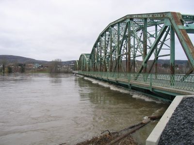
Clair – Fort Kent Bridge, International road bridge at Saint John River between Maine and New Brunswick.

The Clair-Fort Kent Bridge is a steel structure spanning 221 meters across the Saint John River with three sections that connect the communities. It serves as the main road link between Fort Kent in Maine and Clair in New Brunswick.

An initial footbridge from 1905 was replaced by a steel structure in 1930, which operated until the current bridge opened in 2014. This progression shows how the connection between the communities evolved over time.

The crossing joins two communities whose residents share French-Canadian heritage and maintain close cultural ties across the water. Language and traditions shape daily life on both sides of this border region.

The crossing operates around the clock for vehicle traffic, allowing direct passage between Maine and New Brunswick. Note that Canadian border services have limited weekday hours during business times.

The bridge marks the northern terminus of U.S. Route 1, which runs along the entire East Coast of America. This makes it a symbolically important point for travelers exploring the country's longest coastal highway.

The community of curious travelers

AroundUs brings together thousands of curated places, local tips, and hidden gems, enriched daily by 60,000 contributors worldwide.

Start exploring
Location
Location
Inception
1930
Official opening
1930
Part of
Canada–United States border
GPS coordinates
47.24925,-68.60378
Latest update
December 14, 2025 09:41
« Clair – Fort Kent Bridge - International road bridge at Saint John River between Maine and New Brunswick » is provided by Around Us (aroundus.com). Images and texts are derived from Wikimedia project under a Creative Commons license. You are allowed to copy, distribute, and modify copies of this page, under the conditions set by the license, as long as this note is clearly visible.

Discover hidden gems everywhere you go!

From secret cafés to breathtaking viewpoints, skip the crowded tourist spots and find places that match your style. Our app makes it easy with voice search, smart filtering, route optimization, and insider tips from travelers worldwide. Download now for the complete mobile experience.

Around Us App Screenshot

A unique approach to discovering new places

Le Figaro

All the places worth exploring

France Info

A tailor-made excursion in just a few clicks

20 Minutes

Around Us
Travel Guide & Maps
Download

Send to your phone

QR Code
1

Open the camera app on your mobile.

2

Point at the QR code with your camera. A notification will appear.

3

Tap the notification to open the link.