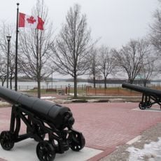
Fort Malden, Military museum and national historic site in Amherstburg, Canada
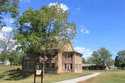
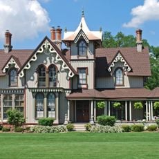
Fort Malden is a military museum and national historic site along a river in Canada, featuring earthworks, a brick barracks building, and various structures across landscaped grounds. The site spans different areas showing how a historical military base was organized and operated.
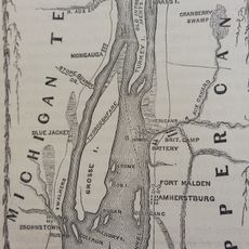
British forces established the site in 1796 as the main defense position for the western frontier. The base played a key role in regional conflicts and shaped the area's development over several decades.
The fort displays uniforms and weapons from different periods, reflecting how Canadian defense forces evolved over time. Visitors can see how these objects shaped soldiers' lives and military practice across generations.
The site sits beside the river and is accessible on foot, with marked paths through the grounds. Good footwear is recommended, as the terrain can be uneven or soft depending on weather conditions.
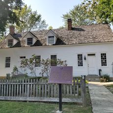
The brick building from the early 1800s is the only surviving original structure, with large chimneys and visible interior walls still in place. This construction reveals the craftsmanship and building methods of that era.
Location: Amherstburg
Inception: 1937
Operator: Parks Canada
Address: Laird Avenue South
Phone: +15197365416
Email: fortmalden@pc.gc.ca
Website: https://pc.gc.ca/fr/lhn-nhs/on/malden
GPS coordinates: 42.10718,-83.11331
Latest update: December 7, 2025 20:43
Boblo Island Amusement Park
1.5 km
Bois Blanc Island
1.3 km
Grosse Ile
4.6 km
Grosse Ile Toll Bridge
8.2 km
Lake Erie Metropark
9 km
Bois Blanc Island Lighthouse and Blockhouse
2.2 km
Fort Amherstburg
32 m
Wayne County Bridge
5.6 km
Sugar Island
3.1 km
Amherstburg Royal Naval Dockyard
633 m
East River Road Historic District
3.1 km
St. James Episcopal Church
3.1 km
Jefferson Avenue–Huron River and Harbin Drive–Silver Creek Canal Bridges
11.1 km
Park House Museum
392 m
Calf Island
5.5 km
Gibraltar Road–Waterway Canal Bridge
6.5 km
Fox Island
2.3 km
Parke Lane Road–Thorofare Canal Bridge
7.2 km
East River Road–North Hickory Canal Bridge
3.3 km
South Pointe Drive–Frenchman's Creek Bridge
4.9 km
Ferry Street–Thorofare Canal Bridge
4.9 km
R.P. McMurphy's
11.2 km
Amherstburg First Baptist Church
804 m
Nazrey African Methodist Episcopal Church
885 m
Bois Blanc Island Lighthouse
2.3 km
St. John the Baptist Church
915 m
Southgate Tower
11.1 km
Belle Vue
1.6 kmVisited this place? Tap the stars to rate it and share your experience / photos with the community! Try now! You can cancel it anytime.
Discover hidden gems everywhere you go!
From secret cafés to breathtaking viewpoints, skip the crowded tourist spots and find places that match your style. Our app makes it easy with voice search, smart filtering, route optimization, and insider tips from travelers worldwide. Download now for the complete mobile experience.
A unique approach to discovering new places❞
— Le Figaro
All the places worth exploring❞
— France Info
A tailor-made excursion in just a few clicks❞
— 20 Minutes