Enable Location

We need your location to show you interesting places around you

Discover nearby places

Find interesting locations and hidden gems around you

Precise directions

Get accurate directions and distances to places

Your location is never shared with other users. It's only used when you tap the location button.

Serge Marcil Bridge

Log in to your account

Start exploring — it's free

Trusted by 63,734 travelers worldwide

Continue with Google
Continue with Apple
or

We will send you a code to connect

By continuing, you accept our Terms and Conditions and our Privacy Policy

Check your inbox

We've sent a pincode in your inbox. Please enter the code below.

Serge Marcil Bridge
Discussion Reviews 1 Photos
2.2k Popularity

Serge Marcil Bridge, Road bridge in Les Cèdres and Salaberry-de-Valleyfield, Canada

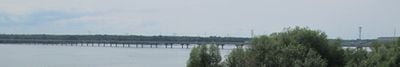
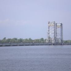
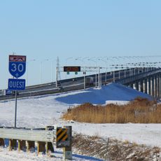
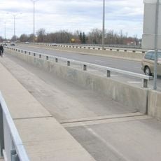
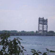
The Serge Marcil Bridge is a concrete structure spanning roughly 2 kilometers that carries Quebec Autoroute 30 across the Saint Lawrence River. It links Les Cèdres with Salaberry-de-Valleyfield and serves as a key regional transportation corridor.

The bridge was completed in the early 2010s and represents a significant infrastructure development for the Montérégie region. The project was needed to handle growing traffic between the two shores.

The bridge honors someone important to Quebec's transportation development, showing how this region recognizes people who shaped its infrastructure. You notice this through local naming traditions that connect places to their builders and leaders.

The bridge is part of Autoroute 30 and functions like a standard highway crossing. Travelers should expect toll charges that change periodically to fund maintenance and operations.

The bridge's strategic position at coordinates 45.306944, -74.014722 makes it a central component for regional economic activities and commercial transportation routes.

The community of curious travelers

AroundUs brings together thousands of curated places, local tips, and hidden gems, enriched daily by 60,000 contributors worldwide.

Start exploring
Location
Official opening
2012
Length
1,860 m
Made from material
concrete
GPS coordinates
45.30694,-74.01472
Latest update
December 13, 2025 17:08
Reviews
Share your experience

No review yet

Discussions
Start a discussion...

No discussion yet

« Serge Marcil Bridge - Road bridge in Les Cèdres and Salaberry-de-Valleyfield, Canada » is provided by Around Us (aroundus.com). Images and texts are derived from Wikimedia project under a Creative Commons license. You are allowed to copy, distribute, and modify copies of this page, under the conditions set by the license, as long as this note is clearly visible.

Discover hidden gems everywhere you go!

From secret cafés to breathtaking viewpoints, skip the crowded tourist spots and find places that match your style. Our app makes it easy with voice search, smart filtering, route optimization, and insider tips from travelers worldwide. Download now for the complete mobile experience.

Around Us App Screenshot

A unique approach to discovering new places

Le Figaro

All the places worth exploring

France Info

A tailor-made excursion in just a few clicks

20 Minutes

Around Us
Travel Guide & Maps
Download

Send to your phone

QR Code
1

Open the camera app on your mobile.

2

Point at the QR code with your camera. A notification will appear.

3

Tap the notification to open the link.