Hebron-Ben Nevis oil field, Offshore oil field in Jeanne d'Arc Basin, Canada
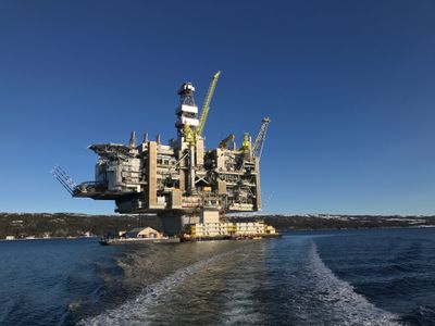
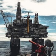
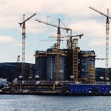
Hebron-Ben Nevis is an offshore oil production facility in the Jeanne d'Arc Basin, located roughly 350 kilometers southeast of St. John's. The field has multiple production blocks beneath the seafloor, supported by infrastructure that processes and transports crude oil.
The field formed from geological processes beginning hundreds of millions of years ago when Pangaea broke apart and created the Atlantic Ocean. This ancient separation laid down the sediment layers that would eventually contain the oil reserves tapped today.
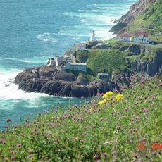
Oil production from this field has shaped regional employment and remains connected to how many people in Newfoundland and Labrador support themselves. The work here reflects the province's relationship with the ocean and its resources.
This site is not open to visitors since it operates far offshore in restricted waters and requires specialized maritime access. To learn more about the field's operations, visitors can explore petroleum museums or information centers in St. John's on the mainland.
The production platform relies on a massive gravity-based concrete structure anchored to the seafloor, engineered specifically to endure the harsh Atlantic conditions. This foundation design allows it to handle repeated impacts from pack ice and drifting icebergs without requiring traditional anchoring systems.
The community of curious travelers
AroundUs brings together thousands of curated places, local tips, and hidden gems, enriched daily by 60,000 contributors worldwide.