Montagne des Lignes, Mountain summit in Estrie, Canada
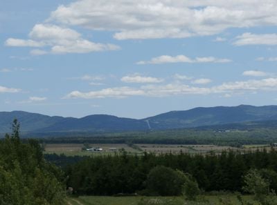
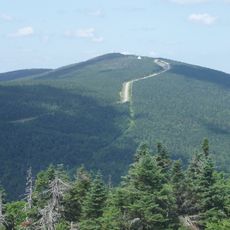
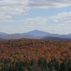
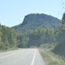
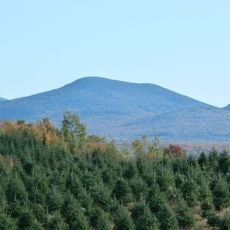
Montagne des Lignes is a mountain summit in Estrie that reaches 904 meters and features forested slopes mixed with rocky outcrops. The peak is marked by a narrow ridge at the top where walkers gain open views in multiple directions.
This mountain territory was originally home to Indigenous peoples before European settlers arrived in the region. It later became part of Quebec's recognized geographical boundaries.
Local residents maintain hiking traditions through the seasons, marking trails and documenting routes for future generations to explore.
Access is via the SF1 trail starting from the Chartierville rest stop, following an ATV track that leads toward the border. The terrain becomes steeper and more rocky as you approach the summit, especially along the ridge section.
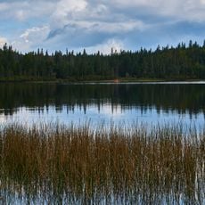
From the narrow ridge at the summit, Third Connecticut Lake in New Hampshire is visible along with the mountain ridges beyond it. This southern view makes the peak a notable vantage point for seeing into the neighboring state.
Location: Estrie
Elevation above the sea: 904 m
GPS coordinates: 45.25377,-71.19700
Latest update: December 14, 2025 20:32
Mont Mégantic Observatory
22.8 km
Mont-Mégantic National Park
22.8 km
ASTROLab
19.7 km
Pittsburg–Clarksville Covered Bridge
27.6 km
Coleman State Park
36 km
Snow Mountain
38.4 km
Saint-Isidore-d'Auckland
24.9 km
Indian Stream Schoolhouse
30.2 km
Chapelle Christ Church (Canterbury), Bury
30.4 km
Mont Scotch Cap
31.7 km
Mount D'Urban
8.6 km
ASTROLab
19.7 km
Site du patrimoine de l'église de Saint-Venant-de-Paquette
25.3 km
Église d'Eaton Corner
33.8 km
Académie d'Eaton Corner
33.7 km
Site du patrimoine du canton de Sainte-Edwidge-de-Clifton
38.4 km
Church of St Joseph
17.2 km
Église de Saint-Venant-de-Paquette
25.3 km
Forest Access Road bridge over the Connecticut River
21.8 km
Church of Our Lady
18.3 km
Croix de chemin Lemire
37.1 km
Croix de chemin du Village de Saint-Edwidge
38.3 km
Scott Brook Road bridge over the Connecticut River
8.2 km
U.S. Route 3 Bridge over the Connecticut River
7.2 km
Magalloway Road Bridge over the Connecticut River
15.1 km
Site du patrimoine d'Eaton Corner
33.7 km
MEC Connecticut River Bridge
38.5 km
Second Connecticut Lake
11.2 kmVisited this place? Tap the stars to rate it and share your experience / photos with the community! Try now! You can cancel it anytime.
Discover hidden gems everywhere you go!
From secret cafés to breathtaking viewpoints, skip the crowded tourist spots and find places that match your style. Our app makes it easy with voice search, smart filtering, route optimization, and insider tips from travelers worldwide. Download now for the complete mobile experience.
A unique approach to discovering new places❞
— Le Figaro
All the places worth exploring❞
— France Info
A tailor-made excursion in just a few clicks❞
— 20 Minutes