Coleman State Park

Log in to your account

AroundUs is a community-driven map of interesting places, built by curious explorers like you. It grows with every review, story, and photo you share.
Connect to save your favorite spots, contribute locations, and create personalized routes.
Continue with Google
Continue with Apple
Continue with X
Continue with Facebook
Continue with email
By continuing, you accept our Terms and Conditions and our Privacy Policy
Create an account
Add to collection
Map
Suggest a change
Share

Coleman State Park, State park in Stewartstown, United States.

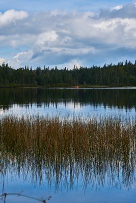
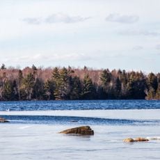
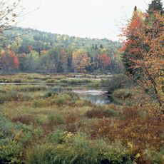
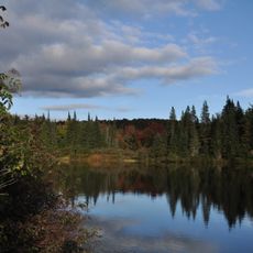
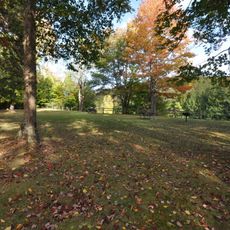
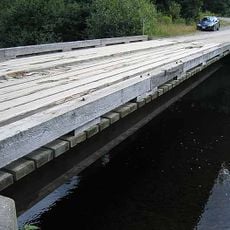
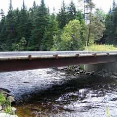
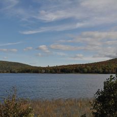
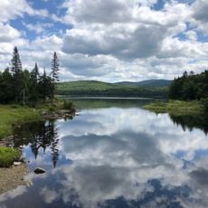
Coleman State Park sits along Little Diamond Pond in northern New Hampshire, featuring thick forests and water views that surround the entire property. The grounds include 29 campsites designed for different visitors, with separate sections for vehicle use and regular camping.

The park was created as a recreation destination and became an important spot in Coos County over time. Its role gradually expanded to support outdoor activities across all seasons, from water-based pursuits to trail use.

Fishing traditions live on at Little Diamond Pond, where anglers spend time catching trout throughout different seasons in a setting that feels genuine and unhurried.

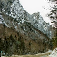
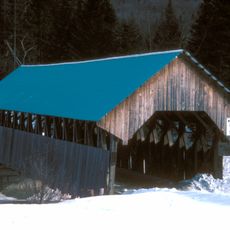
The park is open year-round, though conditions change dramatically from season to season. Visitors should prepare for the weather in advance and bring proper gear, especially during colder months when snow and ice reshape the landscape.

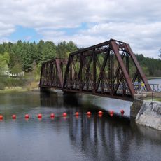
This park connects to more than 600 miles (965 kilometers) of trails throughout Coos County, making it a hub for snowmobile and off-road routes that stretch far beyond the property. That vast trail network lets visitors explore surrounding terrain for hundreds of miles without leaving the regional system.

Location: Stewartstown

Website: https://nhstateparks.org/visit/state-parks/coleman-state-park

GPS coordinates: 44.94370,-71.32800

Latest update: December 14, 2025 12:20

Photos
Around this place
Great North Woods Region
United States of America

Great North Woods Region

28.3 km
United States of America

Silvio O. Conte National Fish and Wildlife Refuge

35.4 km
Dixville Notch State Park
United States of America

Dixville Notch State Park

9.5 km
Pittsburg–Clarksville Covered Bridge
United States of America

Pittsburg–Clarksville Covered Bridge

13.8 km
Umbagog National Wildlife Refuge
United States of America

Umbagog National Wildlife Refuge

25.7 km
Umbagog Lake State Park
United States of America

Umbagog Lake State Park

34.4 km
Mollidgewock State Park
United States of America

Mollidgewock State Park

27 km
United States of America

Beaver Brook Falls Wayside

11 km
United States of America

Mount Kelsey

15.9 km
Columbia Bridge
United States of America

Columbia Bridge

20.3 km
Bennett-Bean Covered Bridge
United States of America

Bennett-Bean Covered Bridge

23 km
Androscoggin Wayside Park
United States of America

Androscoggin Wayside Park

25.3 km
Indian Stream Schoolhouse
United States of America

Indian Stream Schoolhouse

14.6 km
Alice M. Ward Library
United States of America

Alice M. Ward Library

17.6 km
Wallace Farm
United States of America

Wallace Farm

18 km
Bloomfield-Nulhegan River Route 102 Bridge
United States of America

Bloomfield-Nulhegan River Route 102 Bridge

32.9 km
Benjamin Aldrich Homestead
United States of America

Benjamin Aldrich Homestead

11.8 km
Martin Homestead
United States of America

Martin Homestead

28.5 km
Église Saint-Herménégilde de Saint-Herménégilde
Canada

Église Saint-Herménégilde de Saint-Herménégilde

32.7 km
Site du patrimoine de l'église de Saint-Venant-de-Paquette
Canada

Site du patrimoine de l'église de Saint-Venant-de-Paquette

22.8 km
Église de Saint-Venant-de-Paquette
Canada

Église de Saint-Venant-de-Paquette

23 km
Forest Access Road bridge over the Connecticut River
United States of America

Forest Access Road bridge over the Connecticut River

14.5 km
U.S. Route 3 Bridge over the Connecticut River
United States of America

U.S. Route 3 Bridge over the Connecticut River

29.5 km
Scott Brook Road bridge over the Connecticut River
United States of America

Scott Brook Road bridge over the Connecticut River

29 km
Magalloway Road Bridge over the Connecticut River
United States of America

Magalloway Road Bridge over the Connecticut River

21.6 km
MEC Connecticut River Bridge
United States of America

MEC Connecticut River Bridge

17 km
Pontook Reservoir
United States of America

Pontook Reservoir

35.2 km
Second Connecticut Lake
United States of America

Second Connecticut Lake

26.5 km
Show the full map
Reviews

Visited this place? Tap the stars to rate it and share your experience / photos with the community! Try now! You can cancel it anytime.

« Coleman State Park - State park in Stewartstown, United States » is provided by Around Us (aroundus.com). Images and texts are derived from Wikimedia project under a Creative Commons license. You are allowed to copy, distribute, and modify copies of this page, under the conditions set by the license, as long as this note is clearly visible.

Discover hidden gems everywhere you go!

From secret cafés to breathtaking viewpoints, skip the crowded tourist spots and find places that match your style. Our app makes it easy with voice search, smart filtering, route optimization, and insider tips from travelers worldwide. Download now for the complete mobile experience.

Around Us App Screenshot

A unique approach to discovering new places

Le Figaro

All the places worth exploring

France Info

A tailor-made excursion in just a few clicks

20 Minutes