Columbia Bridge

Log in to your account

AroundUs is a community-driven map of interesting places, built by curious explorers like you. It grows with every review, story, and photo you share.
Connect to save your favorite spots, contribute locations, and create personalized routes.
Continue with Google
Continue with Apple
Continue with X
Continue with Facebook
Continue with email
By continuing, you accept our Terms and Conditions and our Privacy Policy
Create an account
Add to collection
Map
Suggest a change
Share

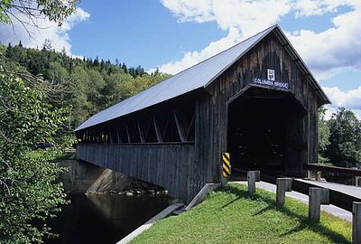
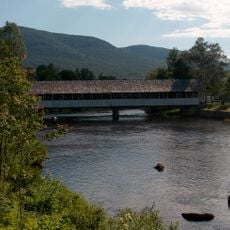
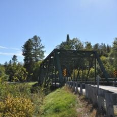
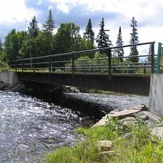
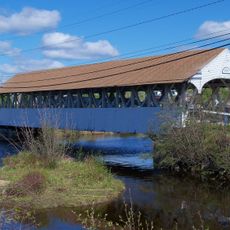
Columbia Bridge, Covered bridge in Columbia, United States.

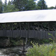
Columbia Bridge is a covered bridge made of wood that crosses the Connecticut River between New Hampshire and Vermont, with its roof protecting the structure from weather damage. The wooden framework and covered design reflect how these crossings were built to last through harsh seasons.

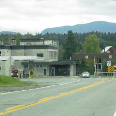
This bridge was built in 1912 to improve transportation connections between the two states. It was later added to the National Register of Historic Places for its historical importance.

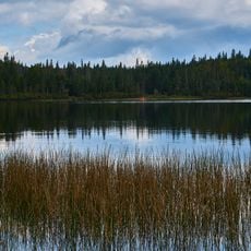
The bridge forms part of the Connecticut River Paddlers Trail, supporting recreational activities and connecting communities across state boundaries.

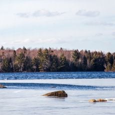
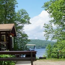
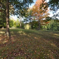
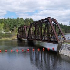
A boat ramp park near the bridge offers parking for vehicles and a maintained path down to the river. This makes it easy to access the water for paddling or other activities.

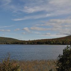
This bridge is part of the Connecticut River Paddlers Trail, a multi-state paddling route that attracts boaters looking to explore the region. The river corridor connects communities in ways that traditional roads do not.

Location: Coös County

Location: Essex County

Inception: 1912

GPS coordinates: 44.85306,-71.55139

Latest update: December 14, 2025 17:41

Photos
Around this place
Great North Woods Region
United States of America

Great North Woods Region

26.9 km
United States of America

Silvio O. Conte National Fish and Wildlife Refuge

15.2 km
Dixville Notch State Park
United States of America

Dixville Notch State Park

20.5 km
Janice Peaslee Bridge
United States of America

Janice Peaslee Bridge

22.4 km
Maidstone State Park
United States of America

Maidstone State Park

24.9 km
Brighton State Park
United States of America

Brighton State Park

24.7 km
Pittsburg–Clarksville Covered Bridge
United States of America

Pittsburg–Clarksville Covered Bridge

25.1 km
Coleman State Park
United States of America

Coleman State Park

20.3 km
Stark Covered Bridge
United States of America

Stark Covered Bridge

30.3 km
United States of America

Beaver Brook Falls Wayside

10.1 km
United States of America

Mount Kelsey

19.6 km
Androscoggin Wayside Park
United States of America

Androscoggin Wayside Park

31.8 km
Indian Stream Schoolhouse
United States of America

Indian Stream Schoolhouse

23.1 km
Alice M. Ward Library
United States of America

Alice M. Ward Library

15.9 km
Wallace Farm
United States of America

Wallace Farm

2.4 km
Bloomfield-Nulhegan River Route 102 Bridge
United States of America

Bloomfield-Nulhegan River Route 102 Bridge

13.5 km
Benjamin Aldrich Homestead
United States of America

Benjamin Aldrich Homestead

10.2 km
Martin Homestead
United States of America

Martin Homestead

9.8 km
Guildhall Village Historic District
United States of America

Guildhall Village Historic District

32 km
Island Pond Historic District
United States of America

Island Pond Historic District

26.4 km
Église Saint-Herménégilde de Saint-Herménégilde
Canada

Église Saint-Herménégilde de Saint-Herménégilde

29.7 km
Site du patrimoine de l'église de Saint-Venant-de-Paquette
Canada

Site du patrimoine de l'église de Saint-Venant-de-Paquette

31.1 km
Église de Saint-Venant-de-Paquette
Canada

Église de Saint-Venant-de-Paquette

31.2 km
Forest Access Road bridge over the Connecticut River
United States of America

Forest Access Road bridge over the Connecticut River

31.4 km
Stanhope border crossing
Canada

Stanhope border crossing

26 km
Groveton Bridge
United States of America

Groveton Bridge

28.8 km
MEC Connecticut River Bridge
United States of America

MEC Connecticut River Bridge

16.4 km
Pontook Reservoir
United States of America

Pontook Reservoir

34.3 km
Show the full map
Reviews

Visited this place? Tap the stars to rate it and share your experience / photos with the community! Try now! You can cancel it anytime.

« Columbia Bridge - Covered bridge in Columbia, United States » is provided by Around Us (aroundus.com). Images and texts are derived from Wikimedia project under a Creative Commons license. You are allowed to copy, distribute, and modify copies of this page, under the conditions set by the license, as long as this note is clearly visible.

Discover hidden gems everywhere you go!

From secret cafés to breathtaking viewpoints, skip the crowded tourist spots and find places that match your style. Our app makes it easy with voice search, smart filtering, route optimization, and insider tips from travelers worldwide. Download now for the complete mobile experience.

Around Us App Screenshot

A unique approach to discovering new places

Le Figaro

All the places worth exploring

France Info

A tailor-made excursion in just a few clicks

20 Minutes