Camoghè, Mountain summit in Lugano District, Switzerland
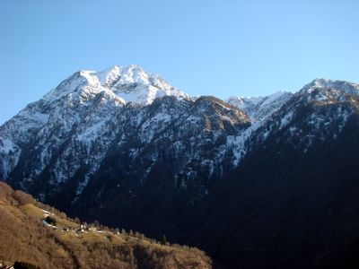
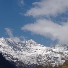
Camoghè is a mountain summit that rises to 2228 meters (7310 feet) and marks the boundary between the Bellinzona and Lugano districts in southern Ticino. The peak forms part of the Lugano Prealps and features the rocky terrain characteristic of this Alpine region.
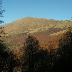
Iron-rich rocks have influenced mining activities in the area for centuries, leaving a mark on the landscape. The reddish color visible in the surrounding slopes comes from this long history of mineral extraction.
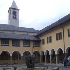
A small chapel near the summit honors Saint Nicholas of Flüe and reflects how mountain communities have long blended faith with life in high places. Visitors passing through notice this quiet shrine as part of the region's Alpine heritage.
Several hiking trails lead to the summit, with the most direct route starting from Gazzirola and taking around four hours to complete. Hikers should prepare for changing weather and bring sturdy boots along with plenty of water.
The slopes here are home to Androsace Brevis, a flowering plant found nowhere else but in this part of the Lugano Prealps. This small flower reveals the special ecological conditions that exist on these particular mountainsides.
Location: Ticino
Location: Lugano District
Elevation above the sea: 2,227.9 m
GPS coordinates: 46.13491,9.06419
Latest update: December 14, 2025 16:40
Montebello Castle
6.9 km
Sasso Corbaro Castle
6.5 km
Santi Pietro e Stefano
7 km
Pizzo di Gino
6.3 km
Santa Maria delle Grazie
6.6 km
Monte Bar
5 km
Gazzirola
2 km
Fortini della Fame
4.9 km
Teatro Sociale
7.1 km
Palazzo delle Orsoline
7.1 km
Chiesa di San Biagio
6.5 km
Chiesa di Santa Maria Assunta
5.8 km
Museo Villa dei Cedri
6.5 km
San Rocco (Bellinzona)
6.9 km
Parochial church of San Martino di Tours
5.4 km
San Lorenzo Parish Church
6.1 km
Chiesa di San Lucio
5.8 km
Civic museum Montebello castle
6.9 km
Rotalinti House
6.4 km
Palazzo comunale
7 km
Evangelical Reformed Church with Rectory
6.9 km
Teatro Sociale (building)
7.1 km
Villa Helsana
6.9 km
Bellinzona ex-praetorian hall
7 km
Ticino bank company
7 km
Ex scuola cantonale di commercio di Bellinzona
7 km
Raiffeisen bank of Bellinzona
7 km
Nineteenth-century fortifications (known as "hunger forts")
7.1 kmVisited this place? Tap the stars to rate it and share your experience / photos with the community! Try now! You can cancel it anytime.
Discover hidden gems everywhere you go!
From secret cafés to breathtaking viewpoints, skip the crowded tourist spots and find places that match your style. Our app makes it easy with voice search, smart filtering, route optimization, and insider tips from travelers worldwide. Download now for the complete mobile experience.
A unique approach to discovering new places❞
— Le Figaro
All the places worth exploring❞
— France Info
A tailor-made excursion in just a few clicks❞
— 20 Minutes