Aiguille d'Argentière

Log in to your account

AroundUs is a community-driven map of interesting places, built by curious explorers like you. It grows with every review, story, and photo you share.
Connect to save your favorite spots, contribute locations, and create personalized routes.
Continue with Google
Continue with Apple
Continue with X
Continue with Facebook
Continue with email
By continuing, you accept our Terms and Conditions and our Privacy Policy
Create an account

Aiguille d'Argentière

Add to collection
Map
Suggest a change
Share

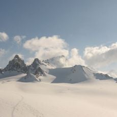
Aiguille d'Argentière, Mountain peak in Mont Blanc massif, France and Switzerland

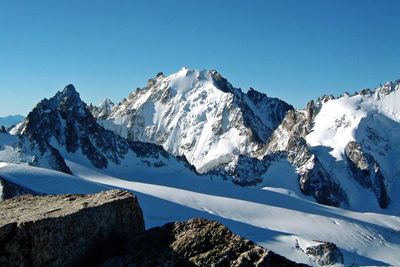
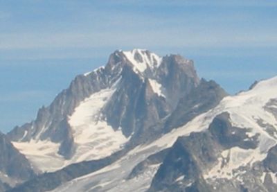
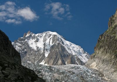
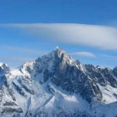
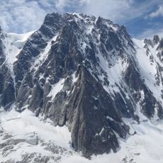
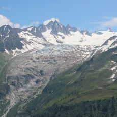
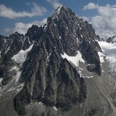
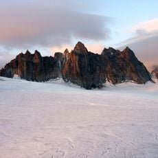
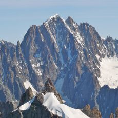
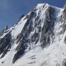
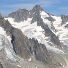
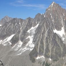
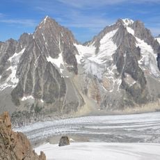
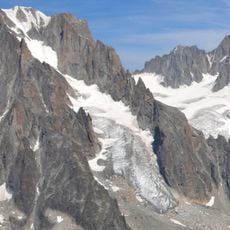
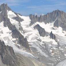
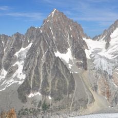
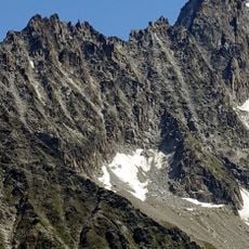
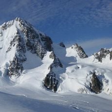
Aiguille d'Argentière is a mountain peak in the Mont Blanc massif on the border between France and Switzerland, rising to 3,901 meters. The north face features steep granite rock formations, while a secondary summit called Flèche Rousse can be reached nearby.

The peak was first ascended on July 15, 1864, by Edward Whymper and A. Reilly with three guides, marking a significant milestone in Alpine climbing history. This achievement established the summit as an important route for future generations of mountaineers.

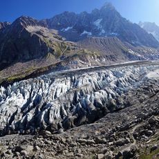
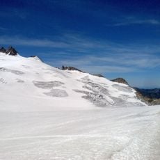
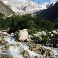
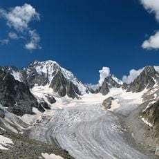
The mountain serves as a gathering place for climbers from around the world who come to test their abilities on its steep granite walls. The technical routes and glacial terrain attract experienced mountaineers seeking a serious climbing challenge.

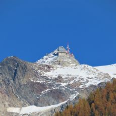
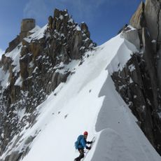
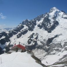
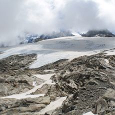
The ascent can start from the Grands Montets cable car station, which provides access to various technical climbing routes toward the summit. The Refuge d'Argentière at about 2,771 meters (9,091 feet) offers a good base for preparation or as a stopping point during the climb.

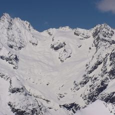
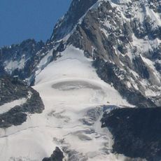
The Glacier du Milieu route presents a particularly steep ascent with gradients up to 45 degrees, demanding advanced climbing skills and specialized equipment. This demanding path is chosen by experienced alpinists seeking an extreme challenge.

Location: Canton of Valais

Location: Auvergne-Rhône-Alpes

Elevation above the sea: 3,898 m

Part of: France–Italy border

GPS coordinates: 45.95956,7.01997

Latest update: December 11, 2025 18:06

Photos
Reviews

Visited this place? Tap the stars to rate it and share your experience / photos with the community! Try now! You can cancel it anytime.

« Aiguille d'Argentière - Mountain peak in Mont Blanc massif, France and Switzerland » is provided by Around Us (aroundus.com). Images and texts are derived from Wikimedia project under a Creative Commons license. You are allowed to copy, distribute, and modify copies of this page, under the conditions set by the license, as long as this note is clearly visible.

Discover hidden gems everywhere you go!

From secret cafés to breathtaking viewpoints, skip the crowded tourist spots and find places that match your style. Our app makes it easy with voice search, smart filtering, route optimization, and insider tips from travelers worldwide. Download now for the complete mobile experience.

Around Us App Screenshot

A unique approach to discovering new places

Le Figaro

All the places worth exploring

France Info

A tailor-made excursion in just a few clicks

20 Minutes