Corn da Tinizong, Mountain summit in Graubünden, Switzerland
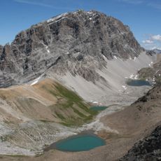
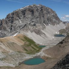
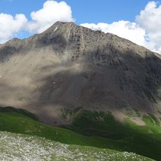
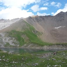
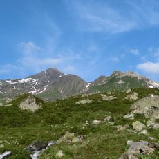
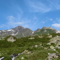
Corn da Tinizong is a mountain summit in the Albula Alps of Grisons, rising to 3,173 m (10,410 ft) with steep rock faces on all sides. The narrow, tower-like top sets it apart from the broader, rounded peaks nearby.
The Albula Alps were shaped by tectonic shifts and glacial erosion over millions of years, leaving behind the sharp rock towers seen today. Corn da Tinizong was first climbed in the 19th century, when mountaineers began exploring the more technical summits of Grisons.
The name Corn da Tinizong comes from Romansh, a language still spoken in parts of Grisons today. Road signs and trail markers throughout the valley carry Romansh names, giving the area a feel unlike most Alpine regions.
The usual trailheads are the Ela Hut (2252 m) in Val Spadlatscha and Plang la Curvanera (1893 m), reached by a narrow alp road from Savognin via Tussagn. From the Ela Hut the normal route through the northeast face, the first climbers' line, takes 3–4 hours at grade WS. A hiking bus runs to Plang la Curvanera on Wednesdays and to Pensa on Tuesdays and Fridays.
Fossilised dinosaur footprints were found on Corn da Tinizong. They come from sauropods of the Triassic period, when the rock lay at sea level 200 to 210 million years ago, and are considered the oldest such traces worldwide. The painter Ernst Ludwig Kirchner, living in Davos from 1917, gave the mountain a central place in many of his landscapes, including Tinzenhorn – Zügenschlucht bei Monstein of 1919/20.
The community of curious travelers
AroundUs brings together thousands of curated places, local tips, and hidden gems, enriched daily by 94,362 contributors worldwide.