Allmen, Mountain summit in Zürcher Oberland, Switzerland.
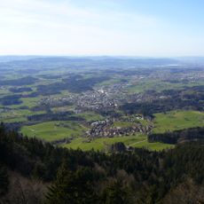
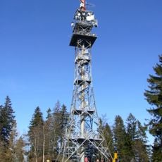
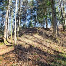
Allmen is a wooded summit of 1079 m above sea level in the Zürcher Oberland, about 2.5 km north of Bachtel in the municipality of Hinwil, canton Zürich. Its northwest flank in Bäretswil holds the Täuferhöhle, a farm on the west slope bears the name at 936 m, and the southern sub-peak is called Hörnli at 1047 m. The summit gives its name to the Allmannkette, the ridge forming the watershed between Töss and Glatt.
The Allmen gives its name to the Allmann chain (also Bachtelkette), the ridge from the Bachtel to Kyburg and Rheinsfelden that forms the watershed between the Töss and the Glatt. This chain is thought to have marked the early medieval border between the Zürichgau and the Thurgau within the Duchy of Alamannia. In 1871 a Töss–Allmann railway across the chain at Bussental was planned but never built; instead the Uerikon-Bauma-Bahn opened in 1901 on Adolf Guyer-Zeller's plans.
The open meadows and grazing lands here reflect how local farming communities have shaped the landscape over centuries, with cattle and sheep still visible on the slopes. This working pastoral environment shows how alpine farming remains part of daily life in the region.
Several hiking routes lead to the summit from different starting areas in the region, all clearly marked with signs showing direction and progress. It is best to come with comfortable walking shoes and weather protection, as mountain conditions can change quickly.
The Allmen gives its name to the Allmann chain, the ridge from the Bachtel to Rheinsfelden that separates the Töss and Glatt catchments. According to the sources, this hill chain is said to have marked the border between the Zürichgau and the Thurgau in the early Middle Ages. The name itself was already linked to the Alemanni by Johannes Stumpf in 1548.
The community of curious travelers
AroundUs brings together thousands of curated places, local tips, and hidden gems, enriched daily by 93,789 contributors worldwide.