Piz Polaschin, Mountain summit in Grisons, Switzerland
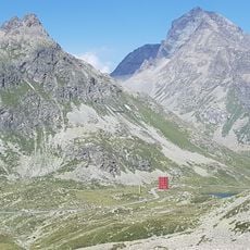
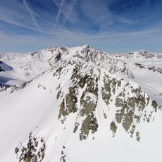
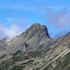
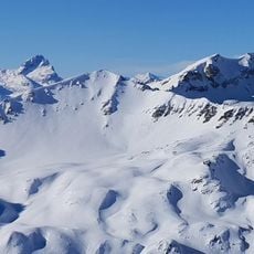
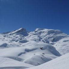
Piz Polaschin is a 3,013-metre summit of the Lagrev group in the Albula Alps, on the municipal boundary between Silvaplana and Sils im Engadin. Its north side is bounded by the Julier Pass road and its southeast side by the Upper Engadin. A small mountain lake lies at 2,721 m between it and Piz Lagrev, and the Lej da la Tscheppa lies below its southern slopes.
The mountain's Rhaetian name, Romansh Puter for "thumb", points to a long use by Romansh-speaking communities of the Upper Engadin. The summit carries the municipal boundary between Silvaplana and Sils im Engadin, and the surrounding alpine pastures and lakes, including Lej da la Tscheppa, belong to the old grazing and route landscape between the Julier Pass road and the Oberengadin.
The name comes from Romansh Puter: Piz Polaschin means "Thumb," a reference to the mountain's shape. The summit ridge forms the municipal boundary between Silvaplana and Sils im Engadin. The standard ascent from Silvaplana via Muttaun and Chavagl dal Polaschin is marked white-red-white as a hiking trail up to Muttaun.
The usual starting points are Silvaplana (1,815 m) and the Julier Pass road, for example at Il Dschember (2,010 m) or Chamanna dal Stradin (2,161 m). The south-east ridge via Muttaun and Chavagl dal Polaschin is marked white-red-white up to Muttaun and takes about 3¾ hours from Silvaplana. The south ridge from Chamanna dal Stradin via Fuorcla Polaschin (2,864 m) takes about 2½ hours. The north ridge is rated ZS, III and calls for rope and climbing gear.
The name comes from Romansh Puter: Piz Polaschin means "Thumb", a reference to the peak's shape. The summit ridge also forms the municipal boundary between Silvaplana and Sils im Engadin. Between it and Piz Lagrev lies a small mountain lake at 2,721 m.
The community of curious travelers
AroundUs brings together thousands of curated places, local tips, and hidden gems, enriched daily by 94,418 contributors worldwide.