Piz Muragl, Mountain summit in Grisons, Switzerland
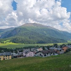
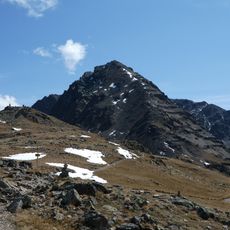
Piz Muragl is a double-peaked mountain of the Livigno Alps above Pontresina in Graubünden. Its eastern summit is the higher at 3,156 m, while the western summit (3,150 m) stands further forward and is the more prominent from the north. The ridge marks the municipal boundary between Pontresina and Samedan, and the two small glaciers on its north and east sides have almost disappeared.
The sources record no climbing or exploration history for Piz Muragl; its documented past is cartographic and linguistic. The name is traced to Latin mora ("heap of stones"), giving moriculu or morale, with influence from the Romansh müraglia ("masonry"). The summit line also carries the municipal boundary between Pontresina and Samedan, and the two glaciers on its north and east flanks have almost disappeared.
The name likely derives from Latin mora, a heap of stones, possibly influenced by the Romansh müraglia, meaning masonry. The double summit is crossed by the municipal boundary between Pontresina and Samedan, and the peak is climbed from Muottas Muragl or Alp Languard in both summer and winter.
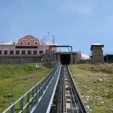
The usual starting points are Muottas Muragl (2,454 m), reached by funicular from Punt Muragl, and Alp Languard above Pontresina. From Muottas Muragl the summer route over the northwest ridge via Lej Muragl takes about 2¾ hours; the winter ski route via Tschimas da Muottas and Gianda Viva takes about 3 hours, with a ski depot at 3,070 m. The descent to Pontresina crosses a protected area above the village.
The two summits differ: the eastern one is the higher at 3,156 m, while the western (3,150 m) juts further out and looks more prominent from the north. On clear days the farthest visible point is the Pointe de Charbonnel in the French Graian Alps, 261 km away.
The community of curious travelers
AroundUs brings together thousands of curated places, local tips, and hidden gems, enriched daily by 92,874 contributors worldwide.