Enable Location

We need your location to show you interesting places around you

Discover nearby places

Find interesting locations and hidden gems around you

Precise directions

Get accurate directions and distances to places

Your location is never shared with other users. It's only used when you tap the location button.

Gumihorn

Log in to your account

Start exploring — it's free

Trusted by 63,026 travelers worldwide

Continue with Google
Continue with Apple
or

We will send you a code to connect

By continuing, you accept our Terms and Conditions and our Privacy Policy

Check your inbox

We've sent a pincode in your inbox. Please enter the code below.

Gumihorn
Discussion Reviews 1 Photos
800+ Popularity

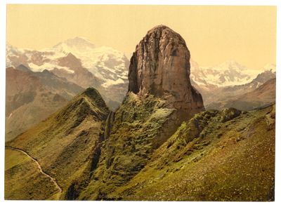
Gumihorn, Mountain summit in Interlaken-Oberhasli, Switzerland

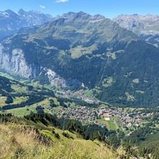
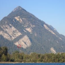
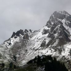
Gumihorn is a mountain summit reaching 2100 meters that forms a limestone tower at the western end of the Schwarzhorn group. It overlooks the Lütschine valley and stands as a distinct landmark in the surrounding alpine landscape.

The mountain has long served as a geographical boundary between the municipalities of Gsteigwiler and Gündlischwand in the canton of Bern. This role as a border marker shaped its importance in the region's geography for generations.

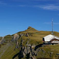
The peak is part of a network of marked trails that connect multiple summits across the region for hikers. The routes show how this alpine area has long been used for mountain exploration and outdoor activities.

Access to the area is best from Schynige Platte railway station, where marked trails branch toward nearby lower peaks. Visitors should wear proper hiking boots and bring weather protection, as alpine conditions can change quickly.

The peak ranks as the 65th most prominent summit among 567 peaks in the Interlaken-Oberhasli district. This high standing among local mountains makes it a noteworthy reference point for climbers exploring the region's range.

The community of curious travelers

AroundUs brings together thousands of curated places, local tips, and hidden gems, enriched daily by 60,000 contributors worldwide.

Start exploring
Elevation above the sea
2,100 m
GPS coordinates
46.65517,7.90821
Latest update
December 14, 2025 20:30
Reviews
Share your experience

No review yet

Discussions
Start a discussion...

No discussion yet

« Gumihorn - Mountain summit in Interlaken-Oberhasli, Switzerland » is provided by Around Us (aroundus.com). Images and texts are derived from Wikimedia project under a Creative Commons license. You are allowed to copy, distribute, and modify copies of this page, under the conditions set by the license, as long as this note is clearly visible.

Discover hidden gems everywhere you go!

From secret cafés to breathtaking viewpoints, skip the crowded tourist spots and find places that match your style. Our app makes it easy with voice search, smart filtering, route optimization, and insider tips from travelers worldwide. Download now for the complete mobile experience.

Around Us App Screenshot

A unique approach to discovering new places

Le Figaro

All the places worth exploring

France Info

A tailor-made excursion in just a few clicks

20 Minutes

Around Us
Travel Guide & Maps
Download

Send to your phone

QR Code
1

Open the camera app on your mobile.

2

Point at the QR code with your camera. A notification will appear.

3

Tap the notification to open the link.