Chest opened
+${chestReward.xp} XP
Explorer
NOUVEAU ×${chestReward.collectible.quantity}
tapez pour fermer

See the monuments around you in AR Open chests in the app

Around Us is built for your phone — point your camera at the streets and discover the monuments and places around you in augmented reality. Around Us is built for your phone — chests unlock when you walk, explore and capture nearby places.

•

Enable Location

We need your location to show you interesting places around you

Discover nearby places

Find interesting locations and hidden gems around you

Precise directions

Get accurate directions and distances to places

Your location is never shared with other users. It's only used when you tap the location button.

Sam Ka Tsuen Typhoon Shelter

Log in to your account

Start exploring — it's free

Trusted by 93,914 travelers worldwide

Continue with Google
Continue with Apple
or

We will send you a code to connect

By continuing, you accept our Terms and Conditions and our Privacy Policy

Check your inbox

We've sent a pincode in your inbox. Please enter the code below.

Sam Ka Tsuen Typhoon Shelter

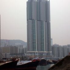
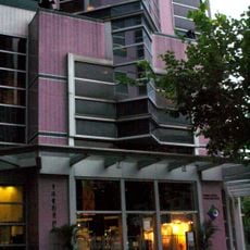
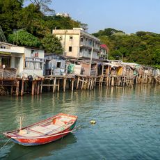
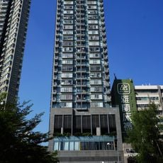
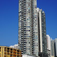
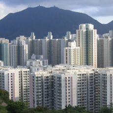
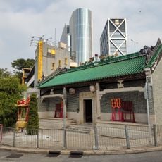
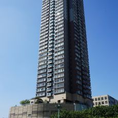
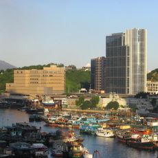
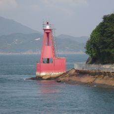
Sam Ka Tsuen Typhoon Shelter, Typhoon shelter in Kwun Tong District, Hong Kong

Sam Ka Tsuen is a typhoon shelter in Kwun Tong District, located along the eastern coast of Kowloon. The natural harbor provides safe anchorage for fishing vessels and leisure boats during severe weather.

In the 19th century the inlet was called Wine Bay, because Lei Yue Mun villagers brewed white rice wine (shaojiu in Hakka) on the site; brewing continued into the 1950s. The British military requisitioned the bay and built Queen's Pier there. After the British left Devil's Peak in 1946, residents began using that pier for ferries to Shau Kei Wan and elsewhere.

The shelter takes its name from the neighbouring Sam Ka Tsuen village. In the 19th century Lei Yue Mun village brewed white rice wine, called shaojiu in Hakka, in the spot now occupied by the shelter, so the bay was known as Wine Bay; brewing continued into the 1950s. Lei Yue Mun Path runs along the shore, and seafood restaurants line Lei Yue Mun Praya Road.

The shelter is easily accessible by public transportation and serves numerous fishing boats and private yachts. Visitors can observe the harbor from the waterfront or join organized harbor tours.

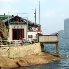
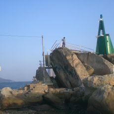
In 2011 the shelter served as the starting point of the revived Victoria Harbour Cross-Harbour Swim. The breakwater's tip holds a leisure area managed by the Leisure and Cultural Services Department, beside Sam Ka Tsuen Pier, where ferries run to Sai Wan Ho.

The community of curious travelers

AroundUs brings together thousands of curated places, local tips, and hidden gems, enriched daily by 93,914 contributors worldwide.

Start exploring
GPS coordinates
22.29111,114.23722
Latest update
November 4, 2026 07:17
Reviews
Share your experience

No review yet

Discussions
Start a discussion...

No discussion yet

« Sam Ka Tsuen Typhoon Shelter - Typhoon shelter in Kwun Tong District, Hong Kong » is provided by Around Us (aroundus.com). Images and texts are derived from Wikimedia project under a Creative Commons license. You are allowed to copy, distribute, and modify copies of this page, under the conditions set by the license, as long as this note is clearly visible.

Discover hidden gems everywhere you go!

From secret cafés to breathtaking viewpoints, skip the crowded tourist spots and find places that match your style. Our app makes it easy with voice search, smart filtering, route optimization, and insider tips from travelers worldwide. Download now for the complete mobile experience.
Around Us App Screenshot
❝

A unique approach to discovering new places❞

— Le Figaro

❝

All the places worth exploring❞

— France Info

❝

A tailor-made excursion in just a few clicks❞

— 20 Minutes

Around Us
Travel Guide & Maps
Download

Send to your phone

QR Code
1

Open the camera app on your mobile.

2

Point at the QR code with your camera. A notification will appear.

3

Tap the notification to open the link.