Enable Location

We need your location to show you interesting places around you

Discover nearby places

Find interesting locations and hidden gems around you

Precise directions

Get accurate directions and distances to places

Your location is never shared with other users. It's only used when you tap the location button.

Devil's Peak

Log in to your account

Join the adventure

Create your free account and start exploring (like 60k+ others)

We will send you a code to connect

or
Continue with Google
Continue with Apple
By continuing, you accept our Terms and Conditions and our Privacy Policy

Check your inbox

We've sent a pincode in your inbox. Please enter the code below.

Devil's Peak

Devil's Peak, Military fortification peak in Sai Kung District, Hong Kong.

Description

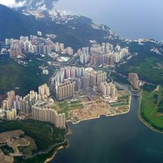
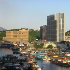
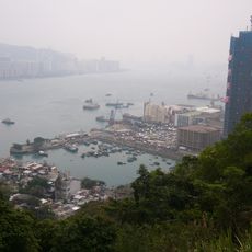
Devil's Peak is a pyramidal mountain in Sai Kung that rises 222 meters above sea level and is topped with stone fortification remains. It overlooks a large cemetery and provides views across Victoria Harbor and the Lei Yue Mun passage.

History

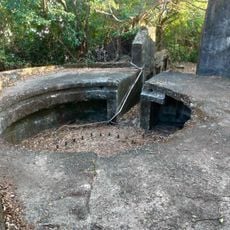
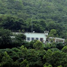
British forces built multiple defense structures on the peak between 1900 and 1914, including Gough Battery and Pottinger Battery to guard the harbor entrance. These fortifications were part of a larger defensive system controlling the strategic waterway.

Culture

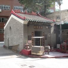
The cemetery at the mountain's base serves as a spiritual center where local families maintain traditional Chinese burial customs and honor their ancestors. Visitors observe how generations gather here to strengthen their family bonds and preserve these practices.

Practical

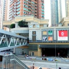
The 3-kilometer loop trail starts at Yau Tong MTR station and follows a paved path through the cemetery grounds before reaching the summit. Wear sturdy footwear as the final section becomes steeper and rougher than the initial paved sections.

Did you know?

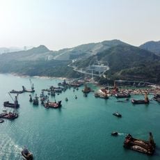
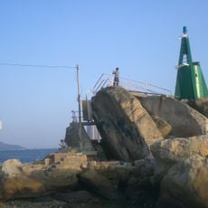
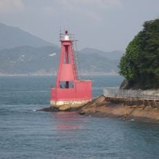
During the 19th century, pirates used the peak as a strategic post to monitor merchant ships passing through Lei Yue Mun strait. This illicit activity shows how important the location was for controlling a major shipping route.

Elevation above the sea
222 m
GPS coordinates
22.29377,114.24389
Latest update
December 14, 2025 11:06

AroundUs brings together thousands of curated places, local tips, and hidden gems, enriched daily by 60,000 contributors worldwide. Discover all places nearby (Sai Kung District).

« Devil's Peak - Military fortification peak in Sai Kung District, Hong Kong » is provided by Around Us (aroundus.com). Images and texts are derived from Wikimedia project under a Creative Commons license. You are allowed to copy, distribute, and modify copies of this page, under the conditions set by the license, as long as this note is clearly visible.

Discover hidden gems everywhere you go!

From secret cafés to breathtaking viewpoints, skip the crowded tourist spots and find places that match your style. Our app makes it easy with voice search, smart filtering, route optimization, and insider tips from travelers worldwide. Download now for the complete mobile experience.

Around Us App Screenshot

A unique approach to discovering new places

Le Figaro

All the places worth exploring

France Info

A tailor-made excursion in just a few clicks

20 Minutes

Around Us
Travel Guide & Maps
Download

Send to your phone

QR Code
1

Open the camera app on your mobile.

2

Point at the QR code with your camera. A notification will appear.

3

Tap the notification to open the link.