Fort Gorgast, Military fortification in Küstriner Vorland, Germany.
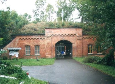
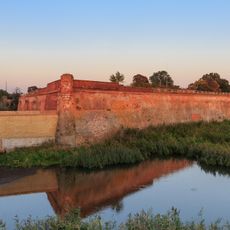
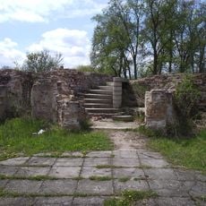
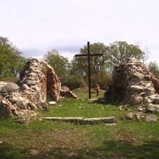
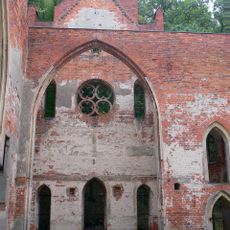
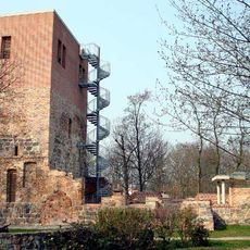
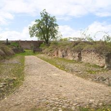
Fort Gorgast is a military fortification in the Küstriner Vorland region built with red brick and stone walls designed to withstand artillery fire. The structure includes multiple bastions, casemates, and a network of underground passages that supported troops and supplies during defensive operations.
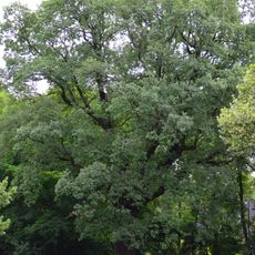
The fort was completed in 1889 as part of a defensive network protecting Küstrin city on the Oder River. It was constructed during the period when Prussia strengthened its eastern fortifications against potential threats.
The Fort Gorgast association organizes military history gatherings, concerts, and exhibitions within the tunnels and vaults of this preserved structure.
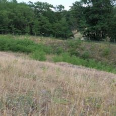
You can walk through the fort independently to view its structures from different angles and explore the outer defenses. Plan your visit during warmer months when the underground areas are more comfortable and the grounds are easier to navigate.
The structure contains a network of underground passages and vaults that create natural sound effects, enhancing the experience of musical performances.
Location: Küstriner Vorland
GPS coordinates: 52.56050,14.54520
Latest update: December 10, 2025 20:04
Kostrzyn nad Odrą Fortress
6 km
Kostrzyn nad Odrą Castle
6.3 km
Ruins of Saint Mary Church in Kostrzyn nad Odrą
6.4 km
Village church Reitwein
7.2 km
Oderinsel Küstrin-Kietz
6 km
Kostrzyn-Kietz railway border crossing
5.9 km
Reitweiner Wallberge
8.1 km
Sowjetischer Ehrenfriedhof Reitwein
7 km
Dorfkirche Sachsendorf
7.5 km
Village church Gorgast
905 m
Kościół Najświętszej Maryi Panny Matki Kościoła w Kostrzynie nad Odrą
8.4 km
Oderaue Genschmar
7.3 km
Elms gate in Buschdorf
9.4 km
Reitweiner Sporn mit Priesterschlucht, Mühlen- und Zeisigberg
8.7 km
Mittlere Oderniederung
5.9 km
Village Church
9.9 km
Behelfskirche Buschdorf
9.2 km
Oderaue Genschmar
7.6 km
Landschaftsschutzgebiet Odervorland Groß Neuendorf-Lebus
5.9 km
Priesterschlucht
8.7 km
Naturdenkmal Stiel-Eiche Im Reitweiner Wald
7.7 km
Trockenrasen am Oderbruch
7 km
Sowjetischer Ehrenfriedhof in Manschnow
1.4 km
Landschaftsschutzgebiet Oderhänge Seelow-Lebus
8.6 km
Naturdenkmal Eiche von 1815 Nordostufer Oderinsel, ca. 110 m südöstlich der Straßenbrücke in Alt Tucheband
3.3 km
Zeisigberg
9.8 km
Fortyfikacje ziemno-murowane
7.7 km
Priesterschlucht
8.7 kmVisited this place? Tap the stars to rate it and share your experience / photos with the community! Try now! You can cancel it anytime.
Discover hidden gems everywhere you go!
From secret cafés to breathtaking viewpoints, skip the crowded tourist spots and find places that match your style. Our app makes it easy with voice search, smart filtering, route optimization, and insider tips from travelers worldwide. Download now for the complete mobile experience.
A unique approach to discovering new places❞
— Le Figaro
All the places worth exploring❞
— France Info
A tailor-made excursion in just a few clicks❞
— 20 Minutes