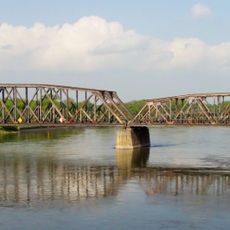
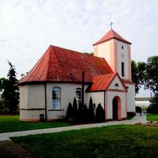
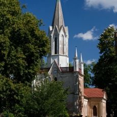
Kostrzyn nad Odrą Fortress, Military fortress at confluence of Oder and Warthe rivers, Poland
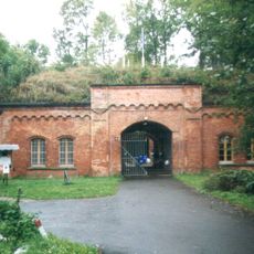
Kostrzyn nad Odrą Fortress is a military stronghold built where the Oder and Warthe rivers meet, straddling the border between Poland and Germany. The complex features thick ramparts and several bastions, including the Berlin Gate and Kietzer Gate that still stand as entry points.
The fortress was built in the 16th century and underwent major transformations during the wars of the 17th and 18th centuries. It remained strategically important for competing European powers until it suffered severe damage during the 20th century.
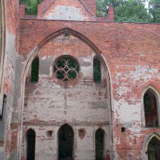
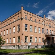
The name derives from Slavic origins, reflecting centuries of settlement in this region. Visitors can see exhibitions in the preserved buildings that show how soldiers and officials lived and worked within these walls.
The best way to explore the grounds is by joining a guided tour that starts at the visitor center in the restored Berlin Gate. Wear comfortable shoes since the terrain is uneven and many paths go across the old ramparts.
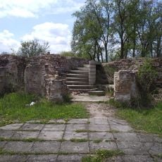
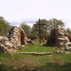
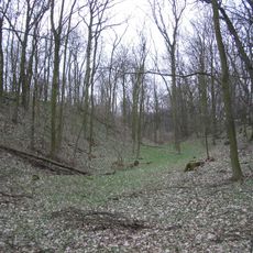
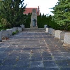
Within the fortress walls, the old town center survives only as scattered foundation stones and cellars, which is why locals sometimes call it the Pompeii of the Oder. These remains reveal how densely populated the settlement once was before its destruction.
Location: Kostrzyn nad Odrą
Location: Küstriner Vorland
GPS coordinates: 52.57907,14.62898
Latest update: December 7, 2025 20:25
Ujście Warty National Park
6.6 km
Fort Gorgast
6 km
Kostrzyn nad Odrą Castle
313 m
Tamsel
7 km
Słońsk
7 km
Ruins of Saint Mary Church in Kostrzyn nad Odrą
407 m
Village church Reitwein
9.5 km
Oderinsel Küstrin-Kietz
1.1 km
Church of the Assumption in Sarbinowo
9.3 km
Kostrzyn-Kietz railway border crossing
164 m
Reitweiner Wallberge
10.4 km
Sowjetischer Ehrenfriedhof Reitwein
9.4 km
Our Lady church in Górzyca
9.5 km
Village church Gorgast
5.7 km
Kościół Najświętszej Maryi Panny Matki Kościoła w Kostrzynie nad Odrą
2.4 km
Our Lady of the Scapular church in Czarnowo
10.2 km
Oderaue Genschmar
8.1 km
Kościół Najświętszego Serca Pana Jezusa w Żabicach
9.1 km
Mittlere Oderniederung
564 m
Saint Joseph church in Dąbroszyn
6.9 km
Oderaue Genschmar
8.3 km
Landschaftsschutzgebiet Odervorland Groß Neuendorf-Lebus
10.5 km
Sowjetischer Ehrenfriedhof in Manschnow
6.1 km
Naturdenkmal Stiel-Eiche Im Reitweiner Wald
10.2 km
Basen miejski
1.4 km
Park
6.8 km
Pałac w Dąbroszyniu
6.9 km
Naturdenkmal Eiche von 1815 Nordostufer Oderinsel, ca. 110 m südöstlich der Straßenbrücke in Alt Tucheband
9 kmVisited this place? Tap the stars to rate it and share your experience / photos with the community! Try now! You can cancel it anytime.
Discover hidden gems everywhere you go!
From secret cafés to breathtaking viewpoints, skip the crowded tourist spots and find places that match your style. Our app makes it easy with voice search, smart filtering, route optimization, and insider tips from travelers worldwide. Download now for the complete mobile experience.
A unique approach to discovering new places❞
— Le Figaro
All the places worth exploring❞
— France Info
A tailor-made excursion in just a few clicks❞
— 20 Minutes