Pfullendorf, Medieval municipality in Baden-Württemberg, Germany.
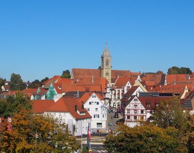
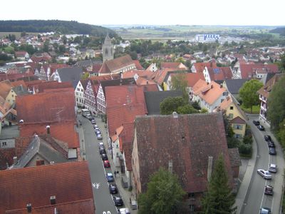
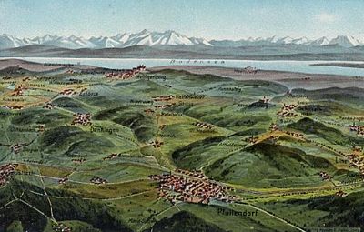
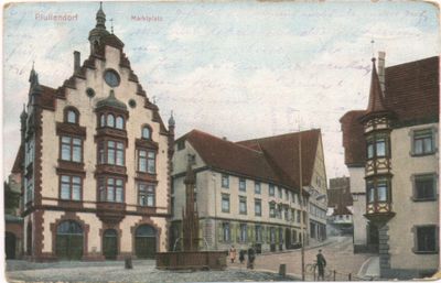
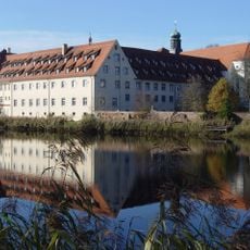
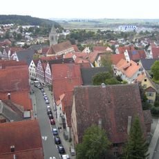
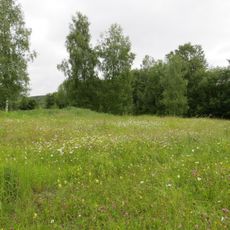
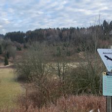
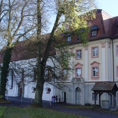
Pfullendorf is an urban municipality in the Sigmaringen district of Baden-Württemberg with a medieval center. The town sits at 654 meters elevation roughly 25 kilometers north of Lake Constance and features timber-framed buildings organized around a central marketplace.
Emperor Frederick II granted this settlement imperial city status in 1220, conferring autonomy and self-governance rights. This charter allowed the town to organize through guilds and develop its economic influence in the region.
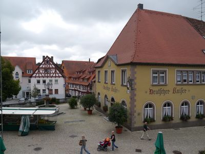
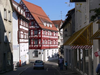
Timber-framed houses with their distinctive beams and details shape the town's appearance and gather around the marketplace. Regular markets held here keep traditional trading practices visible to residents and visitors alike.
The town is accessible by public transportation with several parking options in the center for visitors. Most places in the old town are easily reached on foot during a walk through the area.
The town hosts a German Army special operations training facility that once served as an international NATO training center. This military installation has shaped local development and infrastructure for decades.
Location: Landkreis Sigmaringen
Location: Pfullendorf VVG
Inception: 12 century
Elevation above the sea: 654 m
Website: https://pfullendorf.de
GPS coordinates: 47.92435,9.25598
Latest update: December 14, 2025 20:01
Photo license: CC BY-SA 3.0
Kloster Wald
6.4 km
Burg Ramsberg
6.8 km
Stadtkirche St. Jakob
60 m
Seepark
1.6 km
Erlebnistierpark Jägerhof
2.7 km
Kunsthalle Kleinschönach
7 km
Parish church of Saint Peter and Paul
9.1 kmBurg Burrach
5.4 km
Parish church of Sankt Antonius
7.1 km
Taubenried
3.6 km
Egelsee-Ried
4 km
Kreuzäcker
5 kmBurg Freudenberg
5.2 km
Riede und Gewässer bei Mengen und Pfullendorf
2.7 kmRuhestettener Ried
7.6 kmBurg Leiterberg
8.7 km
Klosterkirche Wald
6.3 km
Lausheimer Weiher
6.6 km
Burgstall Hünaburg
6.4 kmDominikanerinnenkloster Maria zu den Engeln, Pfullendorf
80 mKapuzinerinnenkloster Pfullendorf
57 mTaubenried
3.9 km
Kapelle St. Josef
6.5 km
Friedhofskapelle St. Leonhard
424 m
Ruhestetter Ried
6.1 kmSpitalmühle
2.6 kmStieleiche bei Rengetsweiler
8 kmGruppe von zwei Winterlinden
7.2 kmVisited this place? Tap the stars to rate it and share your experience / photos with the community! Try now! You can cancel it anytime.
Discover hidden gems everywhere you go!
From secret cafés to breathtaking viewpoints, skip the crowded tourist spots and find places that match your style. Our app makes it easy with voice search, smart filtering, route optimization, and insider tips from travelers worldwide. Download now for the complete mobile experience.
A unique approach to discovering new places❞
— Le Figaro
All the places worth exploring❞
— France Info
A tailor-made excursion in just a few clicks❞
— 20 Minutes