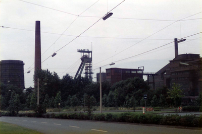
Zeche Erin, Coal mine heritage monument in Castrop-Rauxel, Germany.
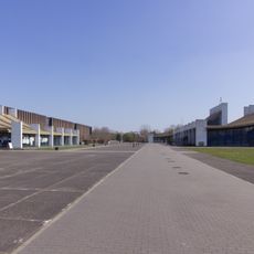
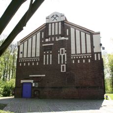
Zeche Erin is a coal mine heritage site in the Ruhr region, distinguished by its 68-meter-tall headframe above shaft 7 with characteristic German strut frame design. Today the grounds house a technology and business park, with historical structures preserved among modern commercial buildings.
Irish investor Thomas Mulvany founded the mine in 1866, naming it after the Irish word for Ireland, and coal extraction continued there for nearly 120 years. The operation shaped industrial development in the region until closure in 1983, after which the site was eventually redeveloped.
The headframes of shafts 3 and 7 serve as industrial monuments on the grounds and are part of the Route of Industrial Heritage in North Rhine-Westphalia. They mark how this place once functioned as a working coal extraction center and how such structures are now preserved for future generations.
The grounds are accessible from outside, with industrial monuments visible from various angles, especially the striking headframe structure. The best time to visit is during daylight hours and good weather, when the metal structures and their details are clearly visible.
In 1964, Zeche Erin introduced the first fully automated, machine-operated coal face in the region, functioning without human operators at the cutting edge. This innovation was groundbreaking for its era and demonstrated how mining technology was transforming during this phase of industrial history.
The community of curious travelers
AroundUs brings together thousands of curated places, local tips, and hidden gems, enriched daily by 60,000 contributors worldwide.