Black Elster, River in eastern Saxony, Germany
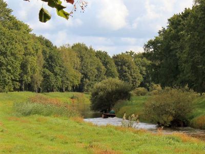
The Black Elster flows through Saxony and Brandenburg, traveling approximately 179 kilometers before joining the Elbe River near Wittenberg. The waterway receives contributions from tributaries including the Pulsnitz, Große Röder, and Kleine Elster throughout its journey.
The Black Elster developed as a waterway in a region shaped by multiple territorial changes over time. In 1813, the area witnessed significant military movements during the Napoleonic Wars as armies reorganized across eastern Germany.
The river has different names across local languages: Schwarze Elster in German, Carny Halšter in Lower Sorbian, and Čorny Halštrow in Upper Sorbian. This linguistic diversity reflects the region's cultural heritage shaped by several communities.
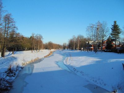
The river is most accessible during warmer months when water flow is stable and riverbank access is easier. Those exploring the waterway should follow established regional walking paths and use designated crossing points when moving between riverbanks.
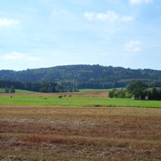
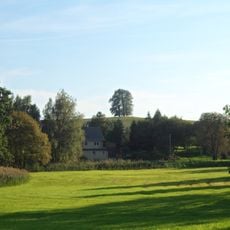
Between Hoyerswerda and Senftenberg, the river passes through a major lignite mining district that shaped the region's industrial past. These mining landscapes reveal the economic transformations that have reshaped eastern Germany over recent decades.
Location: Bautzen District
Location: Oberspreewald-Lausitz District
Location: Elbe-Elster District
Location: Wittenberg
GPS coordinates: 51.18500,14.14220
Latest update: December 20, 2025 14:20
Dresden has many monuments that show centuries of history. The heart of the city has baroque churches like the Frauenkirche, rebuilt stone by stone after the war. There are fancy palaces such as the Zwinger, with its collections of porcelain and old paintings. You also find cultural places like the...
Barockschloss Rammenau
3 km
Hochstein
2.1 km
Kleppischberg
2.9 km
Pfarrkirche und Friedhof in Rammenau
3.4 km
Wohnhaus mit Schuppenanbau Johann-Gottlieb-Fichte-Straße 4
3.4 km
Betkreuz Säuritz, bei Dorfstraße 9
2.1 km
Alte Schäferei
2.8 km
Pfarrhaus
3.5 km
Betkreuz Kaschwitz, Landstraße
3.4 km
Wohnhaus mit Schuppenanbau Johann-Gottlieb-Fichte-Straße 20
3.1 km
Am Schloss 9
2.8 km
Wegestein Kaschwitz
3.4 km
Mittelgasthof mit anschließendem Tanzsaal und Vorplatz, ohne hinten anschließenden Wirtschaftshof (3 Seiten) Hauptstraße 99
2.7 km
Schule und Gefängnis Johann-Gottlieb-Fichte-Straße 3
3.4 km
Säuritzer Mühle
2.6 km
Wohnhaus mit Schuppenanbau Johann-Gottlieb-Fichte-Straße 7
3.1 km
Am Schloss 7
2.9 km
Kriegerdenkmal
3.4 km
Wohnhaus mit Schuppenanbau Johann-Gottlieb-Fichte-Straße 35
3.4 km
Wohnhaus, Wohnstallhaus und Scheune eines Dreiseithofes sowie Granitpfeiler Hauptstraße 8
1.4 km
Seitengebäude mit Oberlaube eines ehemaligen Vierseithofes Dorfstraße 27
1.8 km
Rittergut Oberburkau
2.1 km
Rittergut Niederburkau (Sachgesamtheit) Hauptstraße 142, 143, 144, 146, 147, 148
3.4 km
Straße der Jugend 2, 2a, 2b
2.9 km
Betkreuz (an der Straße zur Janksmühle)
2.5 km
Herrenhaus (Einzeldenkmal zu ID-Nr. 09304121) Hauptstraße 64
2.1 km
Wohnhaus und Scheune einer Mühle sowie Mühlteich (Raschemühle) Hauptstraße 17
1.5 km
Empfangsgebäude des Bahnhofs Burkau (Alter Bahnhof), heute Wohnhaus Straße der Jugend 7
2.9 kmVisited this place? Tap the stars to rate it and share your experience / photos with the community! Try now! You can cancel it anytime.
Discover hidden gems everywhere you go!
From secret cafés to breathtaking viewpoints, skip the crowded tourist spots and find places that match your style. Our app makes it easy with voice search, smart filtering, route optimization, and insider tips from travelers worldwide. Download now for the complete mobile experience.
A unique approach to discovering new places❞
— Le Figaro
All the places worth exploring❞
— France Info
A tailor-made excursion in just a few clicks❞
— 20 Minutes