Chest opened
+${chestReward.xp} XP
Explorer
NOUVEAU ×${chestReward.collectible.quantity}
tapez pour fermer
Chest locked

Open chests in the app

Around Us is built for your phone — chests unlock when you walk, explore and capture nearby places.

Enable Location

We need your location to show you interesting places around you

Discover nearby places

Find interesting locations and hidden gems around you

Precise directions

Get accurate directions and distances to places

Your location is never shared with other users. It's only used when you tap the location button.

Dinkel

Log in to your account

Start exploring — it's free

Trusted by 72,881 travelers worldwide

Continue with Google
Continue with Apple
or

We will send you a code to connect

By continuing, you accept our Terms and Conditions and our Privacy Policy

Check your inbox

We've sent a pincode in your inbox. Please enter the code below.

Dinkel
Discussion Reviews 1 Photos
9.2k Popularity

Dinkel, River between North Rhine-Westphalia, Germany and Netherlands

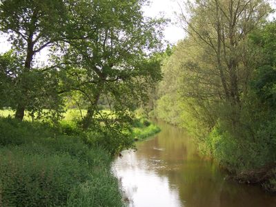
The Dinkel is a river between North Rhine-Westphalia, Germany and the Netherlands, flowing for about 89 kilometers with natural meanders and high sandy banks. The waterway runs through flat farmland and continuously shifts its course due to sand deposits in its bed.

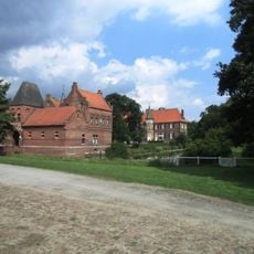
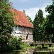
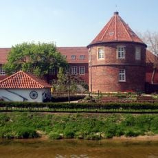
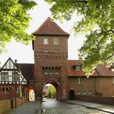
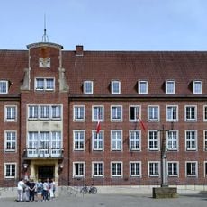
The river supported agricultural development since medieval times, with water mills built along its course to harness its power, and some structures like those near Singraven still remain visible today. The region maintained its connection to the Dinkel across centuries despite political boundary changes between Germany and the Netherlands.

The Dinkel River forms part of a shared landscape between Germany and the Netherlands, where local people fish and boat along its banks as part of daily rural life. The waterway connects small villages and farmland on both sides of the border in ways that reflect how the region has always worked across the international boundary.

The river is best for boating and exploration from September onward once the nesting period for local birds concludes and water levels become stable. The sandy banks can be slippery underfoot, so sturdy footwear is wise if you plan to walk along the water's edge.

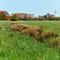
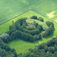
The Lutterzand area is known for its shifting sand deposits that move several meters annually, continuously reshaping the landscape. This rapid transformation creates new islands and inlets that exist only briefly before water movement reshapes them again.

The community of curious travelers

AroundUs brings together thousands of curated places, local tips, and hidden gems, enriched daily by 60,000 contributors worldwide.

Start exploring
Elevation above the sea
19 m
GPS coordinates
51.98670,7.12850
Latest update
December 10, 2025 15:58
Reviews
Share your experience

No review yet

Discussions
Start a discussion...

No discussion yet

« Dinkel - River between North Rhine-Westphalia, Germany and Netherlands » is provided by Around Us (aroundus.com). Images and texts are derived from Wikimedia project under a Creative Commons license. You are allowed to copy, distribute, and modify copies of this page, under the conditions set by the license, as long as this note is clearly visible.

Discover hidden gems everywhere you go!

From secret cafés to breathtaking viewpoints, skip the crowded tourist spots and find places that match your style. Our app makes it easy with voice search, smart filtering, route optimization, and insider tips from travelers worldwide. Download now for the complete mobile experience.

Around Us App Screenshot

A unique approach to discovering new places

Le Figaro

All the places worth exploring

France Info

A tailor-made excursion in just a few clicks

20 Minutes

Around Us
Travel Guide & Maps
Download

Send to your phone

QR Code
1

Open the camera app on your mobile.

2

Point at the QR code with your camera. A notification will appear.

3

Tap the notification to open the link.