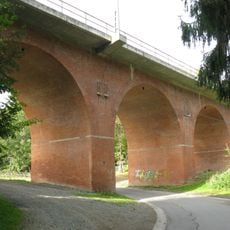
Elster Viaduct, Railway viaduct in Saxony, Germany
The Elster Viaduct is a brick arch bridge that spans 283 meters across the valley while supporting railway tracks above. Multiple layers of brick and stone construction create a sturdy framework that has endured for generations.
Construction started in 1846 with 800 workers laying 12 million bricks until completion in 1851. German forces destroyed it in April 1945, prompting reconstruction efforts that used reinforced concrete to strengthen the rebuilt sections.
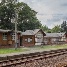
The viaduct demonstrates how industry reshaped the valley landscape and became a source of regional pride in engineering achievement. It stands as a reminder of what communities could accomplish through collective effort in the 1800s.
An educational walking path runs along the base of the second arch level with information panels explaining the construction history. This route allows visitors to see the structure up close and understand its scale and engineering.
The structure survived two world wars and was rebuilt after 1945 destruction using modern reinforced concrete while maintaining its original brick appearance. This blend of historical craftsmanship and contemporary engineering makes it an unusual example of adaptive restoration.
The community of curious travelers
AroundUs brings together thousands of curated places, local tips, and hidden gems, enriched daily by 60,000 contributors worldwide.