Chest opened
+${chestReward.xp} XP
Explorer
NOUVEAU ×${chestReward.collectible.quantity}
tapez pour fermer
Chest locked

Open chests in the app

Around Us is built for your phone — chests unlock when you walk, explore and capture nearby places.

Enable Location

We need your location to show you interesting places around you

Discover nearby places

Find interesting locations and hidden gems around you

Precise directions

Get accurate directions and distances to places

Your location is never shared with other users. It's only used when you tap the location button.

Log in to your account

Start exploring — it's free

Trusted by 72,881 travelers worldwide

Continue with Google
Continue with Apple
or

We will send you a code to connect

By continuing, you accept our Terms and Conditions and our Privacy Policy

Check your inbox

We've sent a pincode in your inbox. Please enter the code below.

Großer Dreiherrenstein
Discussion Reviews Photo
2.6k Popularity

Großer Dreiherrenstein, Border marker at Rennsteig Trail, Thuringian Forest, Germany

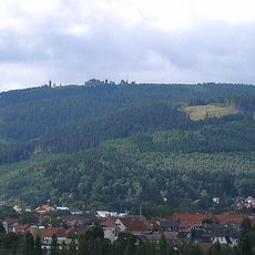
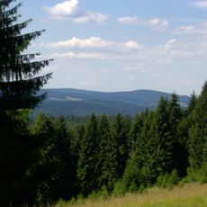
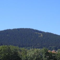
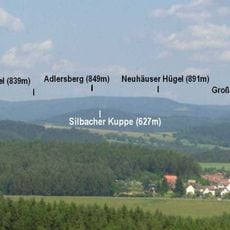
The Großer Dreiherrenstein is a boundary stone at approximately 800 meters elevation in the Thuringian Forest, marking the convergence of several historical territories. The monument stands at a crossroads where hiking trails and old trade routes meet, offering views across the surrounding forested landscape.

The stone was carved in 1596 and marked the boundaries between the Principality of Schwarzburg-Arnstadt, the Duchy of Saxe-Eisenach, and Henneberg County. These three rulers shared a boundary point here, shaping the political map of this forest region for centuries.

The stone marks a place where historical borders met and people from different territories encountered one another. Today the monument reminds visitors of when political boundaries shaped daily life and trade in this region.

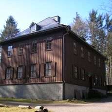
The location is easily reached via the Rennsteig hiking trail and has a parking area and bus stop for visitors. A restaurant and rest areas nearby provide refreshment options before or after your walk.

Before the territorial reform of 1990, five different municipalities converged at this single point, making it a rare administrative oddity. Today this quirk reminds visitors how fragmented local boundaries once were in this region.

The community of curious travelers

AroundUs brings together thousands of curated places, local tips, and hidden gems, enriched daily by 60,000 contributors worldwide.

Start exploring
Part of
political border
GPS coordinates
50.61000,10.89390
Latest update
December 12, 2025 17:47
Reviews
Share your experience

No review yet

Discussions
Start a discussion...

No discussion yet

« Großer Dreiherrenstein - Border marker at Rennsteig Trail, Thuringian Forest, Germany » is provided by Around Us (aroundus.com). Images and texts are derived from Wikimedia project under a Creative Commons license. You are allowed to copy, distribute, and modify copies of this page, under the conditions set by the license, as long as this note is clearly visible.

Discover hidden gems everywhere you go!

From secret cafés to breathtaking viewpoints, skip the crowded tourist spots and find places that match your style. Our app makes it easy with voice search, smart filtering, route optimization, and insider tips from travelers worldwide. Download now for the complete mobile experience.

Around Us App Screenshot

A unique approach to discovering new places

Le Figaro

All the places worth exploring

France Info

A tailor-made excursion in just a few clicks

20 Minutes

Around Us
Travel Guide & Maps
Download

Send to your phone

QR Code
1

Open the camera app on your mobile.

2

Point at the QR code with your camera. A notification will appear.

3

Tap the notification to open the link.